Maroon north glacier
Oct 31st, 2024 12:00 PM
sebycharest
Sea To Sky
Details
Type
quick
Coordinates
54.790942, -128.646024
Quick Observation
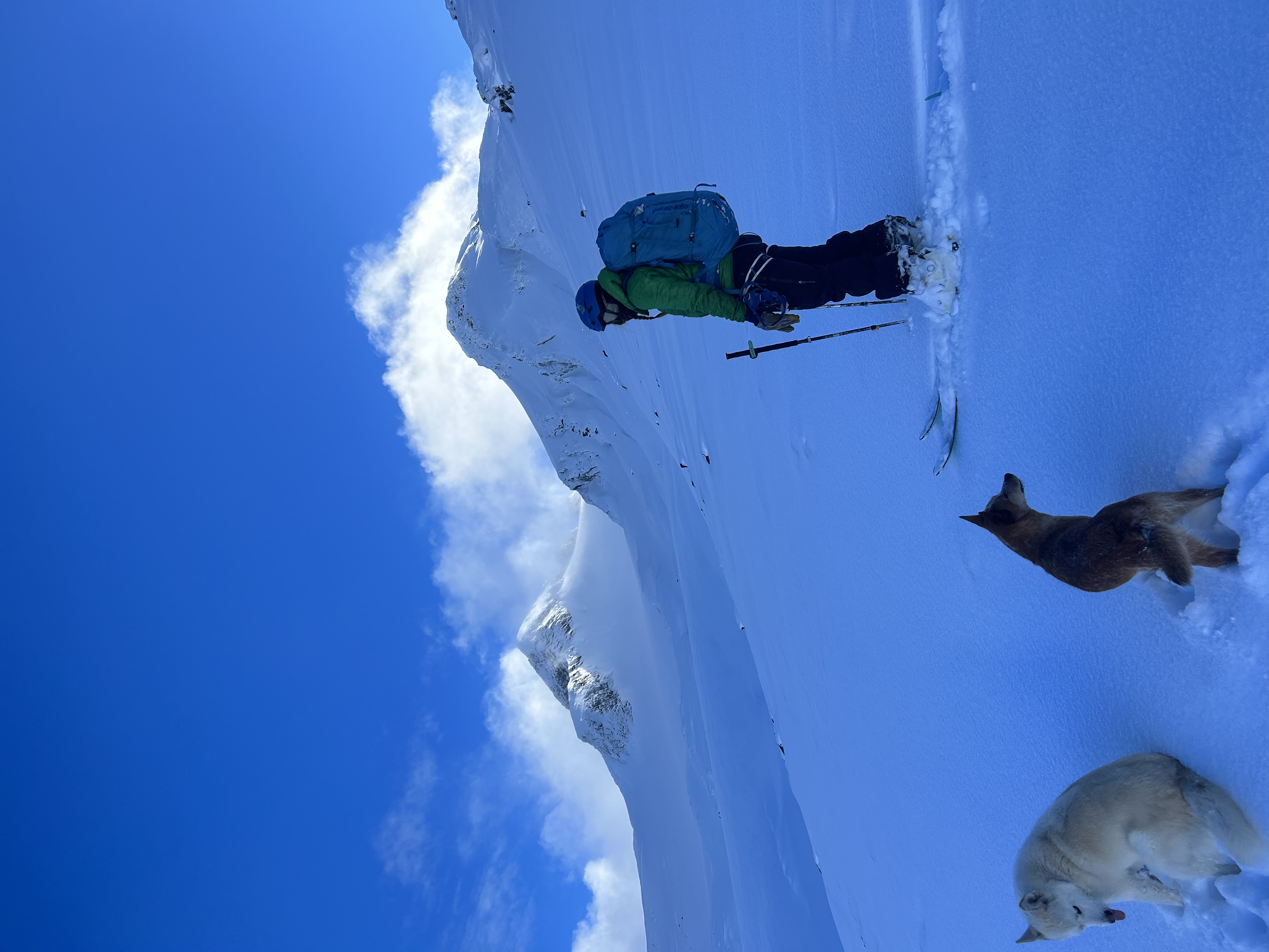
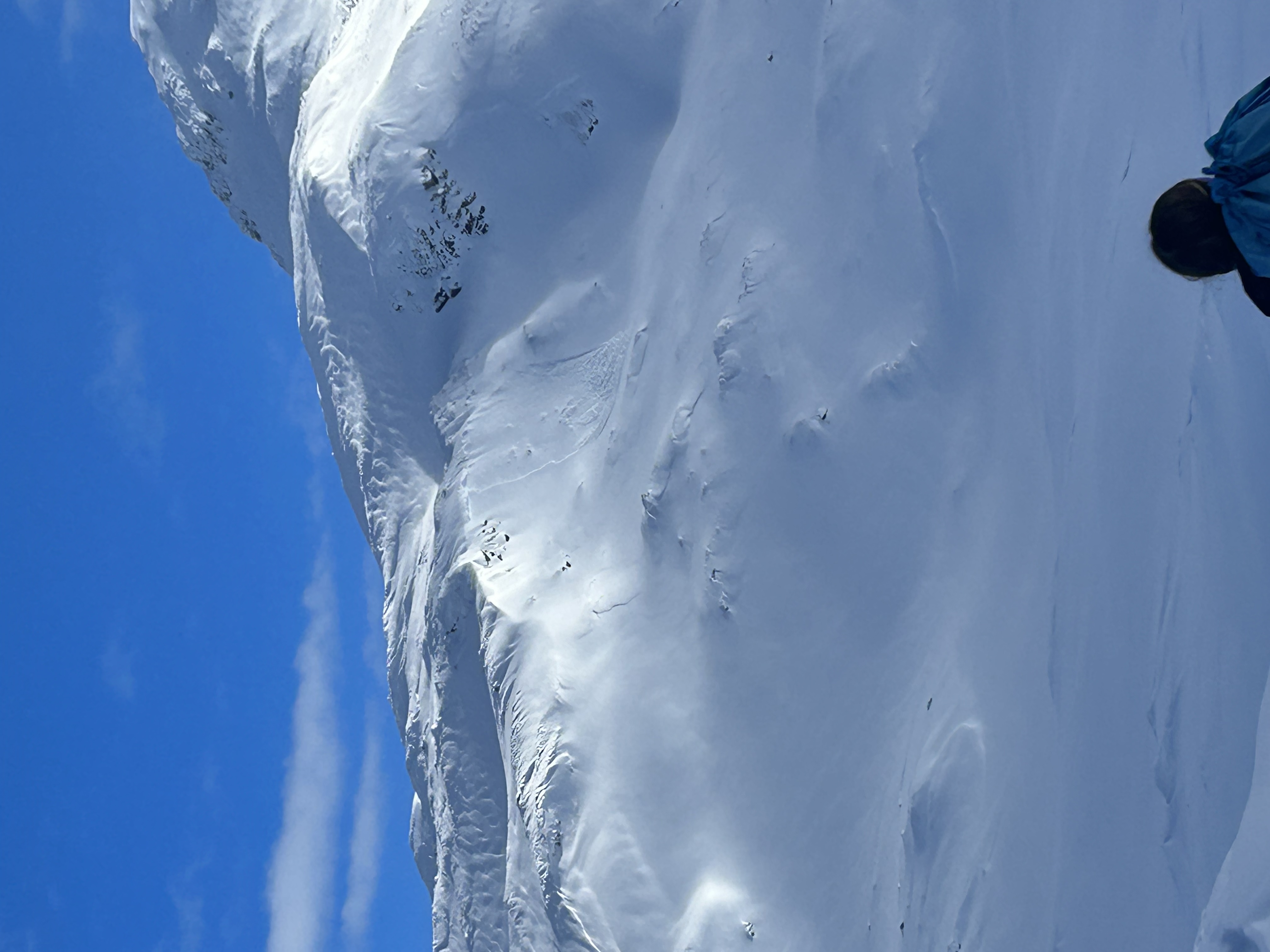
Absolute stunner of an opener. First real alpine turns of the 24/25 season!
Cool temps in the alpine hovering around -6.
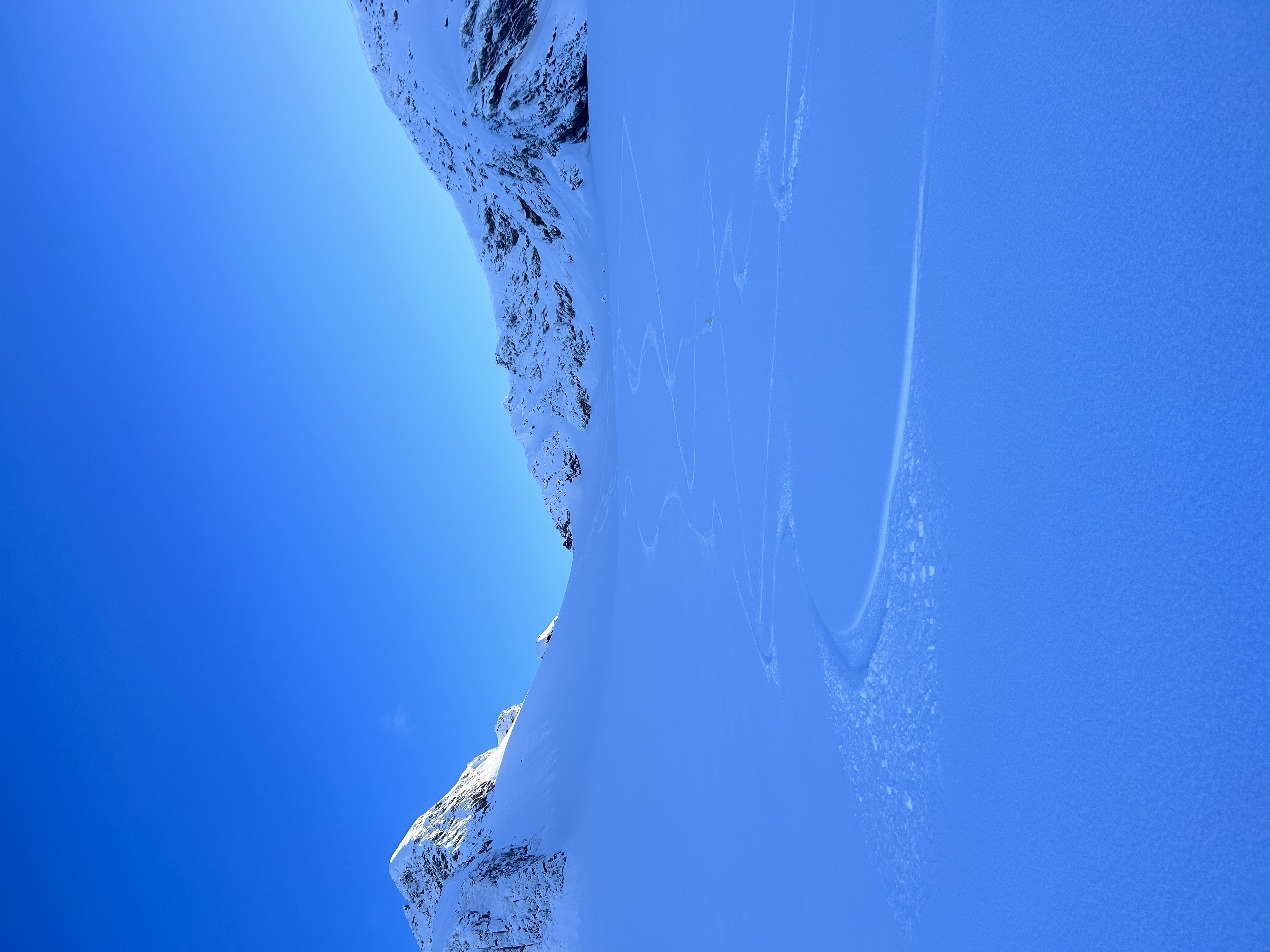
No winds and mix sun/cloud. Boot top blower pow in the high alpine and thigh deep powder in sheltered areas at treeline.
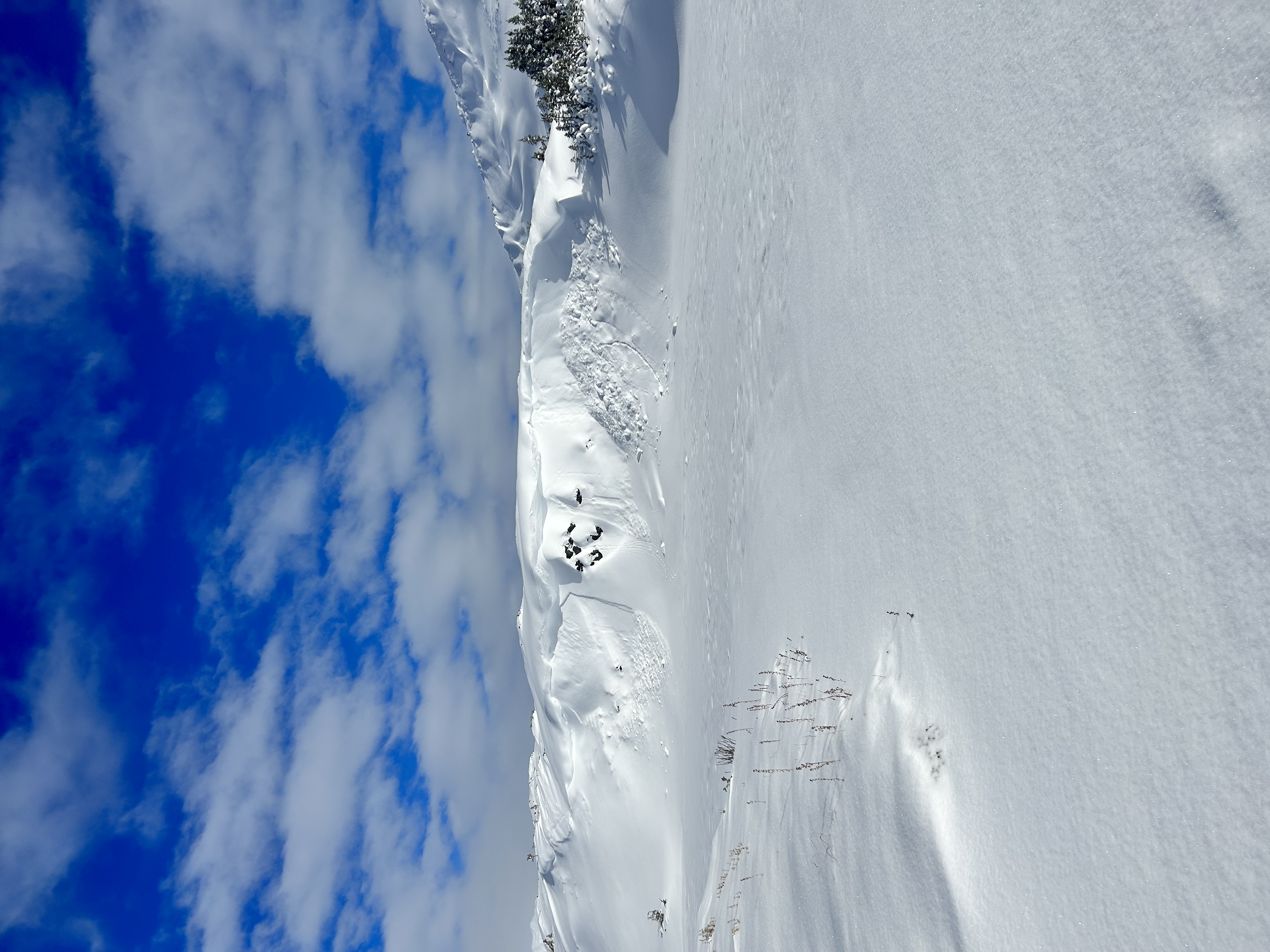
Evidence of some NE wind effect during last storm cycle with numerous small size 1 windslabs released on specific, steep, west facing lee features.
No evidence of slabs today.
Storm seemed to come in warm and tapper off quite cold, with good bonding of the storm snow to older surface.
Avalanche Information
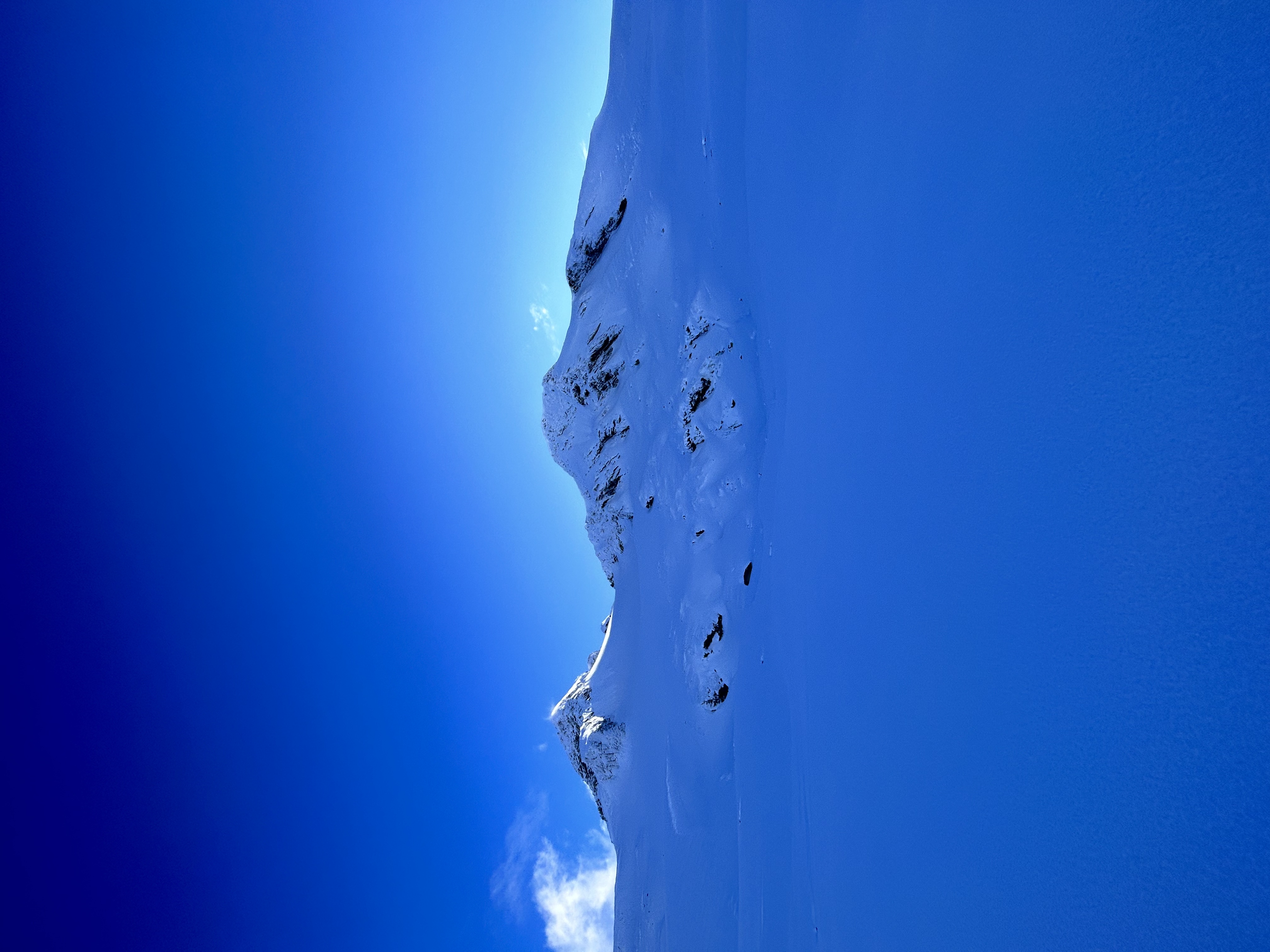
Several small size 1 windslabs released in the middle of the last storm on specific, steep, lee features.
Some loose dry from steep, polar features above 1700m and loose wet on solar aspects ro ridge top.
Weather
Clearing throughout day. Steady temps. Calm wind but evidence of loading from the NE in the last storm.
Snowpack
80cm of snow at treeline 1400m
150cm of snow at 2000m
Variable HN depending on aspect and elevation.
Photos (5)