
Quick report
Salt River Range
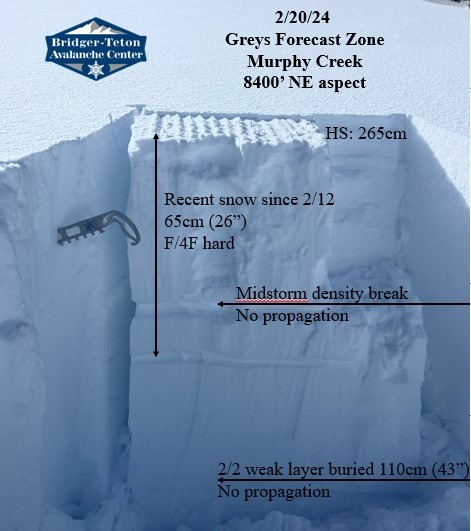
The area recieved around 24" (60cm) of snow since Feb 12th storm cycles, with 2-4" last night. This snow has settled significantly due to recent warming trend. Found no signs of instability. Observed signs of old wind affect, but wind slabs were unreactive in the locations we found. Wind slabs above 9500' are likely limited to isolated terrain such as exposed ridgelines. Warm temperatures and a solid freeze tonight will continue to help lock up the recent snow. Cornices are growing significantly larger on easterly aspects (stay clear during warming). Snow surfaces warmed significantly mid day before broken to full cloud cover. Small wet loose observed throughout the day below 8000'. Northerly aspects stayed fairly preserved despite warm temps. Total height of snow was 200-300cm (~80-120") between 8-9000'.
At 8400' on a NE aspect we found no propagation in recent snow or digging down to Feb 2nd weak layer which was buried 110cm (43"). Jan 4th weak layer was buried around 200cm (78").