Silver king ridge
Nov 13th, 2023 10:00 AM
summitmountainguides
McGregor
Details
Type
quick
Coordinates
49.448470, -117.134270
Snowpack
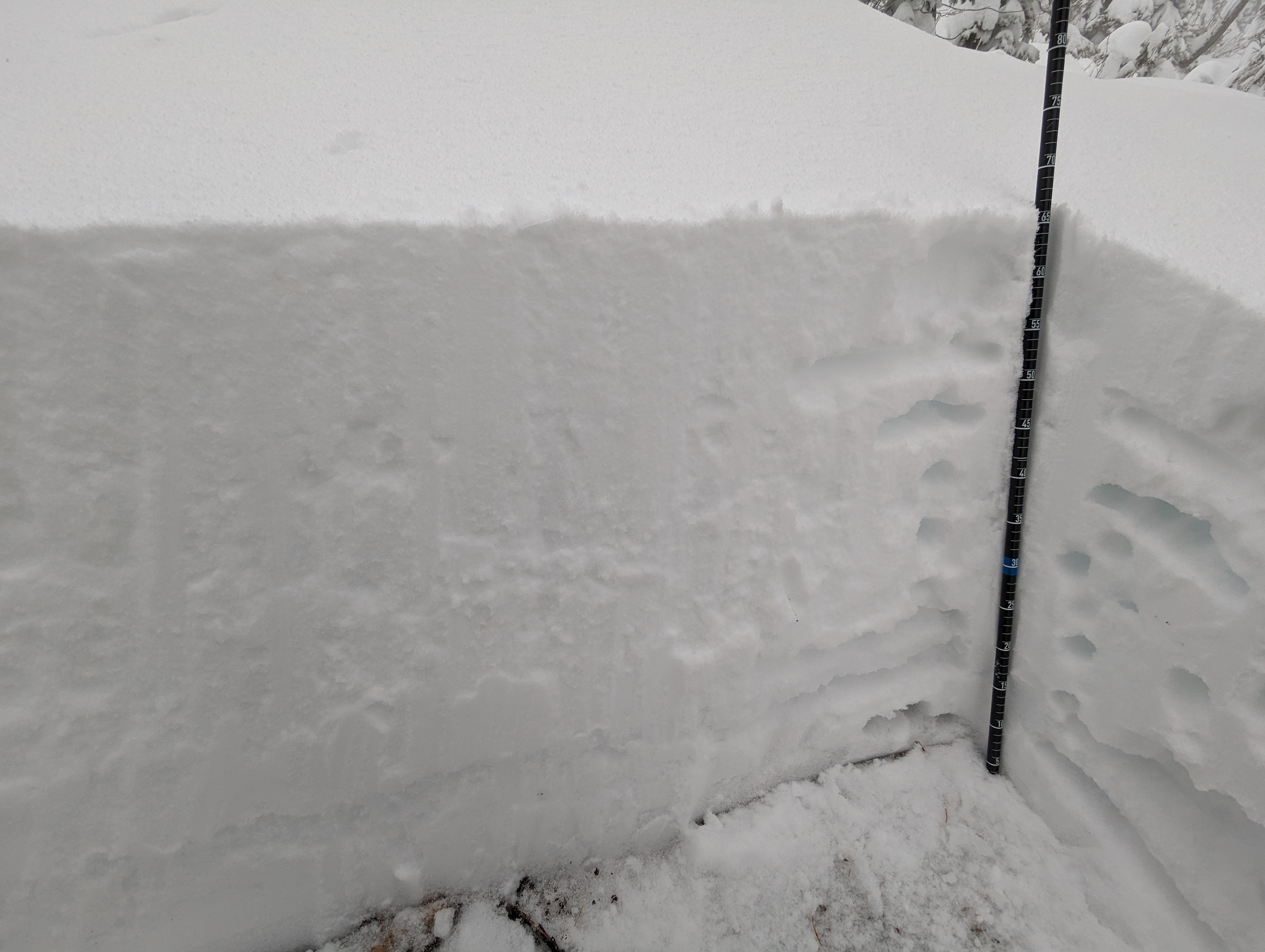
Test profile at 2050 m on a Northeast aspect on a run called acidophilus in the Whitewater backcountry. Quite a thin snow pack (65cm) for this time of the year and this location. Compression test results showed; easy sudden results down 65 cm in thin moist snow layer below pencil resistance laminate crust. Also a moderate resistant shear down 20cm in a previous storm interface was noted.
We skied on cat tracks between 2050m and 1650m. Snow cover was insufficient anywhere else in this area.
The snowpack description would be as follows; 0-10cm of snow overlying a 1-2mm breakable freezing rain crust. The "mid pack" is 4F to 1 F-. It overlies a 10cm laminated pencil resistance crust near the ground with a thin layer of soft moist snow just above the ground.
Photos (1)