Seaton Wet Slides
Feb 6th, 2026 3:00 PM
AvCan Northwest
North Bulkley
Details
Type
quick
Coordinates
55.142490, -127.236880
Quick Observation
Today we rode Seaton to investigate the freezing levels after the warm precipitation event we've been experiencing this week.
Leaving the truck the snow was isothermal and if you got off the trail, down went the skis. Gaining elevation to 1300m we found with the long wave radiation over night, the rain effected snow had been refrozen even though the temps were well above freezing.
It seems that 1800m was the rain/snow line. Below 1800m is a 2cm breakable rain crust and above held 10cm of snow overlying this crust, it seems the storm arrived warm and wet and finished colder and drier.
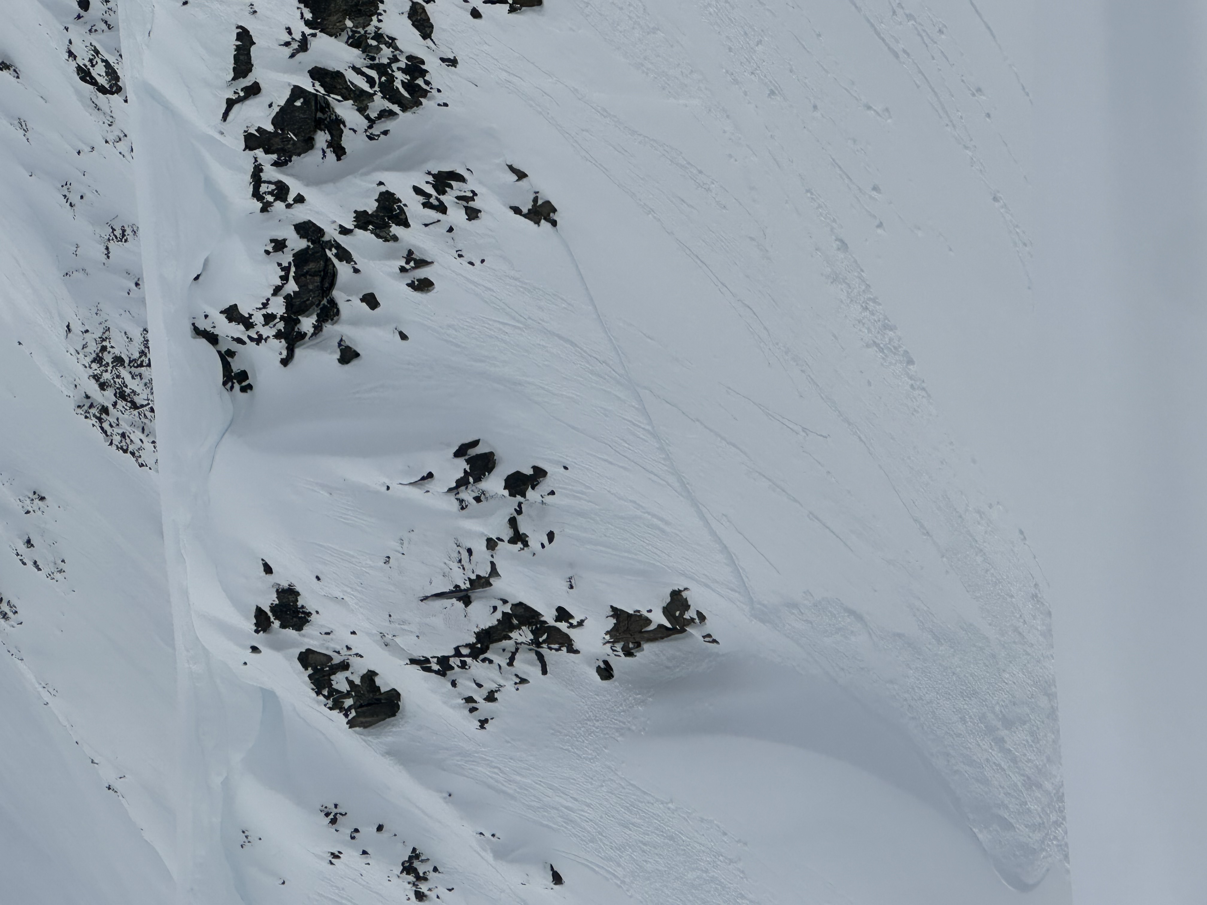
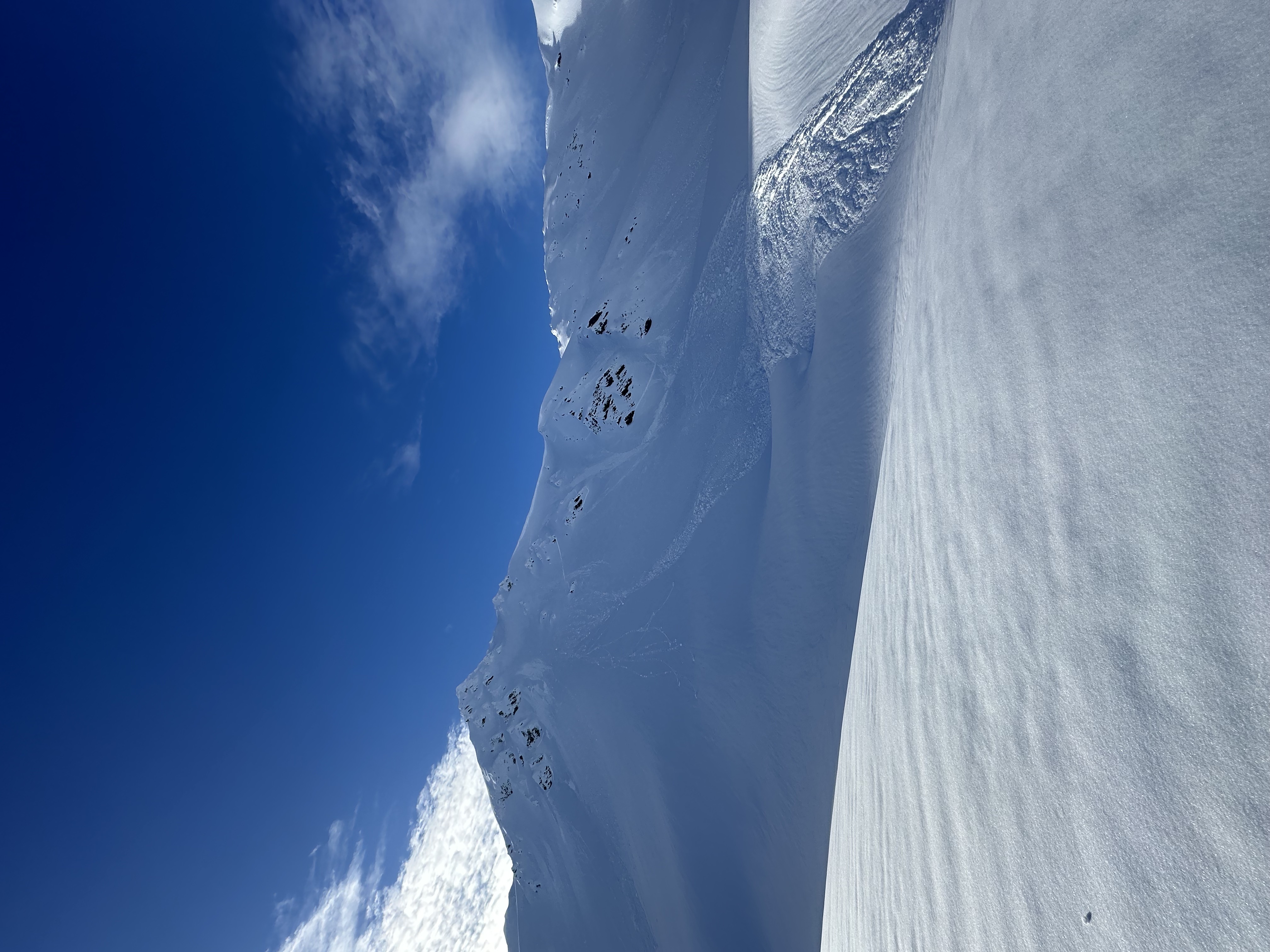
With this storm came a natural avalanche cycle. Numerous wet loose and wet slab avalanches released in steep terrain on all aspects between tree line and alpine, with one to size 2.5 These avalanches all seemed to have run on our previous crust layer from Jan 26.
In testing we got no results on an extended column test but did get hard results in a compression tests on basal facets in the bottom 45cm of the snow pack. This test location was a N aspect with only 110cm of snow. This is our first time seeing these facets this season and its certainly one to keep in mind in thin rocky areas.
Its not spring yet, even if it feels like it out there.
Photos (4)