
Quick report
- Cracking
- specific
- Collapsing
- specific
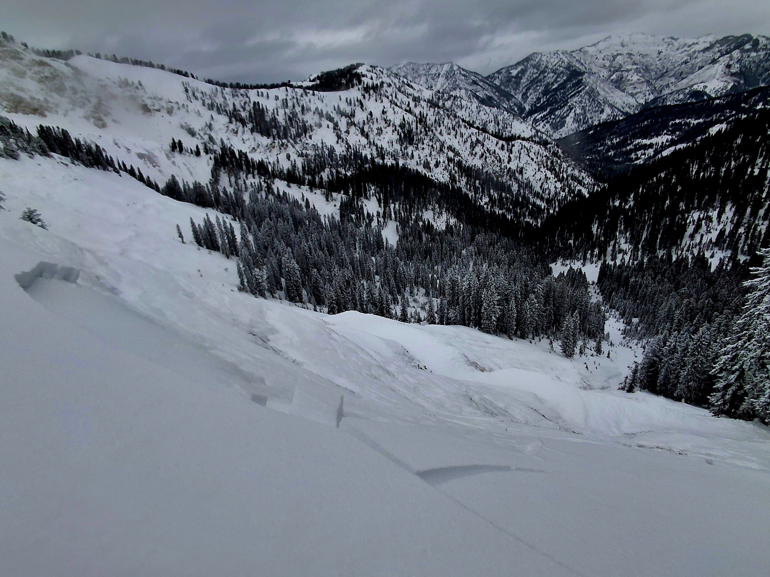
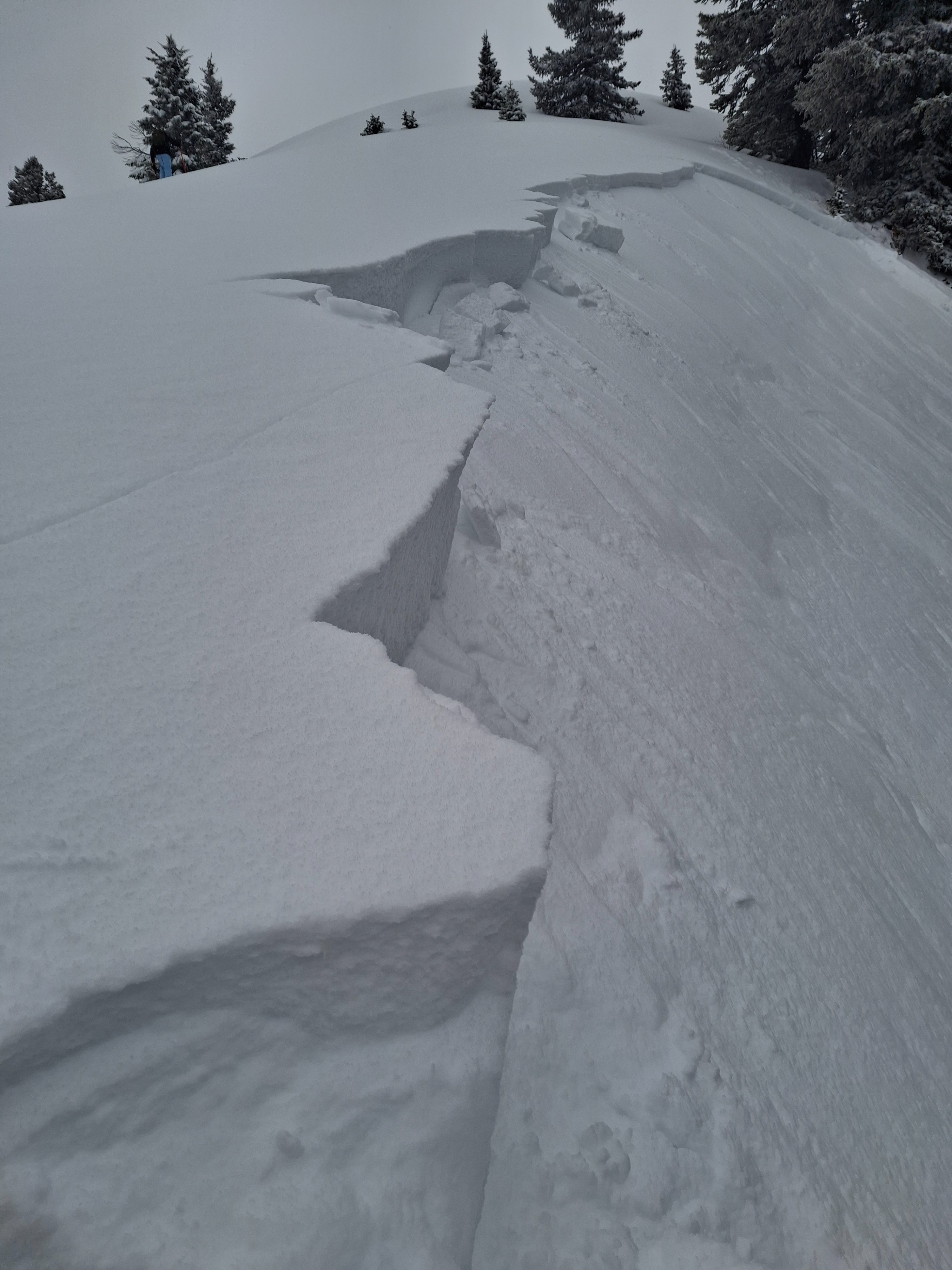
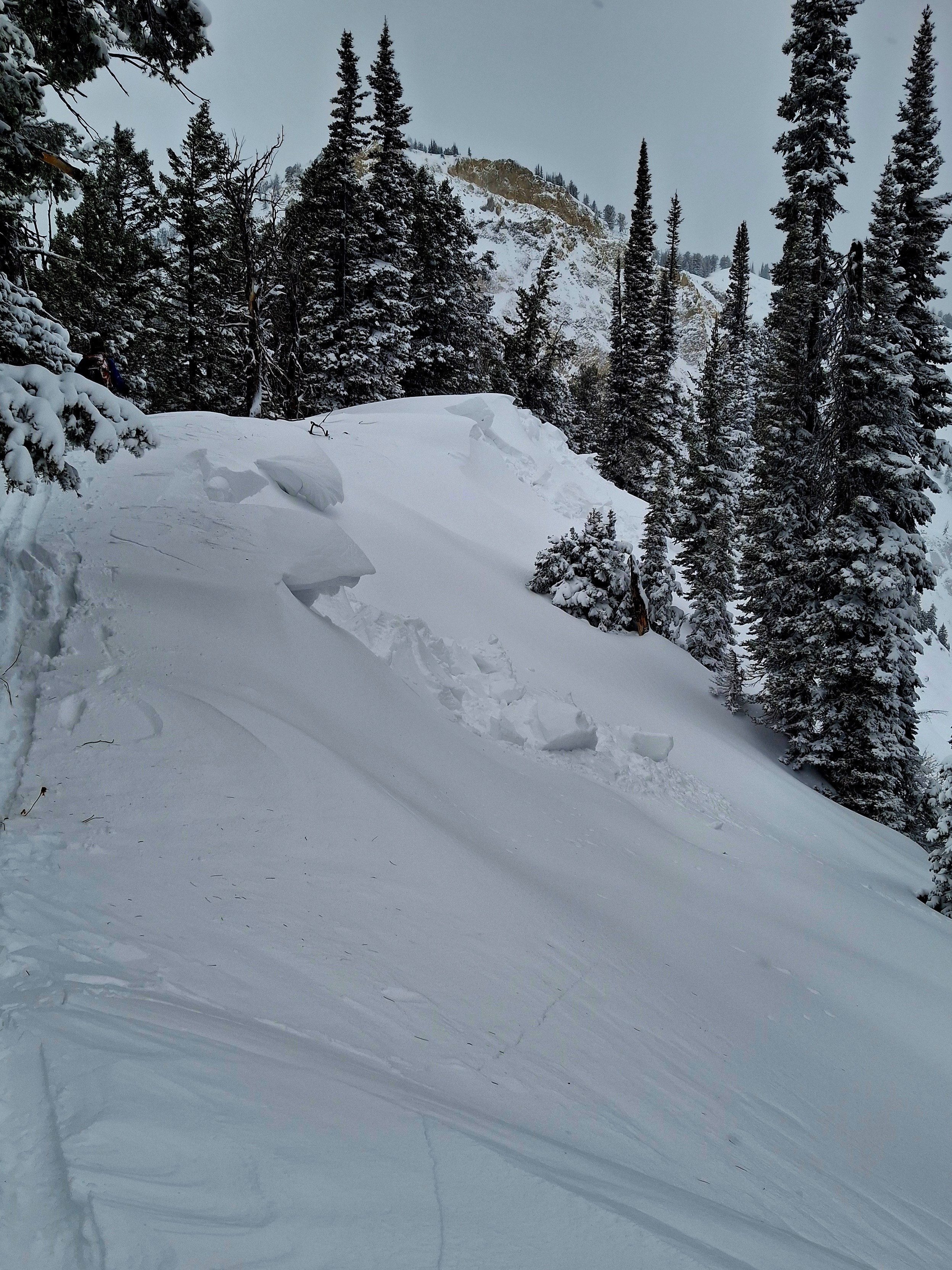
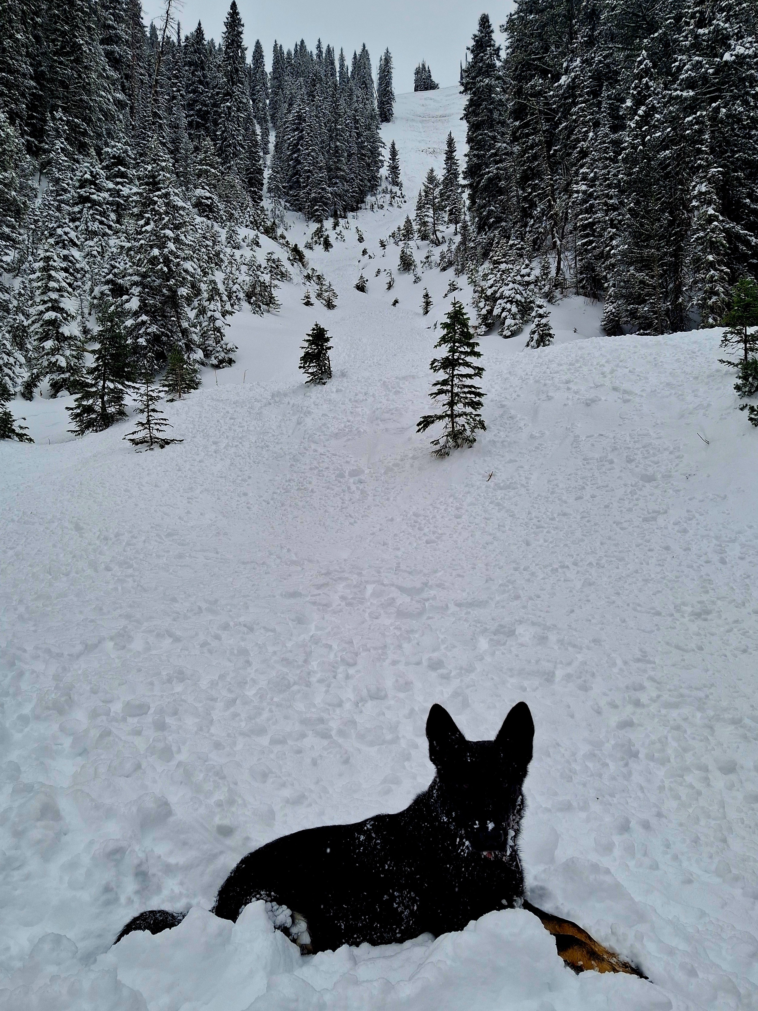
New NATURAL AVALANCHES on W and N NE E aspects down to 6500' and several hair trigger remote releases experienced at mid elevations. WYDAHO SNOW: Mon Dec 16th, 2024: N SALTS (mini golf, back nine) It is super reactive out in the Salts. The biggest avalanches witnessed today popped off around 8700' on windloaded N NE and E facing 30-40* slopes. Some went naturally during the recent storm and some were triggered remotely today up to 150' away from the relative safety of a well worn skintrack on the ridgeline. The steep creekbeds far below this zone hold shallow snowpack and are impassible via snowmachine at the moment (and we were the only ones out there) so we were not worried about any human travellers below. These slides had 8-24" crowns, travelled about 800' vert and entrained an impressive amount of snow. Nothing stepped down to the ground, although in some areas the pre-storm snowpack barely covered the ground so it slid on a sort of chocolate chip sugar cookie surface. Widespread cracking was witnessed on test slopes. Cornices at 8-9k' were windslabby and cracked consistently. Overall upside down snowpack with about 6' of denser snow atop 6-18' of fluffy snow from the recent storm. Windslabs near the ridgeline, soft slabs below. It is very easy to get a snowmobile stuck at the moment. Visibility has been decent at times over the last few days, and we did not see sign of much natural avalanche activity at upper elevations aside from isolated small storm sluffs. Shady, leeward slopes at mid elevations harbored some surface hoar and sugary snow from the long dry spell. High winds last week at upper elevations did away with a lot of that and consolidated the snowpack higher up. It looks like a snowmobiler slid the entire Squaw road cut ascending it during the recent storm. We saw several additional small W facing natural slides at mid and lower elevations. During the day it snowed intermittently with light winds for an additional 1-2" of snow in the mountains before dark. Around sunset the precip really turned on and it has already snowed several inches in town this evening. Tomorrow would probably be a good day to stay home, but we'll probably go see how many sleds we can get stuck in low angle pow fields instead. While today was a great learning experience we'll certainly be avoiding avalanche terrain at all elevations tomorrow. New NATURAL AVALANCHES on W and N NE E aspects down to 6500' and several hair trigger remote releases experienced at mid elevations. WYDAHO SNOW: Mon Dec 16th, 2024: N SALTS (mini golf, back nine) It is super reactive out in the Salts. The biggest avalanches witnessed today popped off around 8700' on windloaded N NE and E facing 30-40* slopes. Some went naturally during the recent storm and some were triggered remotely today up to 150' away from the relative safety of a well worn skintrack on the ridgeline. The steep creekbeds far below this zone hold shallow snowpack and are impassible via snowmachine at the moment (and we were the only ones out there) so we were not worried about any human travellers below. These slides had 8-24" crowns, travelled about 800' vert and entrained an impressive amount of snow. Nothing stepped down to the ground, although in some areas the pre-storm snowpack barely covered the ground so it slid on a sort of chocolate chip sugar cookie surface. Widespread cracking was witnessed on test slopes. Cornices at 8-9k' were windslabby and cracked consistently. Overall upside down snowpack with about 6' of denser snow atop 6-18' of fluffy snow from the recent storm. Windslabs near the ridgeline, soft slabs below. It is very easy to get a snowmobile stuck at the moment. Visibility has been decent at times over the last few days, and we did not see sign of much natural avalanche activity at upper elevations aside from isolated small storm sluffs. Shady, leeward slopes at mid elevations harbored some surface hoar and sugary snow from the long dry spell. High winds last week at upper elevations did away with a lot of that and consolidated the snowpack higher up. It looks like a snowmobiler slid the entire Squaw road cut ascending it during the recent storm. We saw several additional small W facing natural slides at mid and lower elevations. During the day it snowed intermittently with light winds for an additional 1-2" of snow in the mountains before dark. Around sunset the precip really turned on and it has already snowed several inches in town this evening. Tomorrow would probably be a good day to stay home, but we'll probably go see how many sleds we can get stuck in low angle pow fields instead. While today was a great learning experience we'll certainly be avoiding avalanche terrain at all elevations tomorrow.
Weather
- Cloud Cover
- broken
- Wind Loading
- previous
- Recent Snowfall
- 2" fresh today, 1-2' from the storm a couple days ago, snowing hard in town this evening.
- Snow Avail For Transport
- large amounts
Snowpack
Its all over the place at the moment. Shallow and sugary zones at mid elevations were the most problematic today. We didn't get up above 9k' today.