Bow Hut approach info
Parks Canada Visitor Safety,
Tuesday 25th March, 2025 11:30AM
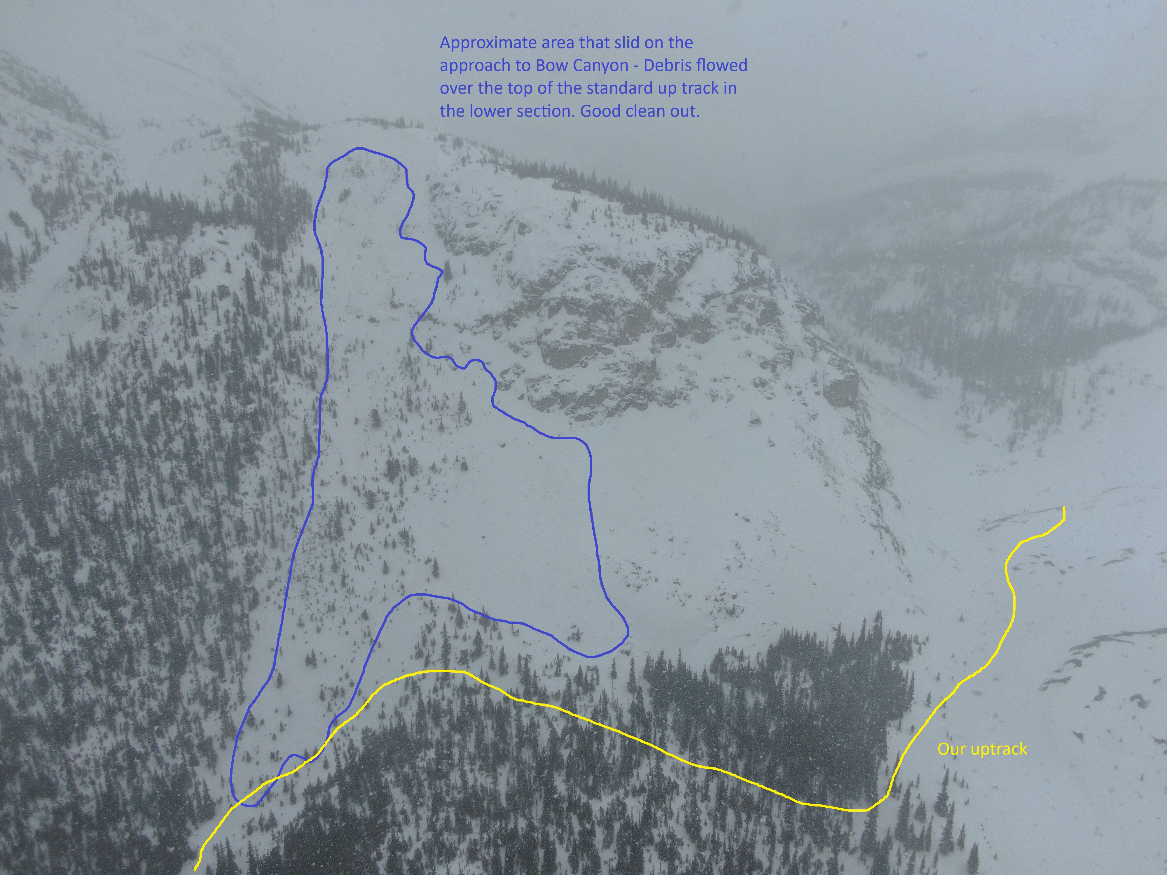
Parks Canada Visitor Safety staff were in the Bow Lake area on Tuesday to try and capture aerial images of the avalanche activity on the approach to Bow Hut. The visibility did not cooperate at the upper elevations, however, we were able to look at the avalanche activity lower down.
The attached image shows approximately what slid above the trees on the standard approach to Bow Canyon with debris covering the upper part of the regular up track. This size 2 avalanche occurred about 10 days ago failing on the late January facet layer.
Not everything above the regular up track had avalanched, so we put in a track that gave the parts that hadn’t slid a wide berth. We had lots of whumpfing even on an existing up track. We did not travel beyond the entrance to the Bow Canyon.
The one good thing is that snow coverage across the gravel flats is way better than before the big storm from 10+ days ago.
Location: 51.65877000 -116.48513000