
Quick report
Rode into the northern Salt River Range to investigate avalanche activity. We found poor snowpack structure, but many areas lacked enough snow for avalanches to slid on the weak, faceted snow formed during the January drought. Recent snow amounts of 3-5" below 9,000' (significantly less than the other forecast zones). Recent snow was still dry above 7500'.
Areas of concern would be previously wind loaded terrain where new snow amounts are ~12" deep. Pay close attention on the next storm as additional loading will make conditions ripe for avalanches based on the weak snow just below the surface on W-NW-N-NE-E aspects.
We did not observe recent avalanches, cracking, or collapsing. No wet loose avalanches and snow surfaces stayed cool until departure at 14:00 (decent cloud cover of over 50%).
Snowpack
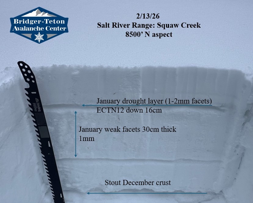
Dug a snowpit on a N aspect at 8500' in terrain similiar to the avalanches triggered in the Snake River Range yesterday.
HS: 130cm ECTN12 down 16cm on F hard well developed 2mm facets. The January drought layer of facets was 30cm thick. The overlying slab was not dense or thick enough to propagate across the column. More snow is necessary to tip the scale.