
Quick report
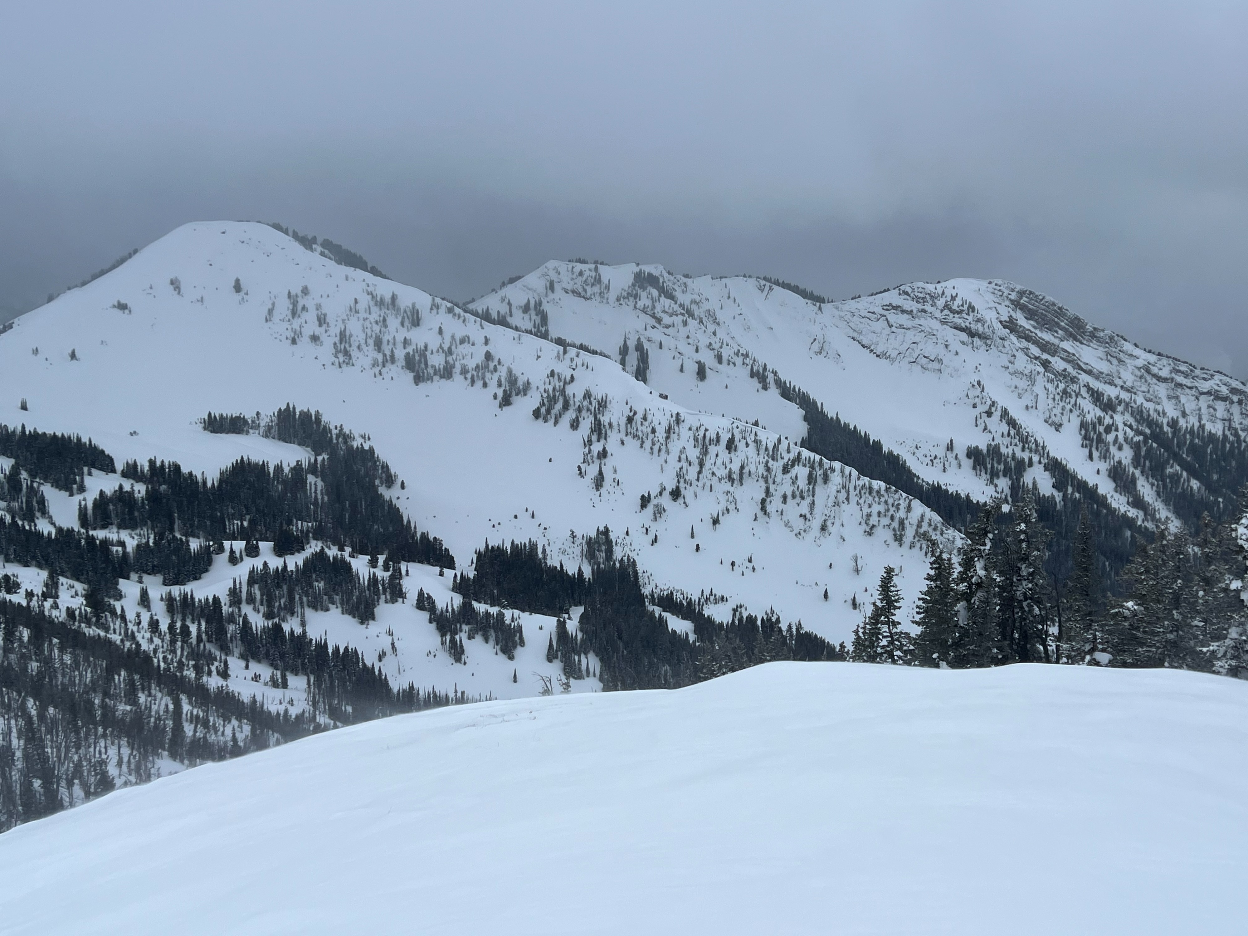
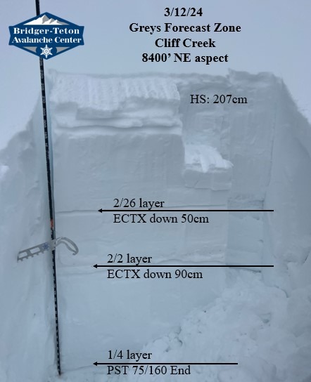
Rode out via Cliff Creek with the primary purpose to go investigate persistent weak layers in one of the shallower areas of the Greys in the Wyoming Range. 2-3" of new snow with moderate SW winds visibly transporting small amounts of snow around 10,000'. Light snow up to S1 (1cm/hr) stopping competely by 14:00. Warm temperatures with overcast skies breaking in the late afternoon. Snowpack is completely scoured and loaded at upper elevations which is typical around Ramshorn Peak. Recent snow from March storms is bonding well with no signs of instability. Observed one likely natural avalanche in the lower elevations that likely occured 3/6 during the last loading event. Also dug two pits with barely unstable results on the Jan 4th weak layer at 8400' on a NE aspect. Pit at 8300' on an ESE aspect did not produce any unstable results.
Stability tests were all fairly stable, but this is just a few data points. Remember that the snowpack varies drastically across the Wyoming Range often times from one drainage to the next. Biggest concern for the now Deep Persitent Slab problem still remains those steep slopes that appear shallow with rocks and signs of previous wind affect (loading and scouring).
Snowpack
Dug numerous snow pits to check persistent weak layers (See attached snow profiles). Probed snow depths to gauge overall snowpack depth and buried weak layers.
8600' NE aspect HS: 270cm Jan 4 layer buried 220cm
8800' NE aspect HS: 280cm Jan 4 layer buried 250cm
9800' E aspect HS: 310cm Jan 4 layer buried 260cm
Avalanche
- Size
- D2 R2
- Type
- HS
- Aspect
- NW
- Elevation
- 6700 ft
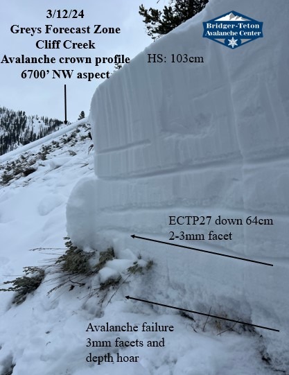
Persistent slab avalanche likely occured naturally during rapid loading around 3/6 (not covered by much recent snow). Avalanche failed on the ground on 3mm facets and 4mm depth hoar (moist). Slope was also potentially wind loaded.