
Quick report
Recent snow has settled to 12-16" above 8500' and 4-8" below. Traveled across numerous ridgelines on leeward terrain to check for wind slab development and sensivity. Visible wind affect all day transporting snow, but no signs of cracking or instability yet. Continued moderate westerly winds with strong gusts will form fresh, more reactive slabs. Lots of signs of previous wind affect from last storm. All old slabs were stubborn. New snow was bonding well. No avalanche activity observed, but poor visibilty did not allow us to get good eyes on the Front Range. Heard reports of similiar conditions found by other snowmobile groups riding in the area today.
No weak interfaces on the surface were observed for incoming storm tmrw. Winds are forecasted to remain 20-30 mph which will form fresh wind slabs in new snow. Incoming storm appears to favor this area. Watch for signs of instability with new snow as avalanche danger will increase the next several days.
No signs of instability despite visible wind transport and previous signs of transport with recent snow.Snowpack
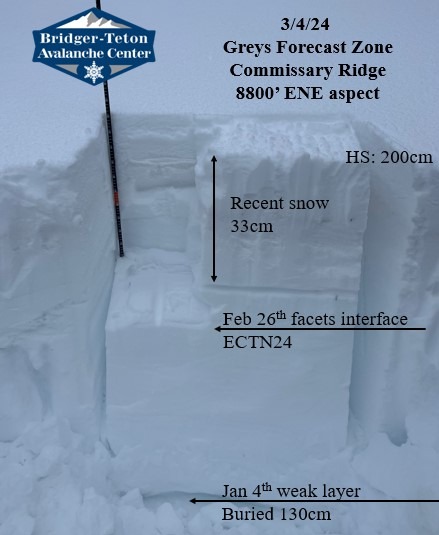
Dug in a shallow area on an ENE aspect at 8800' to test recent snow stability and weaker layers buried in the snowpack. No propagation in our snowpit. Weak snow formed in December was buried 130cm and appeared to be stabilizing significantly with rounding, moist facets. Also observed some percolation columns as warm temperatures has allowed water to filter through the snowpack even on shaded aspects.
We also found a layer of dust buried within the recent snow from the previous storm which was likely transporting from western dry lands. Clear sign that there was a whole lot of wind!