
Quick report
Today, I found a generally stable spring snowpack. All travel was through the mid elevation band as even ridgetops around Lolo Pass fall into this zone.
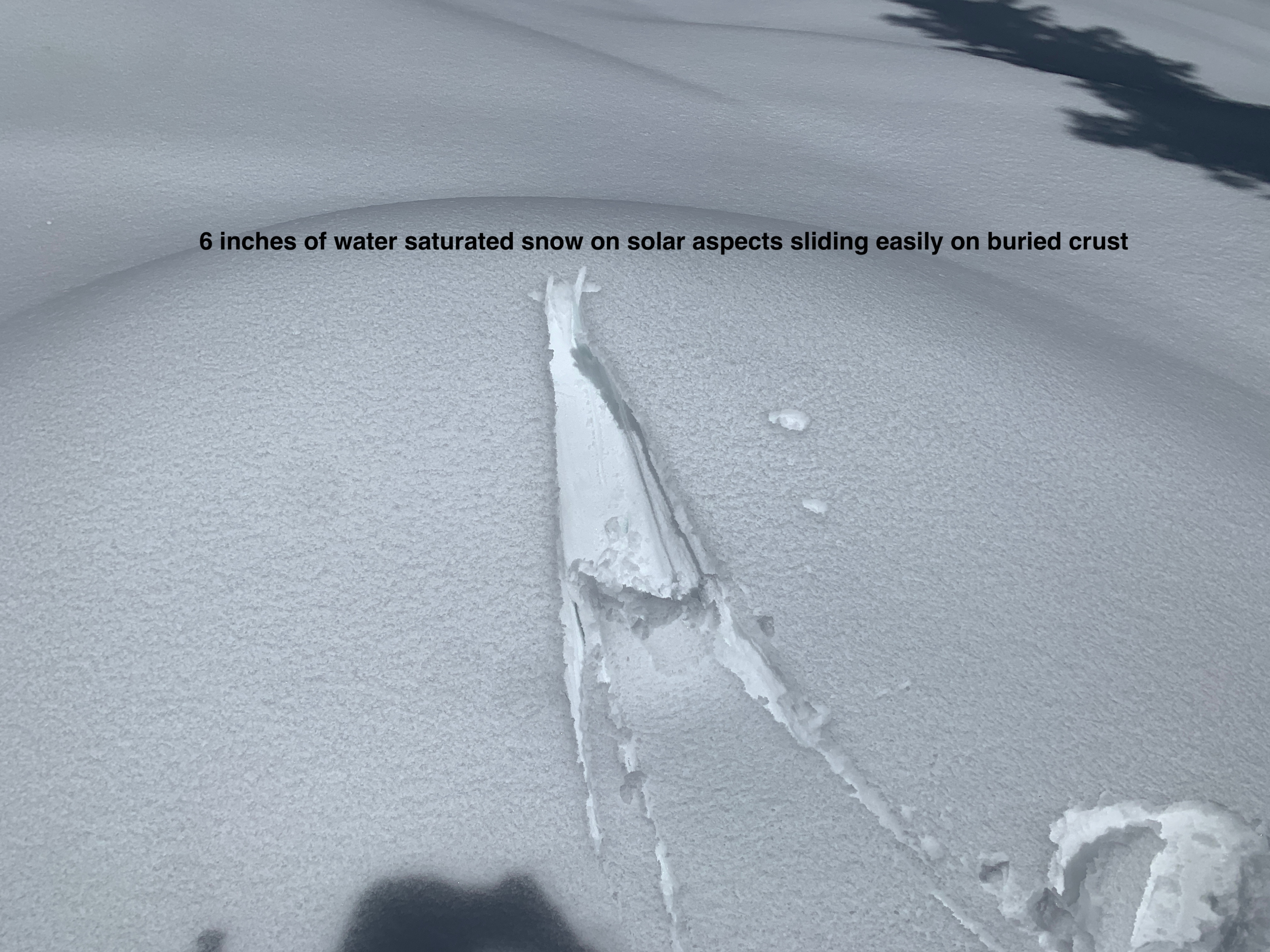
- Solar aspects held 6 inches of very wet snow on top of a melt-freeze crust. On small rollovers, it was easy to push this snow and get it to fan out as small wet loose slides. What is noteworthy is digging below the crust on solar aspects, the snow is still damp 2 feet from the snow surface from percolating water from the rain on snow event yesterday. It will take a longer period of cooling for the heat to leave the snowpack and for this to lock up.
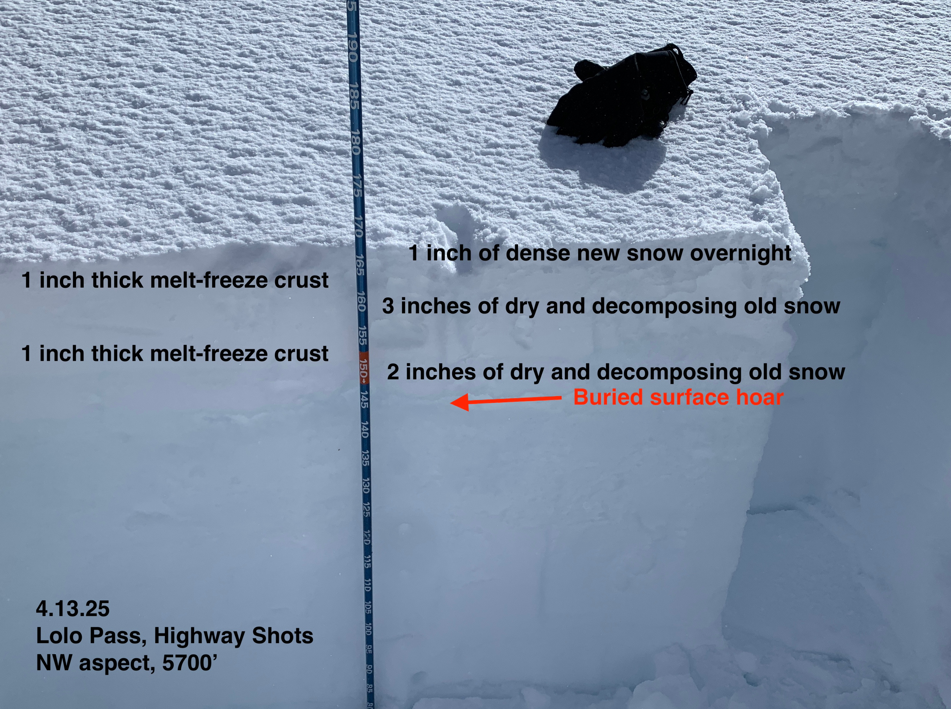
- On north facing terrain, I found pockets of preserved surface hoar buried below two crusts. When I isolated columns, this layer was reactive and showed propagation, but could not impact this layer through the crusts without fully isolating columns. Any avalanche triggered on this layer would be 10-14 inches deep and likely D1.5 in size.
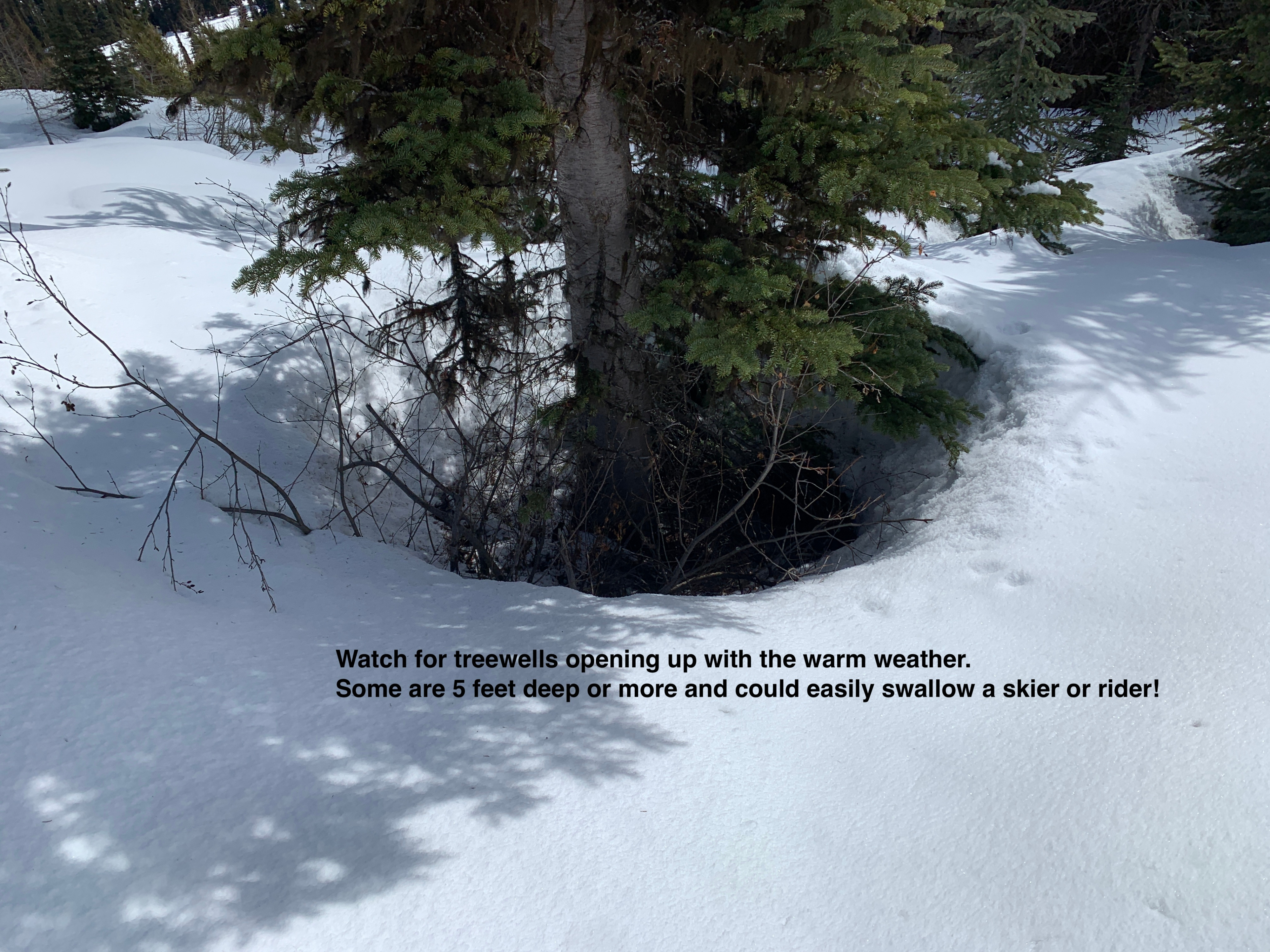
- The other hazard I found were treewells melting out, with some 5 feet deep or more. With the difficult travel and survival skiing in wet snow, a fall into a treewell could be the biggest danger of the day.
- Looking into upper elevation terrain in the distance, I saw lots of evidence of wind transport and blowing snow onto east aspects. With that, I expect sensitive wind slab at upper elevation today.
Weather
- Air Temp
- Temperature back at the truck at 1400 read 53 degrees. That may have been a bit high as temperatures through the day were closer to 40
- Cloud Cover
- few
- Wind Loading
- light
- Recent Snowfall
- 1 inch of high density snow at 6000'
- Snow Avail For Transport
- small smounts
Blue skies and warm weather at Lolo Pass, although moderate to strong winds were dipping into normally sheltered terrain.
Avalanche
No avalanches observed.