
Quick report
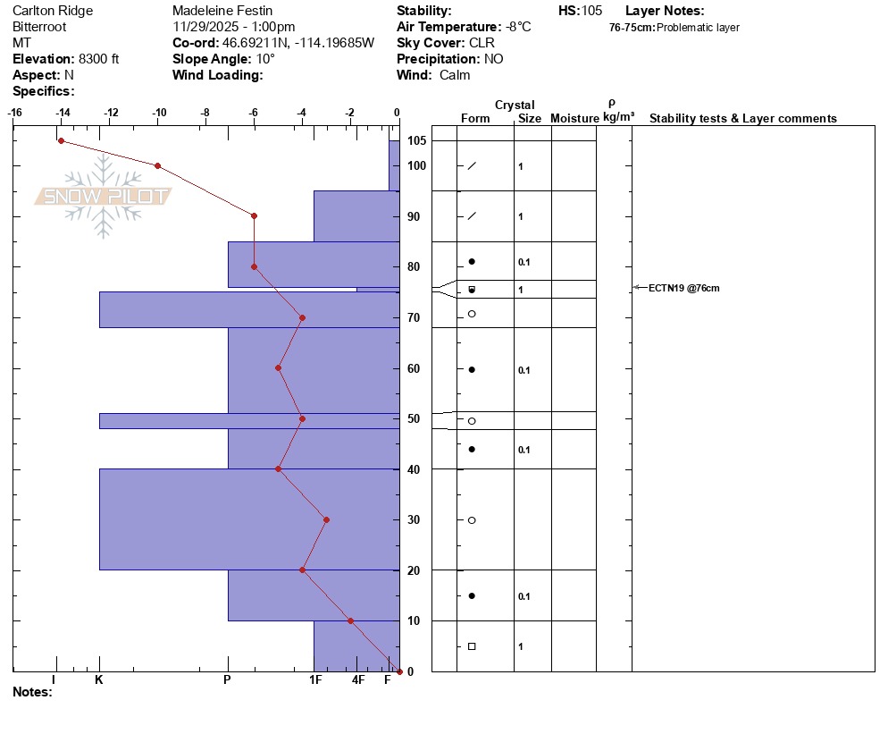
Right now, my only concern is a small layer of facets sitting on top of a crust about 35 cm from the surface. It collapsed but did not propagate. Based on the temperature of the snowpack, I bet this layer is deep enough to heal. I also suspect the layering of melt/freeze layers with rounds and facets varies widely right now and should be assessed locally for weak layers before descending steep terrain. My bigger concern is the steep change in temperature through the top 15 cm of the snowpack (-14 to -6 C in 15 cm). For now, it will preserve good skiing conditions, but I imagine it will become very faceted forming a weak layer that will become problematic when new snow falls. I did not see any obvious signs of instability. No surface signs of wind loading.
Weather
- Air Temp
- 18
- Cloud Cover
- clear
- Wind Loading
- none
- Recent Snowfall
- 35
- Snow Avail For Transport
- moderate amounts
Clear skies and cool temps. Temperature was 18 F at 1 pm near the top of the ridge.
Snowpack
Snow became skiiable at 7500 feet. I dug a pit at 8300 ft, north facing, and found a surprising snowpack. From the ground to 75 cm were alternating layers of rounds and melt/freeze crusts. At 76 cm a thin layer of weak faceting rounds sat on top of a melt/freeze crust. Above that was decomposing new snow to 105 cm. The 76 cm layer proved to be the problem layer and produced an ECTN 19. The temperature profile seems to be stabilizing between 90 cm and the ground, but above that there is a very steep change in temperature to -14C at the surface midday. Some facets exist at the very bottom of the snowpack but didn't seem to be an issue.