
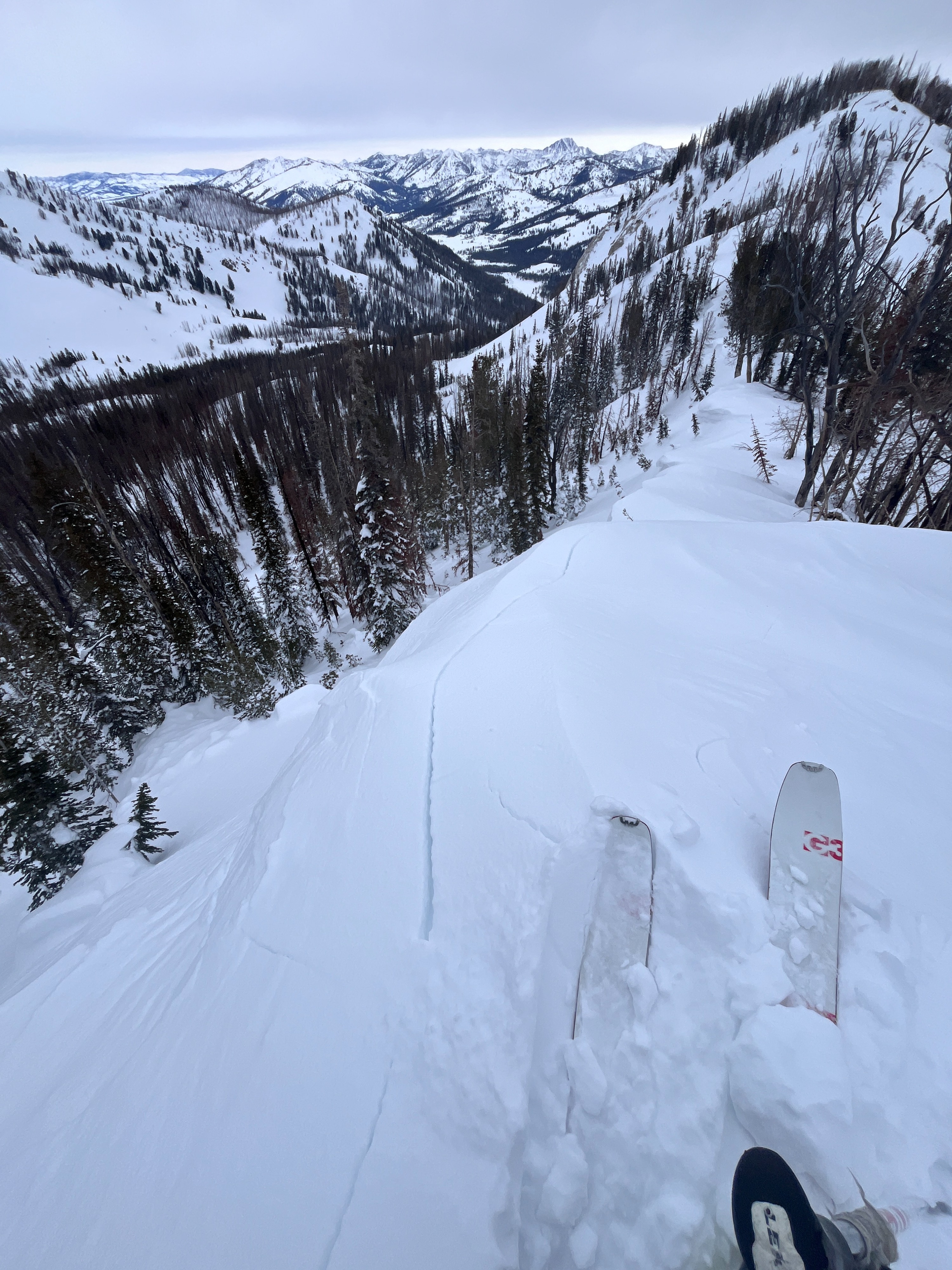
Quick report
- Cracking
- specific
Today was a blustery. snowy day. Snowfall began around 11 AM, and SW wind increased through the day—blowing steadily moderate for most of the day. Signs of instability were isolated to the upper 6-10 inches of the snowpack, where the wind had built small reactive drifts along ridgetops. The snowpack structure is less than inspiring with a thick upper snowpack overlaying weak sugary snow below. Snowpack tests were unremarkable, but poor structure lends concern relating to the stubborn, but consequential nature of triggering a thick avalanche.
Cracking was observed along ridge tops and ridge adjacent slopes where today's wind had built small thin drifts. On a small test slope I was able to trigger a small wind slab ~6 inches deep and 50 feet wide.Weather
- Air Temp
- Single digits
- Cloud Cover
- overcast
- Wind Loading
- moderate
- Recent Snowfall
- Trace-1 inch by 2PM
- Snow Avail For Transport
- moderate amounts
Partly cloudy skies become overcast around 11 AM. Parking lot temperatures were in the single digits (read on truck thermometer). SW winds were light to moderate this morning before increasing this afternoon.
Snowpack
January drought weak layers are buried 75-100 cm deep, and snowpack tests were unremarkable (ECTX, PST 42/100 END @ 93cm: HS 210, E, 9100'). Winds were building small reactive drifts near and along ridge tops.
Avalanche
- Size
- D2 R2
- Aspect
- SE
- Trigger
- N
- Elevation
- 8800 ft