
Quick report
We set out for the day hunting wind slabs and persistent slabs and ended up only finding evidence of dry loose avalanches. That being said, the set up for persistent slabs is definitely there. Overall, the snowpack is weak and faceted. The new snow currently just lacks the amounts and cohesion to create a good slab. I suspect you could find an especially wind loaded area where a bigger and denser slab has built though. This "cold smoke" made for excellent riding/skiing conditions and it was great to see this area with a refresh after seeing it last weekend looking a little rough around the edges after sustained high and dry weather!
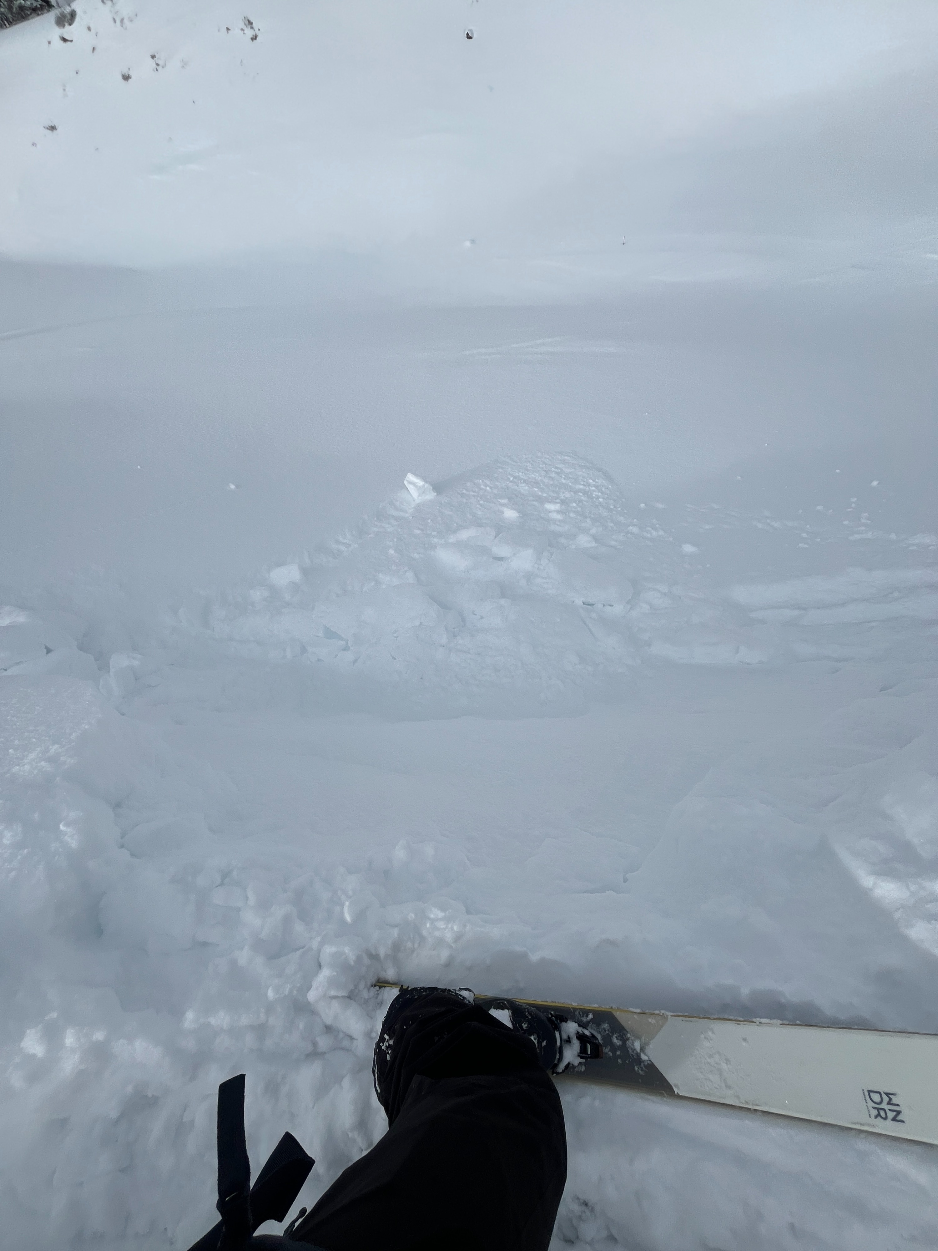
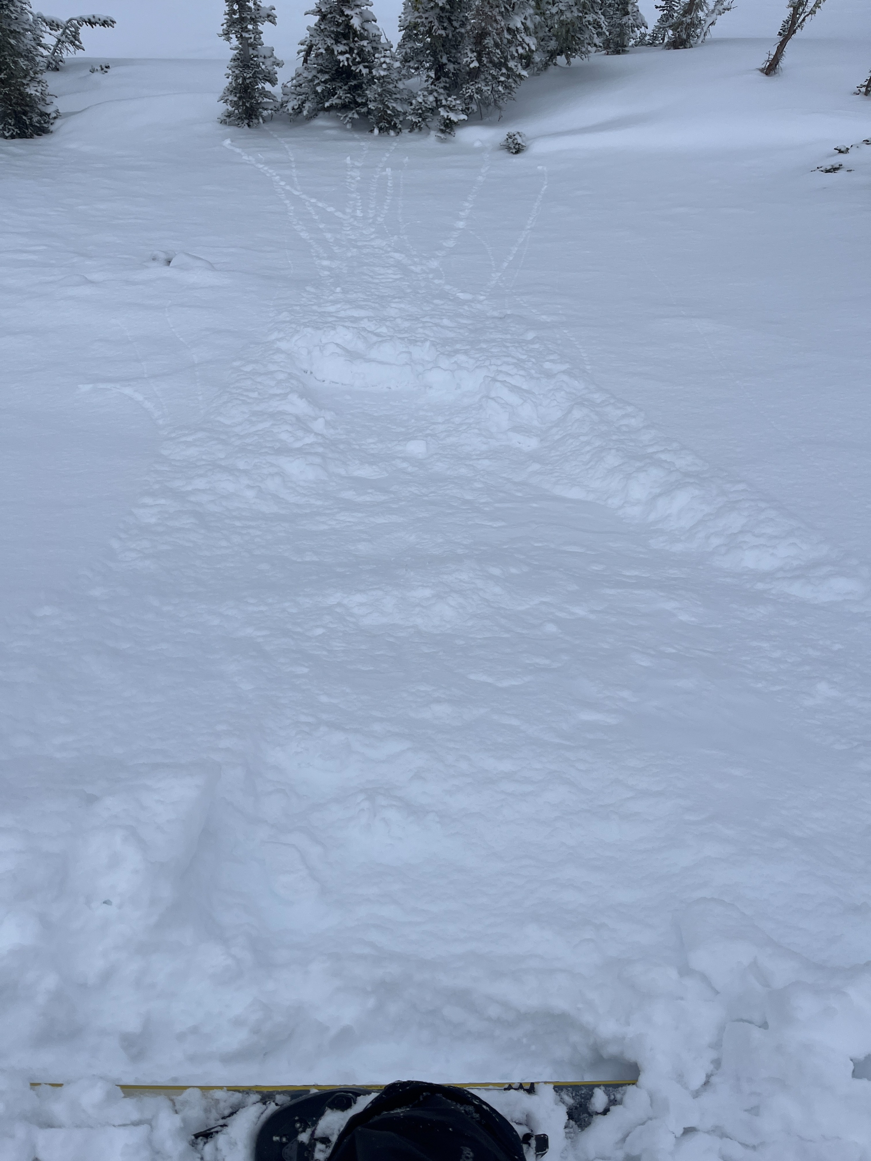
Small dry loose avalanches triggered intentionallyWeather
- Cloud Cover
- overcast
- Wind Loading
- none
- Recent Snowfall
- 15-20
- Snow Avail For Transport
- moderate amounts
The weather was a bit all over the place but definitely quite cold all day. In the early afternoon hours, moderate snowfall fell for about an hour. It then stopped and the sun came out for a brief moment. Cloud coverage quickly returned and very light snow flurries fell for the remainder of the day. The wind was calm and from the southwest with light gusts at ridgeline.
Snowpack
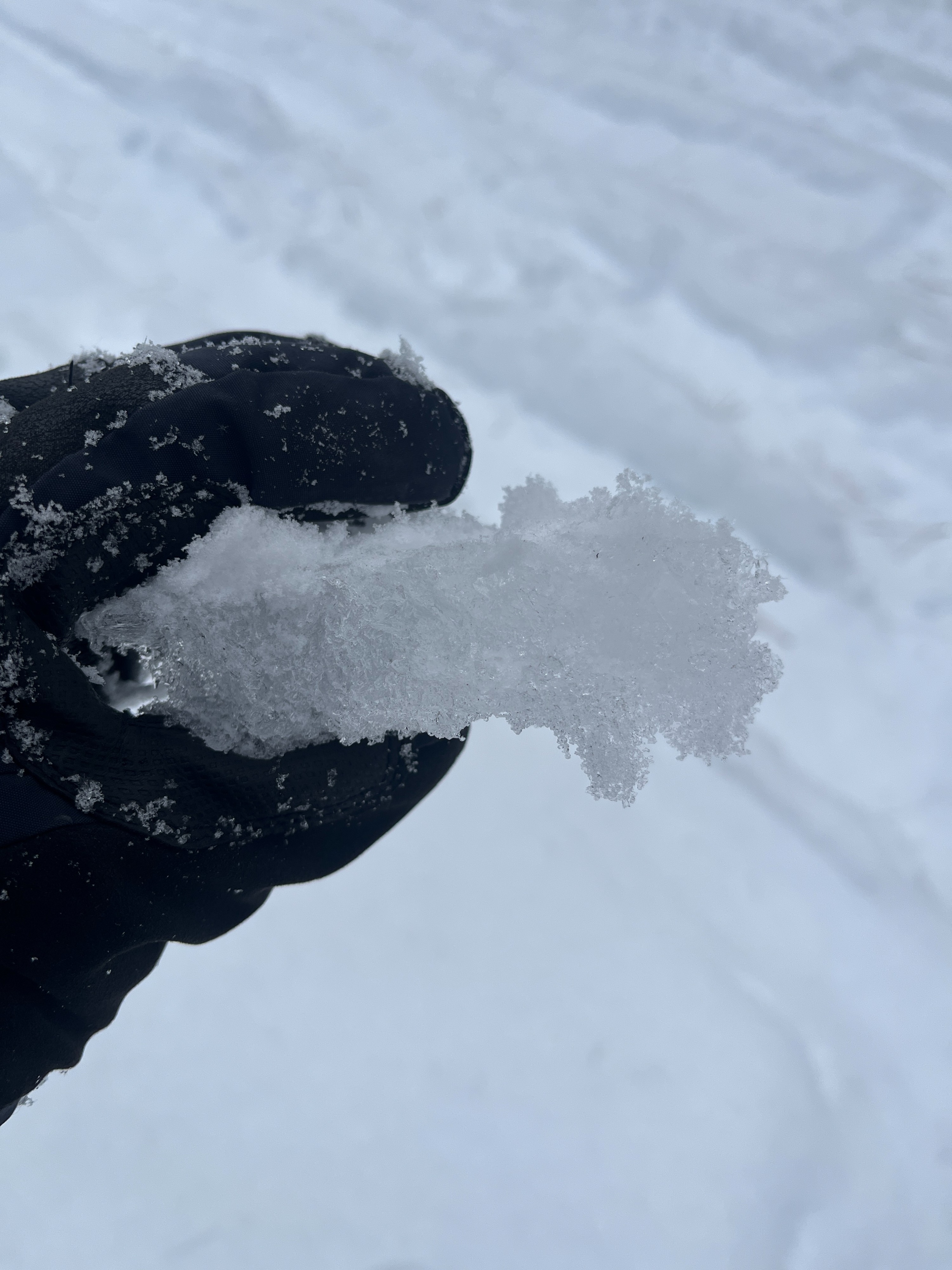
At lower elevations, there generally lacks a substantial enough snowpack up until around 3500' for safe and enjoyable riding/skiing. Only a skiff of new snow had fallen at these elevations and lower. As we worked our way up, around 4500' is where there was a substantial increase in new/recent snow. All of the new snow is very low density and would commonly be referred to as "cold smoke". There was evidence of previous wind affect at middle and upper elevations; wind drifts and cornice development. However, wind slabs were very stubborn or nonexistent. Pushing on drifts/small cornices really only resulted in small dry loose avalanching.
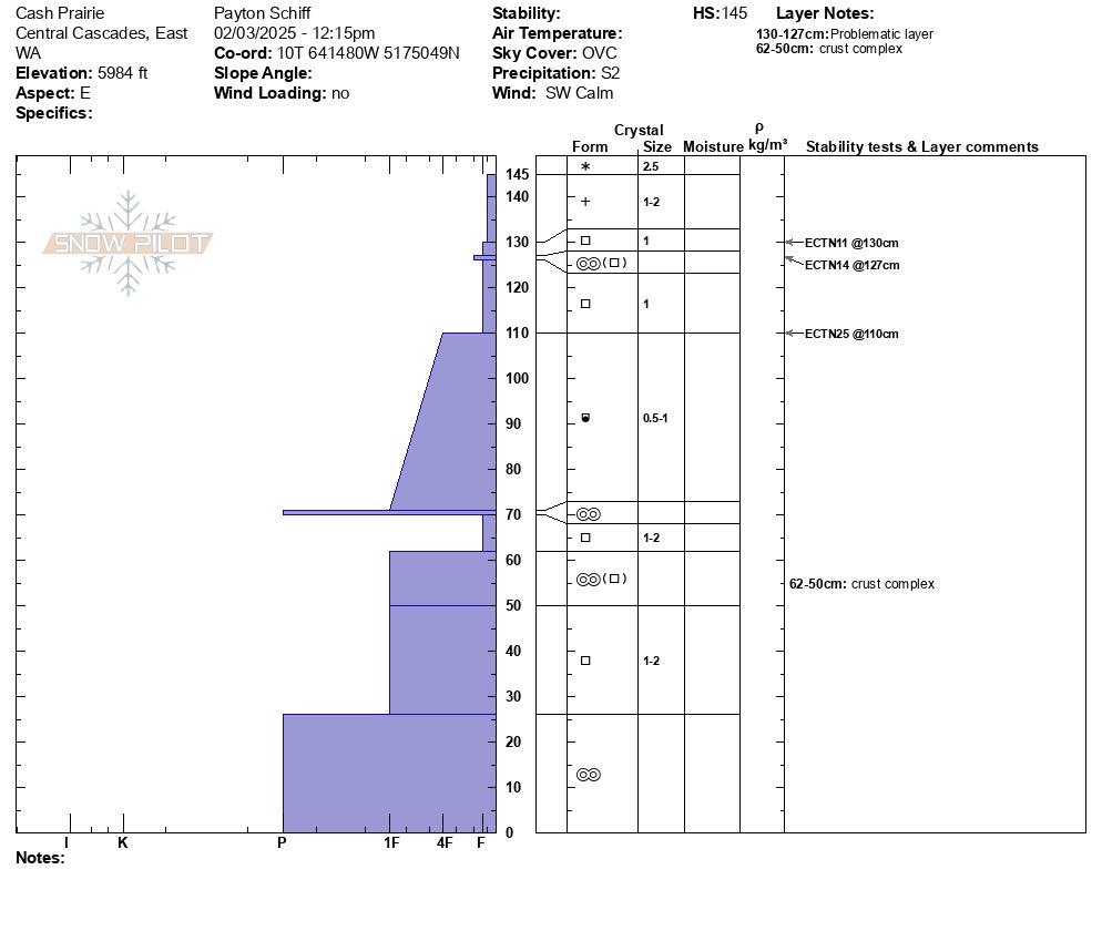
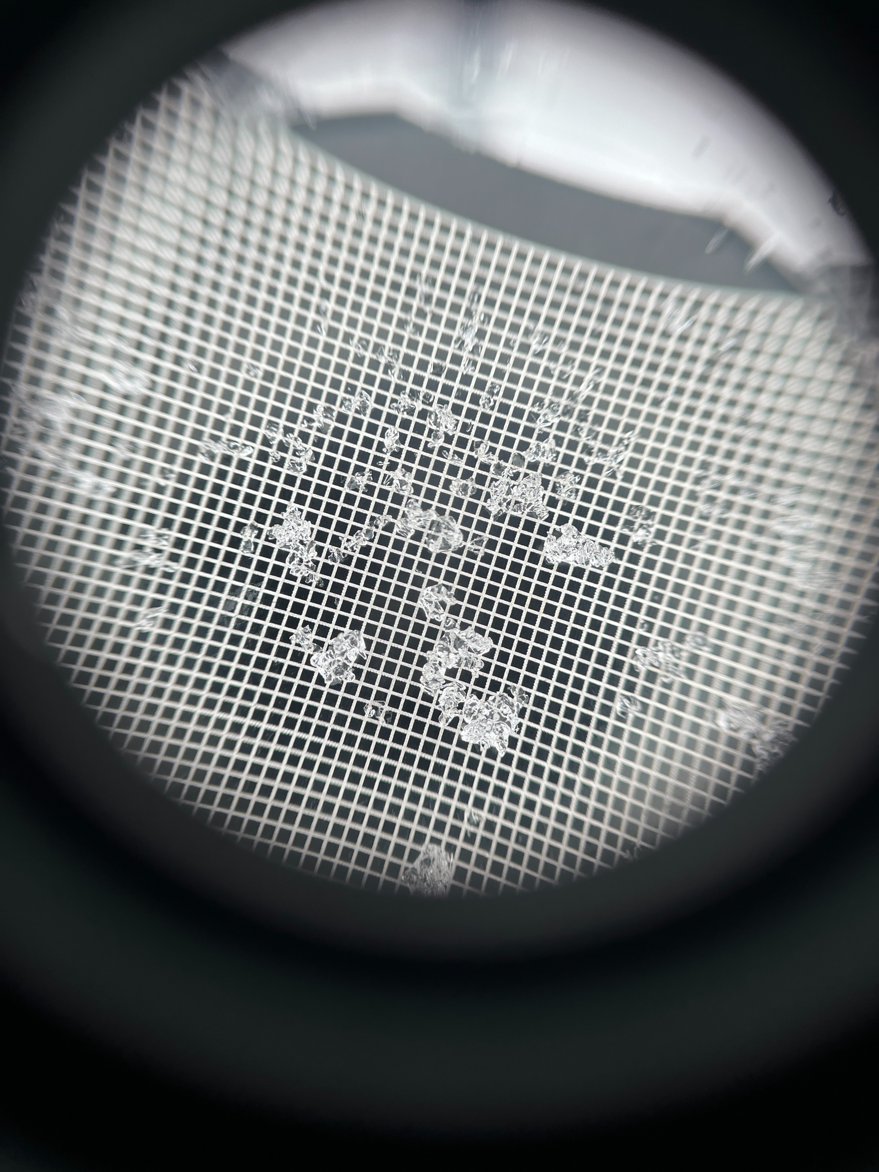
We dug a pit on an east aspect at 5984 ft. The depth of this pit was 57in/145cm. We found 6in/15cm of new snow at the surface. The rest of the snowpack consisted of faceting melt freeze crusts or facets. A quick shovel tap test gave a moderate result at the new and old snow interface (where the new snow overlays the uppermost layer of facets). We performed an extended column test which first yielded moderate, non propagating results at the new/old interface, second moderate non-propagating results just below that interface, and third hard non-propagating results at an interface between two different layers of facets lower down (ECTN11, ECTN14, ECTN25).
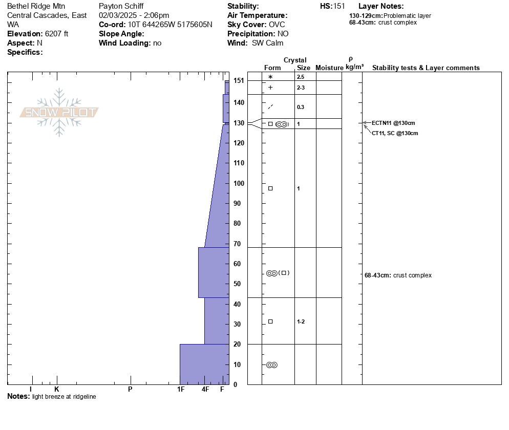
We dug another pit on a north aspect at 6207 ft. The depth of this pit was 59in/151cm. Pretty much the only difference in the snowpack structure between this pit and the first was that we found 8in/21cm of new/recent snow and some of this snow was more wind broken. We performed a compression test and got a moderate sudden collapse at the new/old interface (CT11SC). We performed an extended column test and got moderate, non-propagating results at the same interface (ECTN11).