
Quick report
- Cracking
- specific
New snow, lots of south wind at all elevations transporting snow to leeward northerly slopes and cross-loading east aspects. Observed minor cracking of surface snow on skin track; both in protected terrain with new softer snow, and in exposed areas above 7000' with newly formed wind slab near the ridge.
Weather
- Air Temp
- 25
- Cloud Cover
- overcast
- Wind Loading
- moderate
- Recent Snowfall
- 19
- Snow Avail For Transport
- large amounts
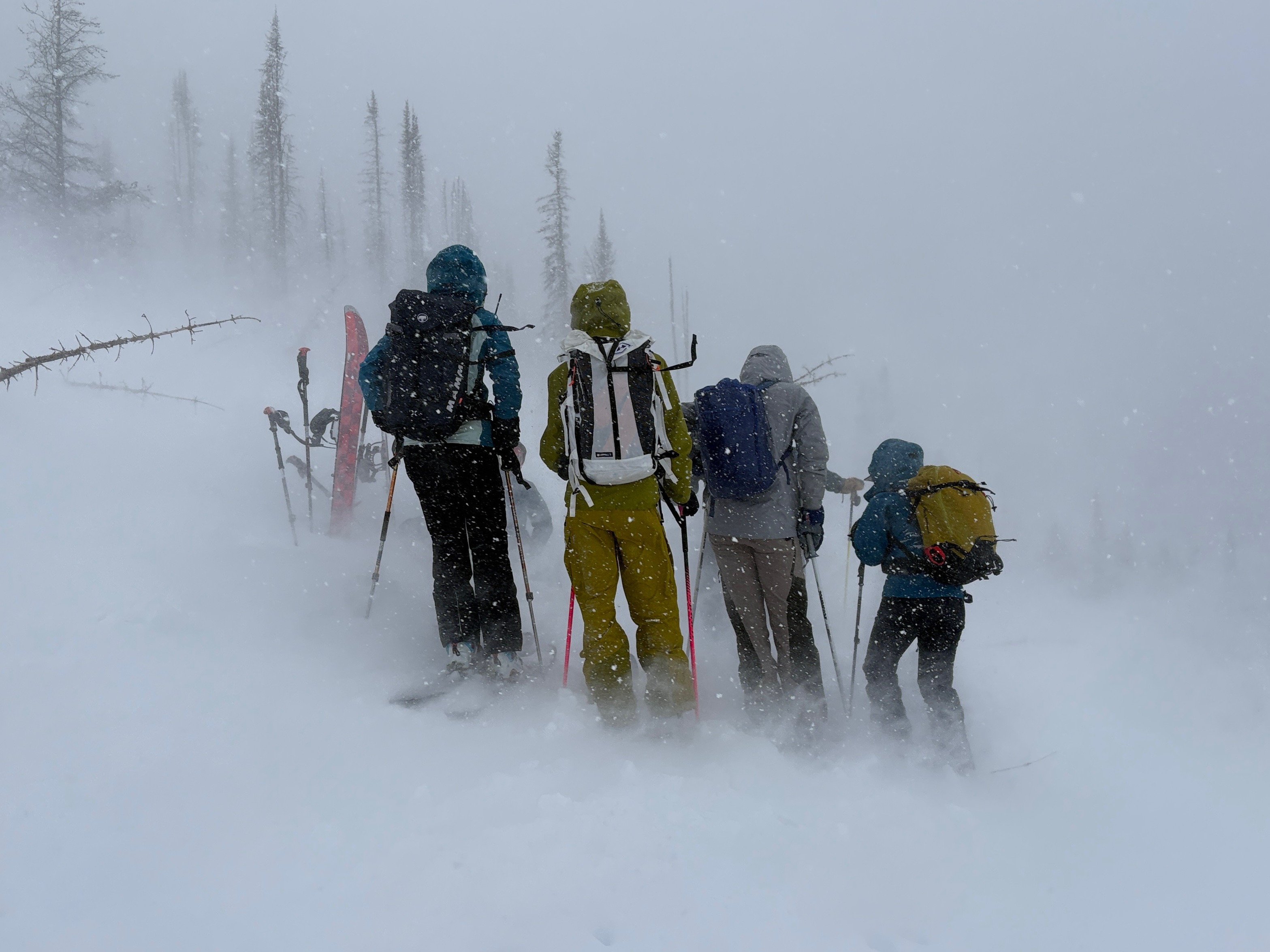
Bairds to 7200' on 2/17 Temperature = 25 F Light to moderate snow (S1-S2) all day ~8in of new snow. Strong gusts and moderate sustained winds past 24 hr had built up stiff but breakable wind-slab in exposed areas, and small softer storm and wind-slabs in other areas. Cross-loading of east aspects on Bairds. Phat Ridge to 7400' on Monday 2/16 Temperature = 30 F Moderate (S2+) snow most of day Moderate SE-S-SW winds and strong gusts on all day transporting a lot of snow at all elevations observed Cross-loading of new snow on ridge over old harder slabs. South aspects and isolated areas around trees were more scoured with lots of active loading on the northerly aspects. (See photo of active transport on 2/16)
Snowpack
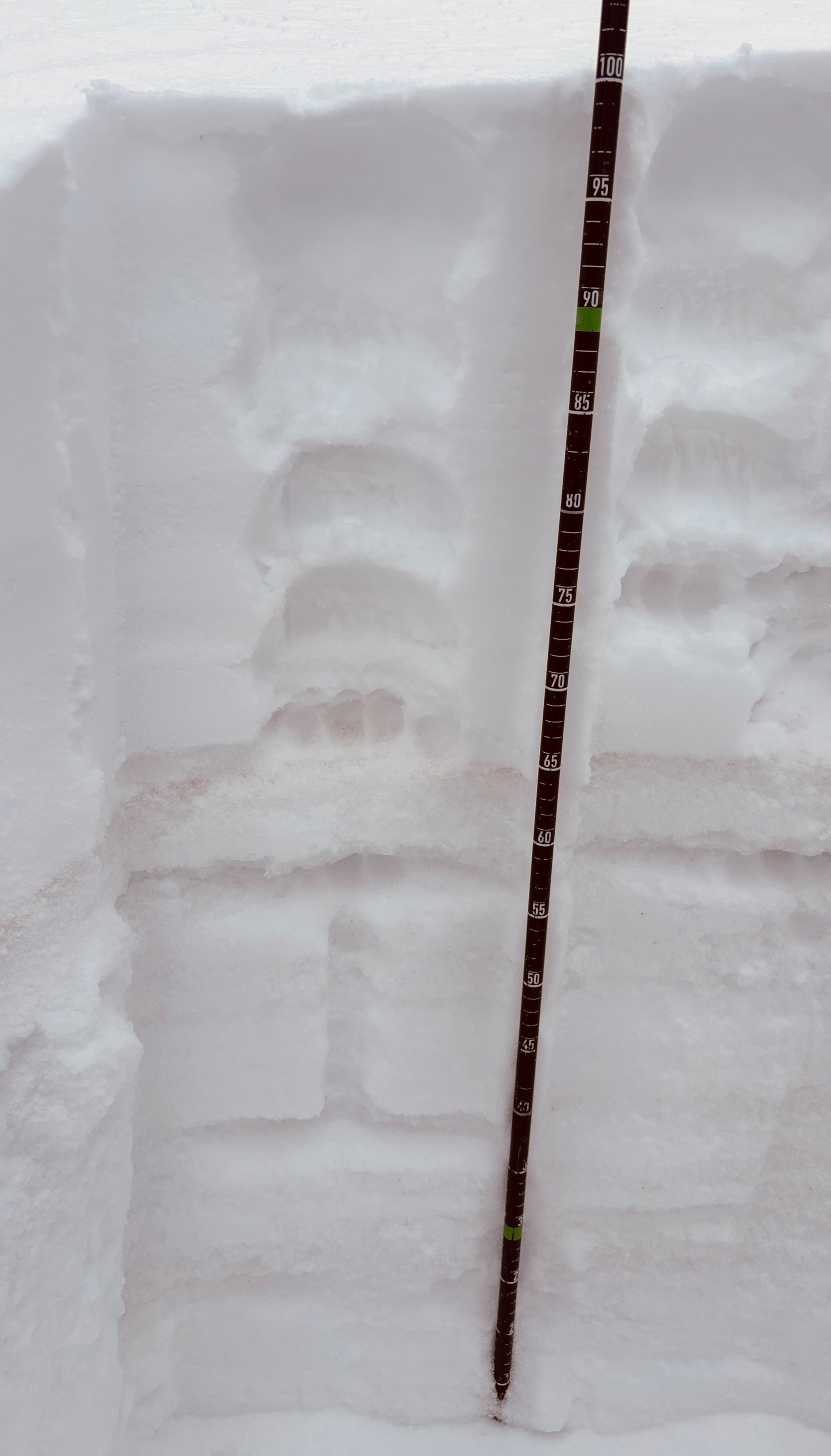
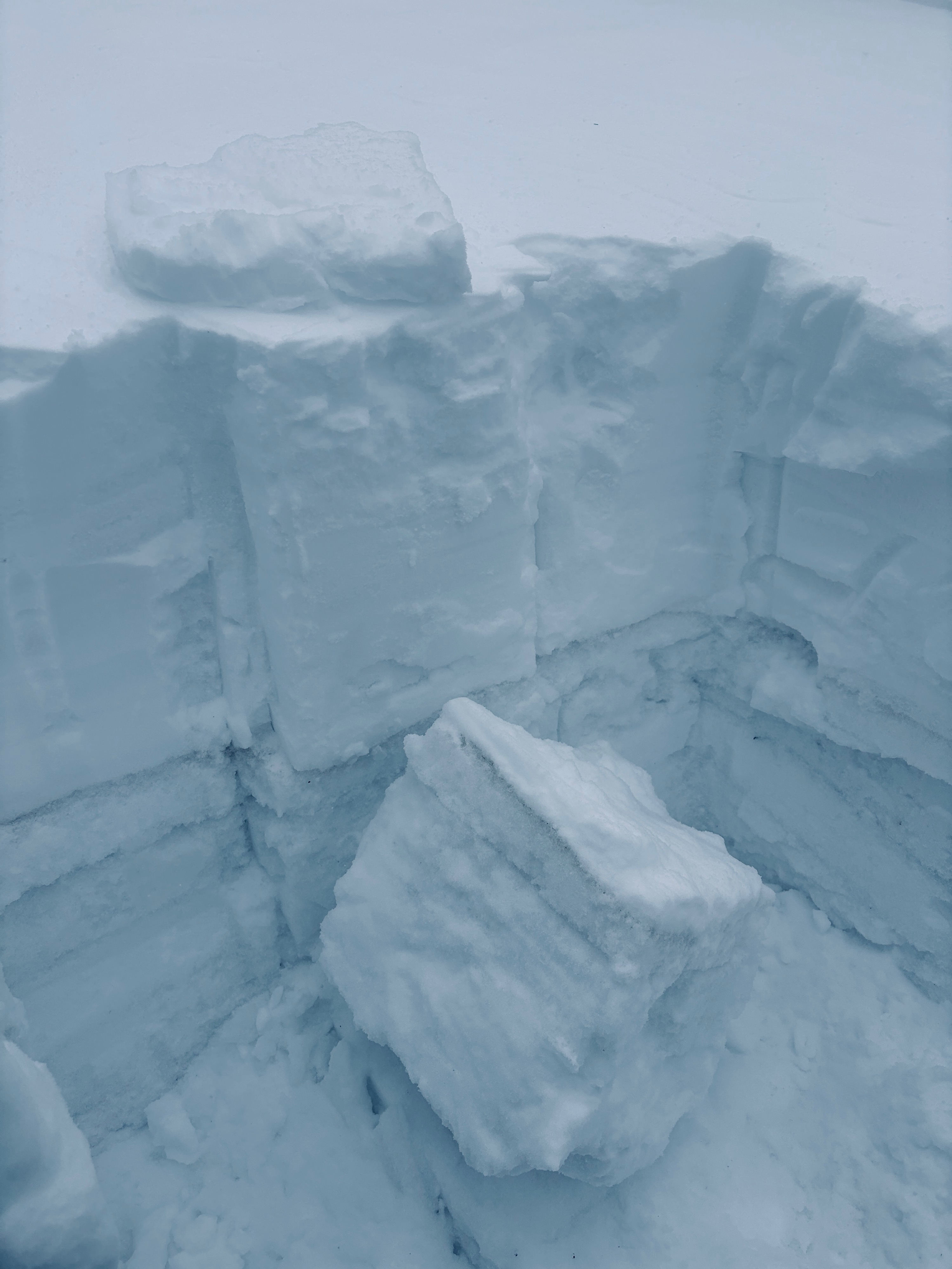
See photo: Dug quick pit near ridge at 7200' on an East slope in open trees with moderate cross-loading from past 2 days. HS = 100-120 cm, with 19 cm new (~8") of new snow since 2/15. Ski pen = 15 cm, Foot pen = 30 cm The recent snow was F, and then 4F right above the buried 2/14 crust @ 65cm down. It was a very stout 5cm K-hard crust that was well-bonded to the 1F to P layers and other crusts below. (See photo). Compression Test: CT9 down 30cm (RP). There was progressive compression of the top 15 cm F-hard snow before the small soft slab fractured above the crust (see photo of stout cohesive lower crust layers and small slab). The top 60 cm of snow is a variation of soft wind-effected snow depending on the wind speeds and drifting snow from past 2 days. The biggest concern is the new formed wind slabs in exposed areas and whether they are forming as larger hard slabs.