
Quick report
Went looking for low-stress rec skiing today on southerly aspects at mid- to low-elevations. We found nice powder turns over a relatively trustworthy snowpack structure compared to what I've been targeting on shadier aspects all week. The biggest concern here was small, fresh drifts in high-consequence terrain, or if you changed aspects so that the suncrusts interspersed between storms this month are thinner and provide less strength. The cold temps should preserve the powder snow for another day of good riding on southerlies tomorrow.
Minor cracking (1' to 2') in fresh wind drifts, which were only 6 to 10" thick where we traveled.Weather
- Wind Loading
- light
- Recent Snowfall
- 15 to 25
- Snow Avail For Transport
- moderate amounts
Winter-like temps at last! Clear skies this morning, with clouds filling in over the Ruby Range by noon. Light wind drifting in the alpine from northerly winds.
Snowpack
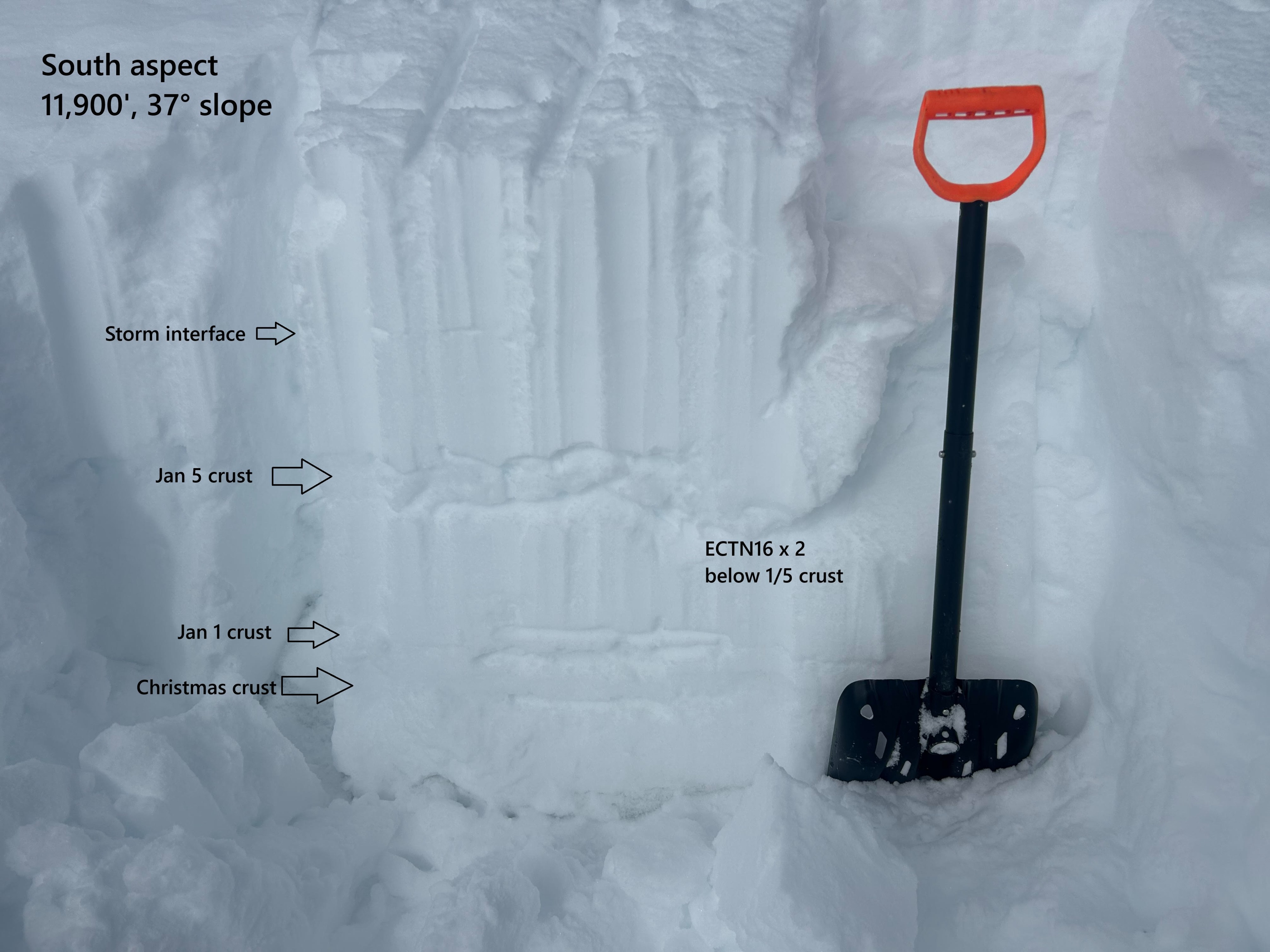
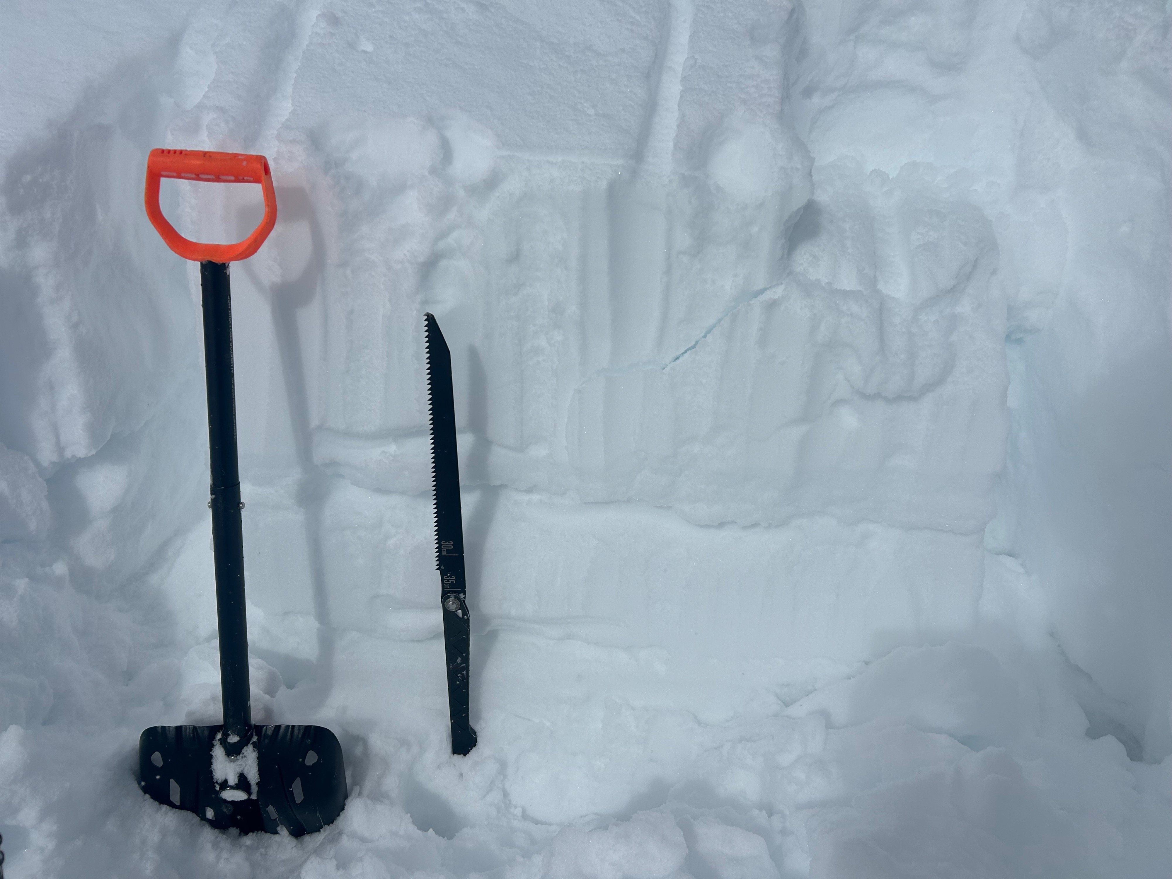
Three or four suncrusts in the snowpack; the thickest and strongest being the Christmas crust (near the ground) and the Jan 5 crust (supportive to skis, 4 - 5 cm thick) up to ~18" deep on as sheltered of a feature as I could find. There are small-grained, rounding facets below the various crusts in the snowpack; I didn't notice any obvious facets above the crusts where I dug, except in a crust/facet/crust sandwich at the Dec 25 to Jan 1 zone.
Avalanche
- Size
- D1
- Type
- SS
- Aspect
- SE
- Trigger
- N
- Elevation
- 11500 ft
A handful of harmless (D1) soft wind slabs that likely ran this morning from increased northerly winds on E to S facing rollovers.