
GTSR - Garden Wall WX
Quick report
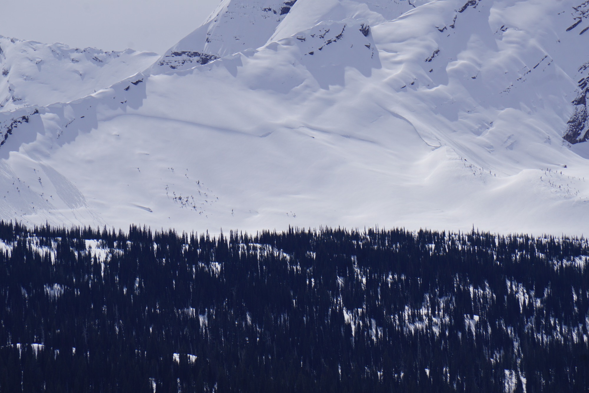
Today was a generally a calm day in the mountains with overcast conditions that evolved into broken clouds with considerable solar heating between 230pm and 4pm. Temperatures climbed quickly in direct sunlight and broke down strong surface refreezes by noon below 6k'. Above 6k' we found variable snow conditions that included hot pow, windboard, and thin melt freeze crusts. Roller balls began to naturally occur between noon and 1pm with a spike in activity during the afternoon clearing and warm up. No obvious signs of instability observed today. Also observed an old partially filled in large crown on the north aspect of Heavens Peak (pictured) and glide cracks forming on Heavens Peak.
Weather
- Air Temp
- 35
- Cloud Cover
- overcast
- Wind Loading
- previous
- Recent Snowfall
- 5 cm
- Snow Avail For Transport
- none
Temperatures climbed from the upper twenties to mid-30s above 6k' and mid-40s at lower elevations.
Snowpack
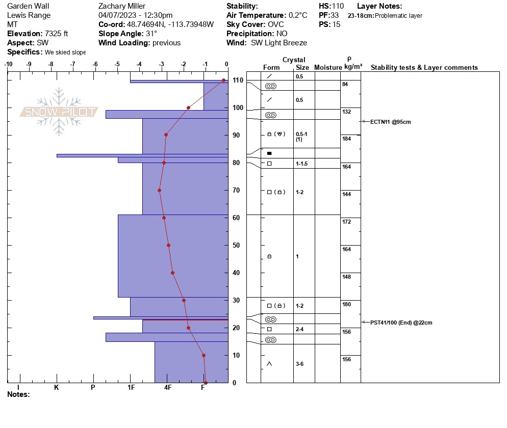
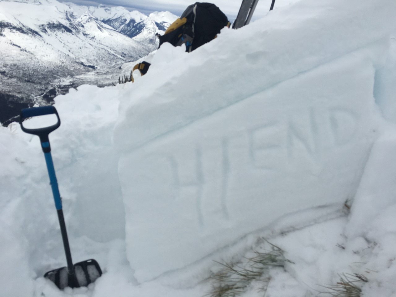
Dug a full pit profile at the Garden Wall weather station and found a generally stable upper and mid-pack with buried large-grained facets and depth hoar in the bottom 25cm of the pit. PST 41/100 END on a layer of large facets between early season crusts (pictured)... the persistent weak layers persist! Full profile attached.