
Quick report
- Aspect
- Northwest
- Red Flags
- Cracking, Rapid Warming
- Elevation
- 3170 m
- Slope Angle
- 30°
- Red Flags Comment
- <p>very pockety wind slabs cracking. did not see anything like long low angle releases noted yesterday.</p> <p>heat on rocks point release observed. rollerballs. exit at 12:40 pm.</p>
i was trying to figure out were rain crust ended/lessened. boot penetration at 9300' was 2" at around 10,300 the boot penetration increased to shin deep.
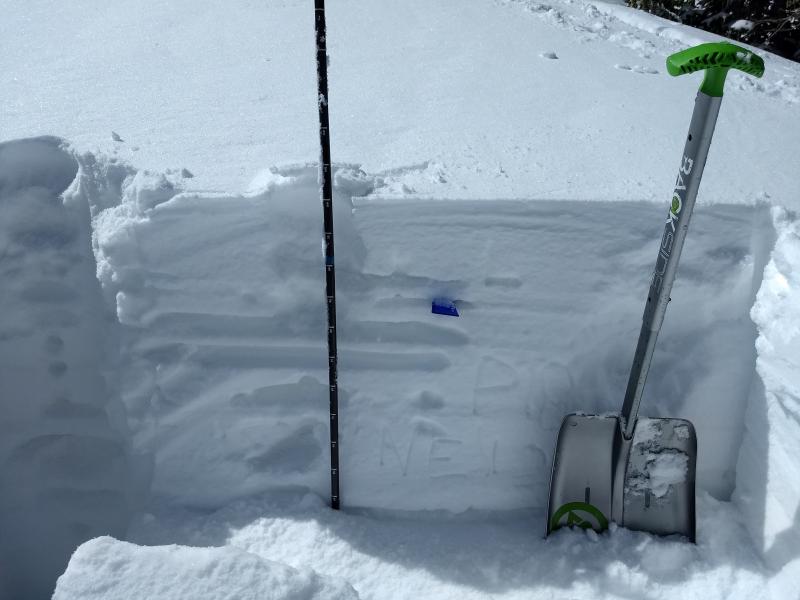
this ne pit at 10,400 I was trying to find/understand some small thinner rain crust layers. ectp 18 to 22 (ran 2x same place) q1maby q2 on/around grauple layer 55cm deep.
Im not sure at this elevation (10,400) how many times it switched from rain to snow, but there seemed to be 2 crust layers below the 7". if it did switch to rain, it wasnt long because none of the crust layers very thick, but kind of confusing, lost a bit of touch with the snowpack past 2 weeks, and i gave up, other than to note that there are a fair number of crust layers.
I didnt do a pit lower, rain crust very thick below about 9800.
I dont know that it will matter this year, but the idea of raising the ground due to deep rain crust theory probably doesnt apply above 10,000 feet (10,200 is my guess) and the top 2' of snow pack is very different starting about 10,000 (maby 9400' where i think previous rain event topped out) due to past 2 big rain events
Snowpack
2" on rock hard rain crust till 10,300' then 7" on spongy base. Low angle was call of day to prevent some nasty hard bottom feeding below 10,000. Riding above 10,000 was good, below that wasnt worth much. when i left some snow still cool above 10,000.
evidence of wind transport observed (bare rain crust, scallops, shallow pillows, etc