
Quick report
- Collapsing
- specific
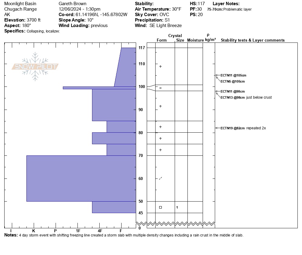
A moisture saturated snowpack below 3000' led way to 12-16 inches of new dry snow with a rain crust in the middle above 3000'. New snow had an uneven depth distribution due to wind. Multiple hand shear tests were performed on the way up that showed fair bonding to the knife+ hard wind board layer at the interface. Failure on hand shears within the storm slab was easy to moderate and on a couple occasions failed on isolation below the mid storm rain crust mentioned above. Pit results at 3700'/S aspect produced multiple failures within the storm slab on a moderate score. No propagation was observed. See profile for more details on stability tests.
Storm slab was 40 cms deep with an HS of 120cm. Below the new snow was a 20 cm thick windboard that I could not shovel through without damaging my shovel
Above 3k collapsing within the storm slab was occurring due to a rain crust that was mid way through the storm slab.Weather
- Cloud Cover
- overcast
- Wind Loading
- light
- Rain Elevation
- 4K +
- Recent Snowfall
- 20-40 cm
- Snow Avail For Transport
- moderate amounts
Moderate snow light wind and temps near freezing
Snowpack
Rain and above freezing temperatures had fully penetrated the average 2' deep snowpack up to 3000'. New snowfall was average 8" in depth below 3k, however was variable due to wind. A slight crust was beginning to form at the surface.
Above 3k there was ~4-8 inches of dry snow on top of a mid storm rain crust with ~8" of dry snow beneath. This setup continued up to 4000' where I turned around due to low visibility. The rain crust mentioned above still existed at 4k, but was weaker and thinner, indicating I was probably close to its upper elevation extent in this location.