
Quick report
Toured up West Angle to the weather station and then up to the ridge at 10k. 4-5 inches of new snow from the last couple of days at the road (8600') and closer to 10 inches above 9500'. Very little wind affect along the ridge up to 10,000 feet.
Interval board: 8.5 inches snow, 1.3 inches SWE. Last cleared 3/10.
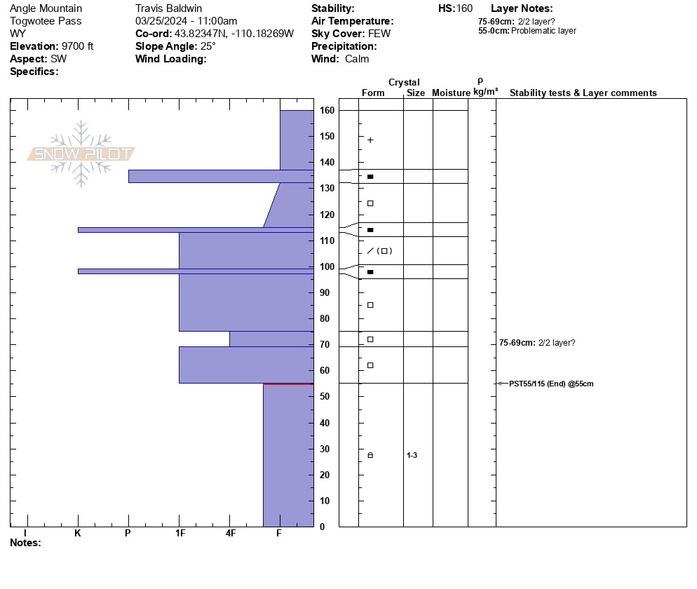
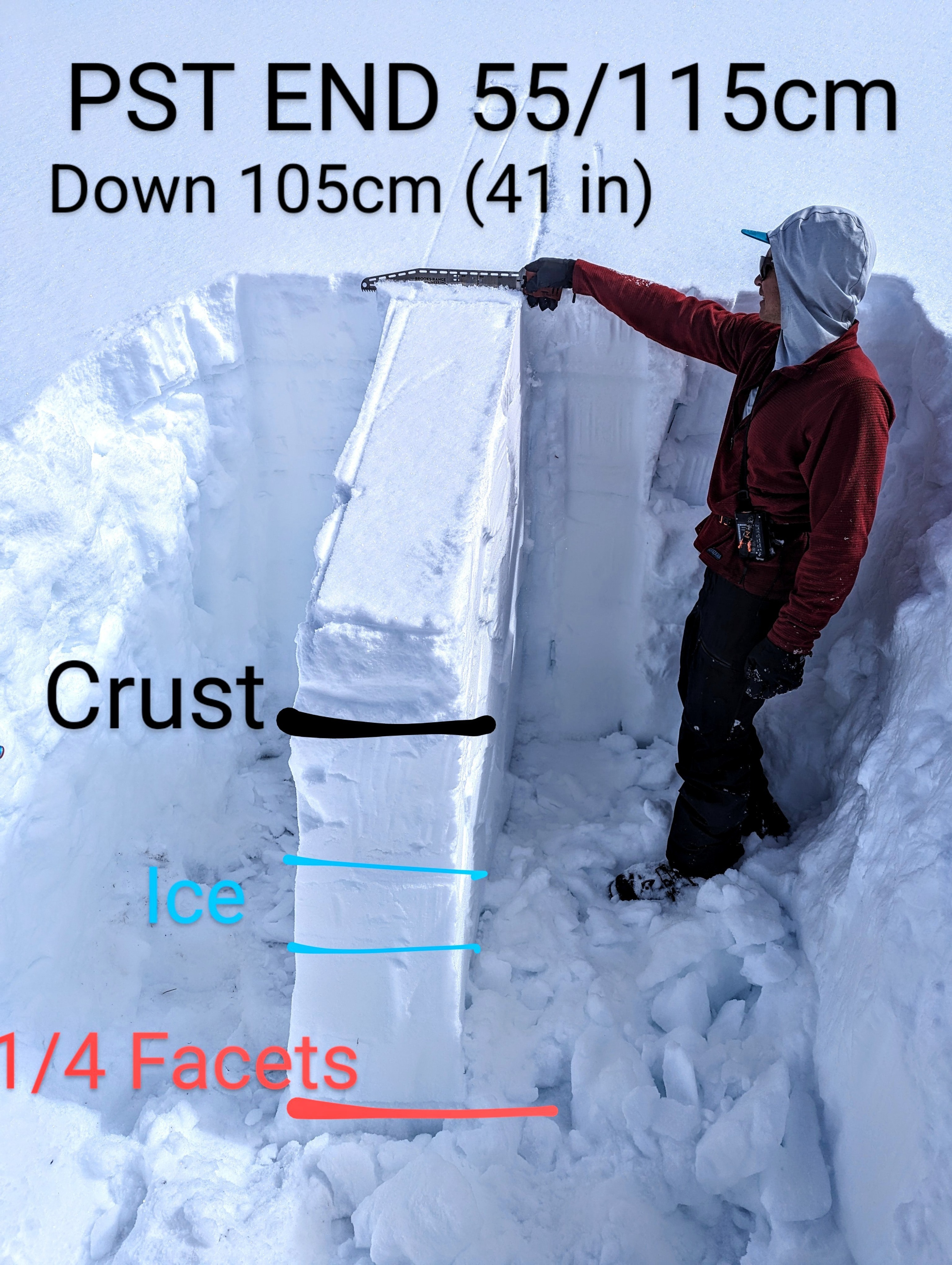
We dug on a SW aspect around 9700 feet. There is a stout melt-freeze crust about 10 inches down and 2 ice lenses another 10-14 inches down. Below that, a stiff (mostly 1 finger) slab sits on top of buried facets from Jan 4. The 1/4 weak layer is down 41 inches (105 cm).
Test results: PST END 55/115 on the 1/4 layer
While the PST results show that propagation is likely on the 1/4 weak layer, there is more to the story here. Meltwater from last week's high pressure and warm weather worked down through the snowpack and formed two ice lenses in the top 2 feet of the snowpack. I suspect that triggering a persistent slab avalanche is unlikely on southerly aspects where a thick, firm slab lies over the 1/4 weak layer.
Steep, rocky wind-affected northerly slopes and thin areas remain suspect on Togwotee.
Weather
Broken skies with periods of intense sun made it feel quite warm even though air temps were in the teens. Mostly calm.