
Quick report
5-9" of new snow (low density and blower) in the last 24 hours. Little to no wind affect observed up to ~9000'. This matched weather station data with westerly wind at JHMR Summit hovering around 15 mph during active precipitation. Overall height of snow varied from 20-32" between 7,000'-9,000'. Steep south facing slopes are holding considerably less snow. Intermittent cloud cover kept snow surfaces relatively cool in our area until at least 14:00 (departure).
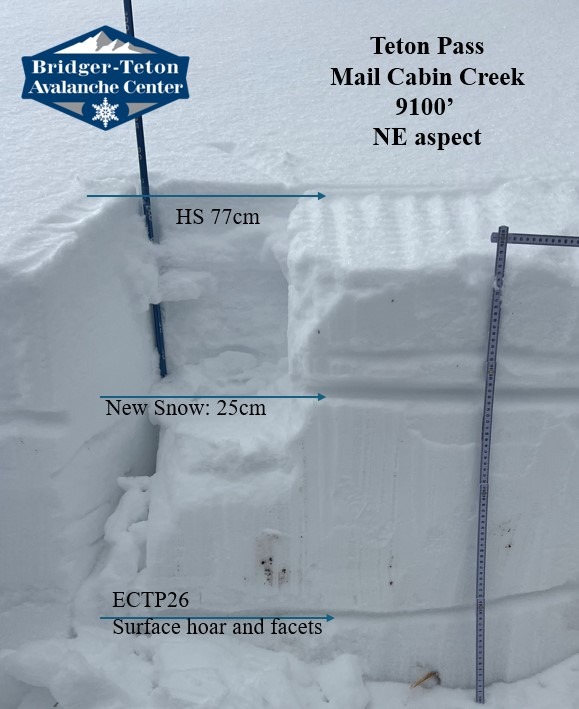
Dug a pit at 9100' on a NE aspect. Here, the top portion of the snowpack was rightside up with a firm layer (1F) down about 20” that was acting as a good, supportable base. It should be noted that the pit location was in a wind loaded spot and this 1F layer is not present everywhere. Below this, the snowpack deteriorated into moist facets (see snowpit). We found high propagation scores in stability tests (ECTP26 x2) down 23" failing on facets and poorly preserved surface hoar (buried on 11/12 after a ~6 day drought period).
Stuck to grass covered slopes to avoid hazards below the surface. This last storm helped conditions improve, but thin coverage still exists and caution is warranted.
Snowpack
See snow profile