
Quick report
- Aspect
- Northwest
- Red Flags
- Poor Snowpack Structure
- Elevation
- 2987 m
- Slope Angle
- 28°
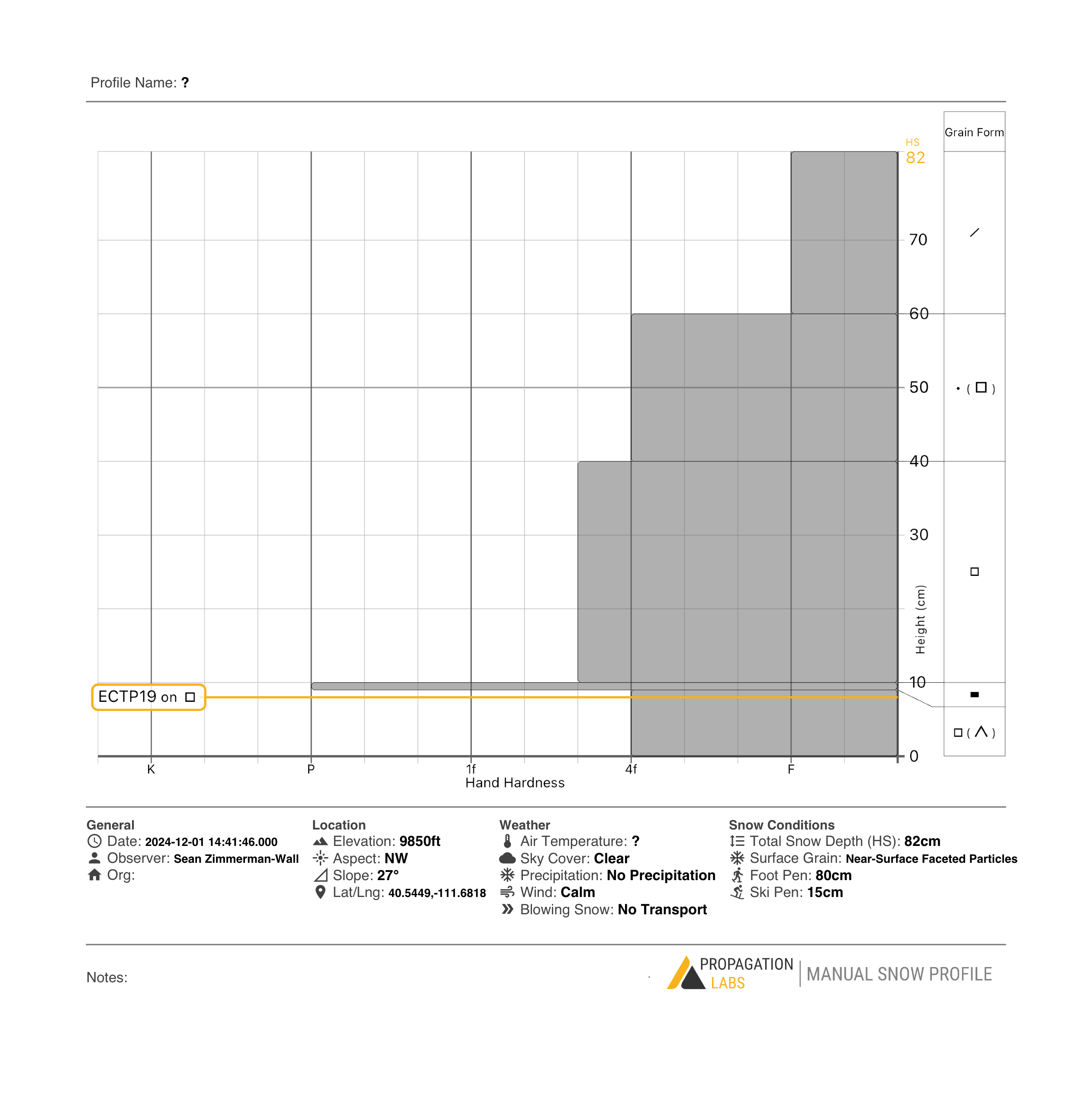
Primary objective was a circumnavigation of the White Pine drainage as snow coverage would allow. Route was up through the brush on the west side of the creek, around back of Spire, across lower ramps of Lake Peak up to White Pine Lake. Descent down dam face to summer trail and exit. Several intrepid skin and ski tracks around on Tri Chutes, Red Baldy, and Pink Pine. I observed HS of 40-100cm across aspects with plenty of rocks and bushwhacking opportunities. Surface conditions are continuing to weaken as faceting and surface hoar development takes hold. 10mm surface hoar observed around creeks and patches of 5mm located in forested openings where moist air had pooled. Open slopes have small grained near-surface facets and they are cohesionless in steeper terrain, sluffing easily off ski cuts.
Snowpack
- Instability Comment
- <p>Structure supports propagation even though the resistance between layers is rather subtle. Two visible old snow avalanches in upper White Pine below White Baldy. The larger of the two was reported on 11/27. The smaller was on a more Easterly aspect about 500' lower and was not nearly as deep.</p>
Surface conditions are still mostly supportable on skis. Foot penetration to ground in many locations.