
Keystone Canyon
Quick report
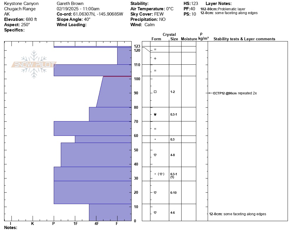
Previous wet loose debris was evident from the previous 24 hours with pinwheels and debris observed at the base of steep terrain. A very thin superficial crust was at the surface with dry snow beneath indicating that the above freezing temps from 2/18 had penetrated very little into the snowpack. Future above freezing temps could easily break down this layer and effect the dry snow beneath causing additional wet loose activity during the heat of the day. Faceted snow beneath the uppermost rain crust that is described above did not seem likely to be triggered on a wider slope due to the connectivity strength of the rain crust. There is a concern that this layer could produce human triggered avalanches up to 1 foot in depth on steep unsupported slopes where the continuity of the rain crust could be compromised and act as a slab.
Moderate wet loose activity was observed from the last 24 hours.Weather
- Cloud Cover
- scattered
- Wind Loading
- none
- Recent Snowfall
- 15
- Snow Avail For Transport
- small smounts
partly cloudy, temps near 32 F and calm
Snowpack
On a slope that was protected from avy and ice fall debris found 6 inches of dry snow above a rain crust. Facets existed beneath this rain crust that were the main layer of concern and produced propagation in ECT tests mutiple times: ECTP 12 down 30 cms. Beneath these facets were multiple layers of melt freeze crusts. See full profile for more details.