
Quick report
- Aspect
- Northeast
- Red Flags
- Poor Snowpack Structure
- Elevation
- 2225 m
- Slope Angle
- 17°
- Red Flags Comment
- <p>Rain and the subsequent snow did interesting things to the snowpack, those hazard was perhaps moderate for the areas we ventured.</p>
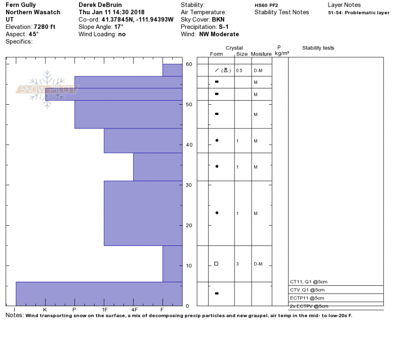
At the middle elevations, water made it's way through the entire snowpack from the rain event. The basal ice layer remains with CT and ECT failing on isolation or at the basal ice layer or on the ground (basal ice is not present in some spots near vegetation, etc.). However, near the top of the snowpack the rain has frozen in and seems to be bridging well. The ice is 10 to 15cm thick, with the center quite hard (K) with additional somewhat softer ice (P) above and below. Below this is moist rounding snow with a pile of facets at the bottom on the basal ice. Interested to see how this sets up with temps the next few days. With hard enough freezing, the upper ice layer could reset "ground level," while providing a new and exciting bed surface with facets and graupel on top. There's plenty of moisture in the snowpack below, so wouldn't be surprised to see faceting on both sides of the ice crust.
Snowpack
Creamy turns--some blown precip and graupel made for dust on crust at mid elevation. At lower elevations, largely just crusty junk.