
Quick report
We mainly traveled between 5000 - 6200’ on W-N aspect and bit on ridgetop. Traveled in just one area and did not have visibility across valley on differing slopes but did not observe or find obvious snowpack instabilities. Saturday 7th rain crust is fully refrozen and on average 5cm thick with dry light snow on top. Elevations below ~5000’ the 12/7 crust appeared to be not yet fully frozen and partly breakable.
small D1 dry loose below ridgetop small cornice formationWeather
- Cloud Cover
- obscured
- Wind Loading
- light
- Snow Avail For Transport
- moderate amounts
Fog and low visibility throughout the day. No precip. Light W ridgetop winds, no active snow transport.
Snowpack
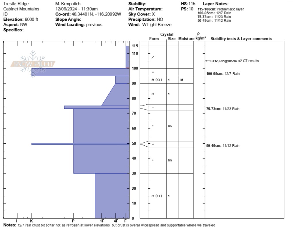
At 4500’ snowpack height is around 2 ft deep. There's 10cm (4in) of new storm snow over a partly frozen rain crust from rain this last weekend on 12/7. Wet snow sits underneath this crust.
At 5200 - 6000’ snowpack heights are 3 - 4 ft deep. There is 10-15cm (4-6 in) of dry light snow over hard, supportive rain crust. We observed resistant CT results down 10cm, 5cm above newest rain crust. No other test results in the snowpack. No cracking underfoot in wind pillowed spots. The new 12/7 rain crust, 5cm (2”) thick on average, is fully refrozen and formed over near surface faceted ~1mm grains. Where we traveled, we did not find evidence of the surface hoar that developed last week, the rain destroyed it here.
Recent wind deposited pillows isolated soft slabs near ridgeline at 6200’. Small recent cornice formation at ridgetop. Small D1 dry loose, no slab, results below cornice.