
Quick report
- Cracking
- specific
- Collapsing
- specific
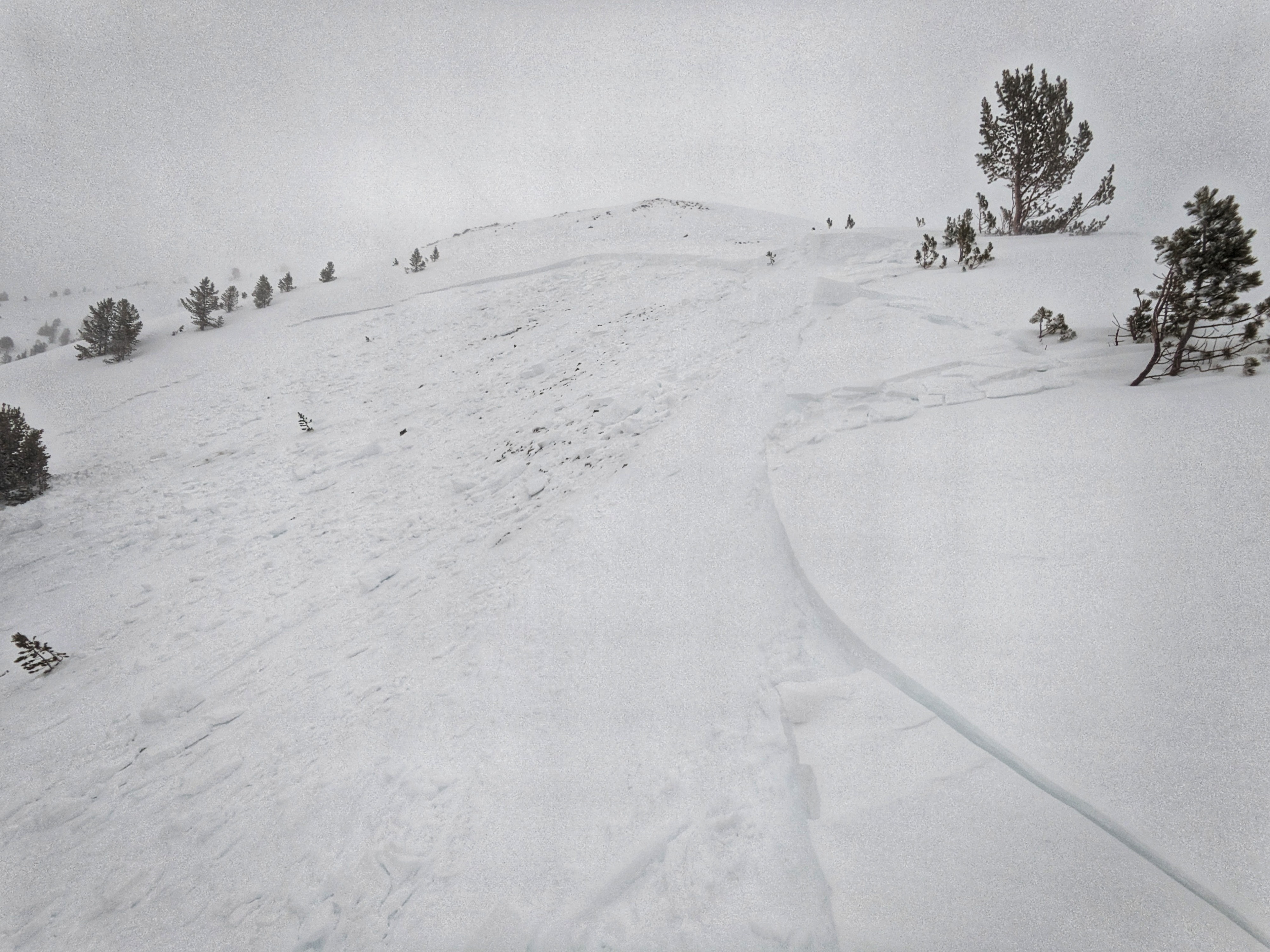
Cracking and collapsing were restricted to heavily wind-affected terrain. Some of this involved older drifts that developed earlier in the week.
Weather
- Cloud Cover
- obscured
- Wind Loading
- intense
- Rain Elevation
- all snow
- Recent Snowfall
- 16-20
- Snow Avail For Transport
- large amounts
Wet and wild! Snowing an average of S1 to S2 throughout the afternoon, with flurries of >S3 observed. At times, it was difficult to tell how much of the snow in the air was actually falling and how much was being knocked out of trees. When I started my tour around 1400 there was 20cm total on top of 2/24, a little less than half of which had fallen today (8-10cm). When I returned to my truck at 1900, an additional 8-10cm had accumulated, for a storm total of 16-20cm.
Snowpack
On lower and low end of middle elevation solars, 2/24 crust was merged with 2/1 weak layer; this package was hard to penetrate with my ski pole.
Despite the amount of blowing going on, wind slab development was minimal/non-existent below about 9,000'. Intermittent strong to extreme winds blowing out of the SW-W portion of the compass were transporting very large amounts of snow and loading starting zones in upper elevation terrain.
Avalanche
- Size
- D2.5
- Aspect
- N
- Trigger
- AS
- Elevation
- 9700 ft
Remotely triggered from ridgeline adjacent to starting zone. This failed both at the base of the snow since Monday (2/24 weak layer), and on weak snow near the ground (1/6?). Slab thickness ranged from 30-40cm to 80 cm.