
Quick report
There is a healthy breakable crust from 8500' to 9200' on SW/W aspects. Above that, the crust slowly gives way to softer snow and near surface facets. In general, snow depths increased from 1.5 to 3 ft up to 10k. Steeper, sunny slopes and wind exposed slopes continue to be much thinner. Both the crust and nsf's are cause for concern if loaded with the incoming storm. The crust did not feel as slick as the middle elevation rain crust I found in the Tetons yesterday but will still be a slippery bed surface for new snow.
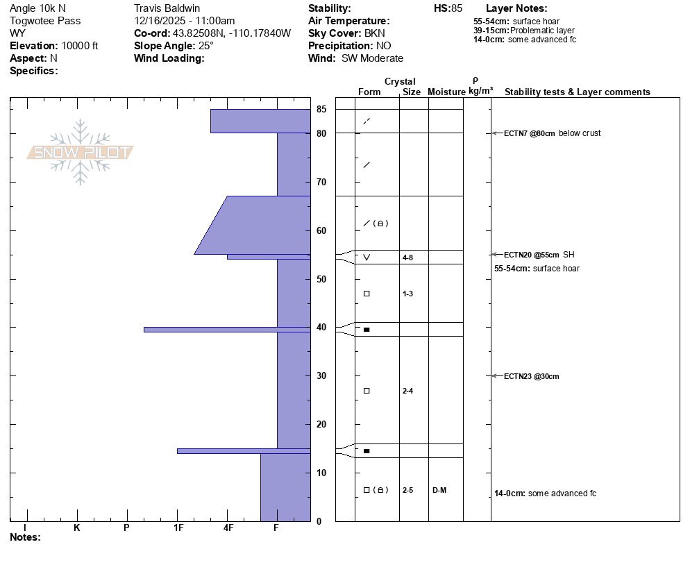
I dug at 10,000' on a N aspect, adjacent to the pit we dug last week. I did not get propogation on the buried surface hoar in my pit today, although that layer was still very obvious. Instead, I got an ECTN 7 down a couple of inches just below the wind crust, an ECTN 20 at the buried surface hoar about a foot below the surface, and an ECTN23 in facets closer to the gound. Given the thin snowpack and poor structure, I could foresee any of these three ECTN layers being problematic with enough of a new load with poetential for a surface avalanche stepping down into facets closer to the ground. The biggest unknown will be how much precipitation comes in with the next system. Some models are calling for over 2 inches of snow water equivalent (SWE) on Togwotee by the end of the weekend, and depending on how quickly it arrives, it could be enough to tip the scales.
No signs of recent instability.Weather
- Cloud Cover
- overcast
- Snow Avail For Transport
- small smounts
Increasing winds out of the southwest throughout the morning. Consistent moderate SW winds on the ridge at 10k.