
Quick report
- Aspect
- Northeast
- Red Flags
- Wind Loading, Rapid Warming
- Elevation
- 2957 m
- Slope Angle
- 30°
- Red Flags Comment
- <p>Obvious plumes of snow visible off the high ridgelines indicating drifting snow and wind slab formation. Rapid warming was no doubt happening however, as it turned out, this did not influence the avalanche danger today.</p>
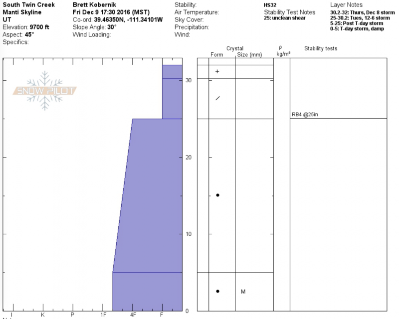
Today I was again pleased with what I found in the current snowpack structure. I see no weak layers of real concern. We were able to produce a "not so clean shear" between last week's big storm and the small storm from Tuesday night. I don't think this is much to be concerned with in the long run. Perhaps some of the recent wind slabs would release on this layer. I suspect it will heal and become nonexistent in short order.
Photo below: This textured and rippled looking snow is formed from the wind. This is the type of snow you want to avoid on steep slopes especially as it is forming during the stronger wind speeds.
The danger for the majority of the terrain is LOW. The danger is MODERATE along the higher ridges where you encounter snow that looks like what is pictured above. Human triggered avalanches are certainly possible on slopes over 35 degrees that have been wind loaded.
Snowpack
- Instability Comment
- <p>The only real concern out there today was the potential to trigger a fresh wind slab (snow drift). I'm not sure how sensitive the new drifts were as we didn't encounter any up close and personal. We only saw the obvious signs of wind loading. We experienced very minor and localized cracking in the wind effected snow.</p>
Warm temperatures and wind has changed the surface snow quite a bit since Thursday. Nearing 10,000', we found wind slabs (fresh drifts) and a slight upside-down feel to the snow surface. The snow was slightly damp even on north aspects up to about 9500'. The entire snowpack was damp from the surface to the ground below about 8600'.