
Quick report
- Aspect
- Southeast
- Elevation
- 2682 m
Snowpack
- Instability Comment
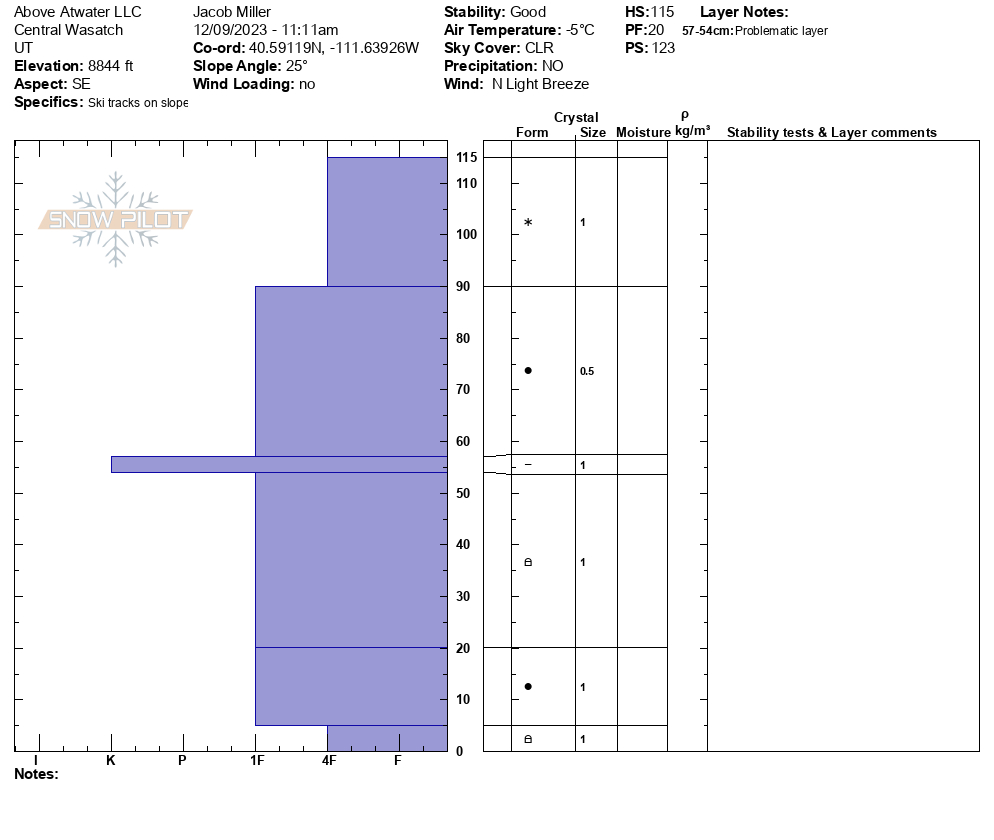
- <p>The top 58 cm of snow is all from the past storm staring on December 6th. This was composed of two layers that increased density as it went deeper into the snowpack. These two layers sat on top of the old snow from the storm ending December 3rd. The warm days between storms created a 3 cm thick sun crust that could be a problem if more weight was added onto it. As of now the old and new snow are bonded well. </p> <p>After that old new snow ice layer the snow pack showed signs of rounding and better bonding as it approached the final 5 cm of the snowpack. The final 5 cm were much more fragile and was still very weakly bonded. The snow did show signs of rounding so hopefully this will heal with a bit more time. </p>