
Quick report
- Slope Angle
- 39°
Avalanche
- Slab Width
- 30 m
- Weak Layer
- Facets
- Trigger Type
- Natural
- Vertical Fall
- 38 m
- Avalanche Type
- Soft Slab
- Slab Thickness
- 61 cm
- Start Zone Aspect
- West
- Avalanche Problem
- Persistent Weak Layer
- Start Zone Elevation
- 3139 m
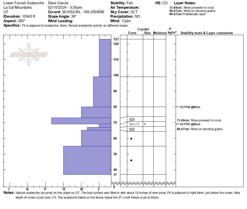
We happened upon this avalanche while skiing out of Goldminer's on Saturday 2/10. This was a natural avalanche that occurred on 2/7 when the La Sal Range experienced numerous natural avalanches. The bed surface was filled in with about 15 inches of new snow. The depth of the crown averaged about 1.5 ft. while the max depth was just over 2 ft. It is hard to tell from the photos, but the avalanche was about 100 feet wide, it broke all the way over to the trees on the looker's right. The last photo is a snowpit dug near the right flank. The avalanche failed on the layer of facets where you see the crystal card in the photo. This layer produced an ECTP 27.