
Quick report
Cleared the interval board: 10 Inches, 4.4 inches of SWE, last cleared 2/17. HS 102"
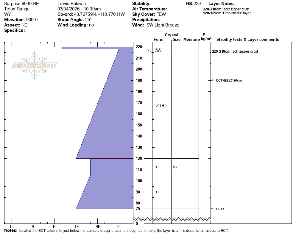
Dug at 9,000 feet on a northeast aspect. HS 87 inches. ECTN22 down a foot. It was actually a little challenging to discern where the drought facet layer started, but there was a slight hardness change down about a meter, 1 finger above the drought layer and 4 fingers plus below in the facets. Rounding facets exist in the drought layer thanks to recent warm temperatures. The ECT I did was a good test for the upper slab, but admittedly not ideal to test propagation potential down a meter.
The structure on the east side of the Tetons is probably better than anywhere else. That said, I would still assess the snow on steep northerly slopes above 8,500k, particularly in rocky terrain where you might find a thin spot. This is in contrast to Teton Pass and the West side, to some extent, where there are still pockets of weak snow (at middle elevations), like on Taylor, where Noah found preserved surface hoar today.
No signs of instability.Weather
- Cloud Cover
- few
- Wind Loading
- none
Clear skies and sunshine in the morning. Thin high clouds rolled in late in the morning with a light SW breeze.
Snowpack
Wide variety of surface conditions. Frozen crust in the valley tranistioned to quickly softening surfaces on sunny slopes. By mid-morning, crusts on steep sunny slopes had broken down up to 8,500'. Consistent cold and dry snow on shady aspects above 9,300'. Shady aspects below 9k had a zipper crust that transistioned to wet snow around 8,000' and isothermal mush at low elevations on the ski out. The high clouds and light breeze (and slightly cooler temps than yesterday) helped prevent another day of full sun bake. I couldn't really get anything to move on steep rollovers either in the sun or shade.