
Quick report
- Cracking
- specific
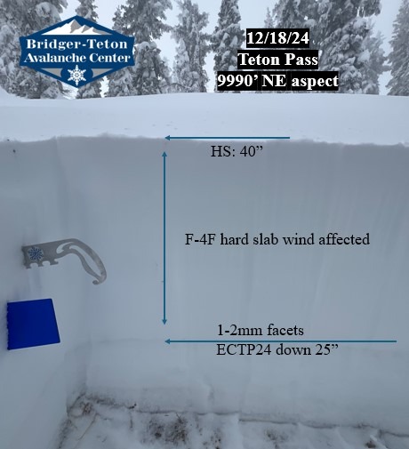
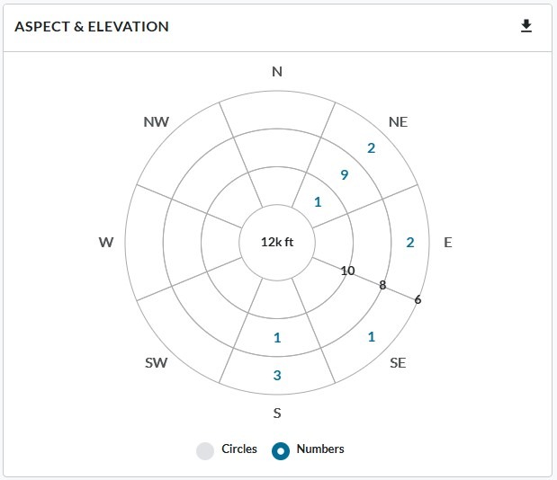
The highest concentration of reported avalanches during this weeks storm cycle was on NE aspects (see Radial Plot photo). I wanted to compare the middle and upper elevations on NE aspects so I dug two snowpits (see Snowpack section) and found propagation in the extended column test only in the upper elevation. Found weak and well developed facets below the new snow at both locations. Observed obvious signs of wind loading and cracking snow on upper elevation leeward terrain (NE aspect). Strong to moderate SW wind this morning decreasing throughout the day. Skies were overcast in the morning becoming broken by the afternoon. New snow on southerly aspects was settling and warming quickly thanks to solar influence yesterday afternoon and today. Ambient air temperature was increasing throughout the day as well. Dry snow still on northerlies.
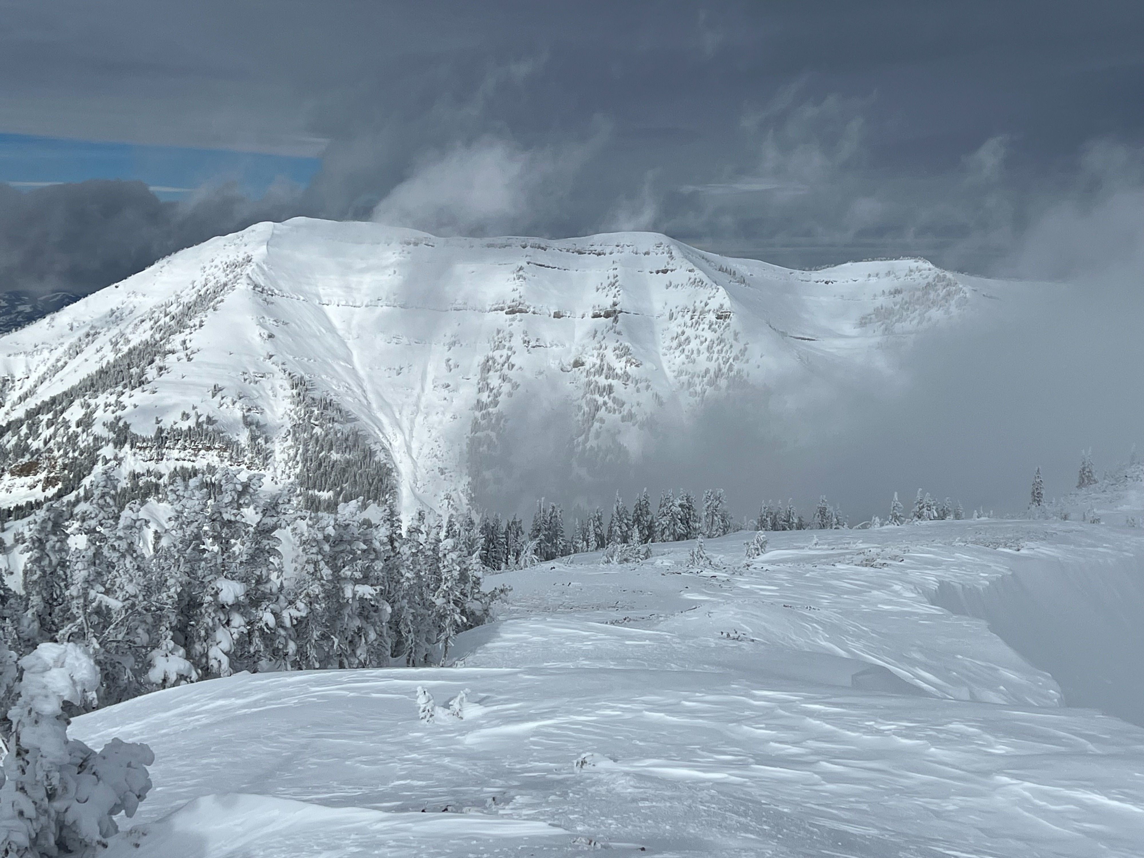
Observed an avalanche on the Do Its, NE aspect at 8400'. Details unknown, but feel free to reach out if you know more. Thanks!
Snowpack
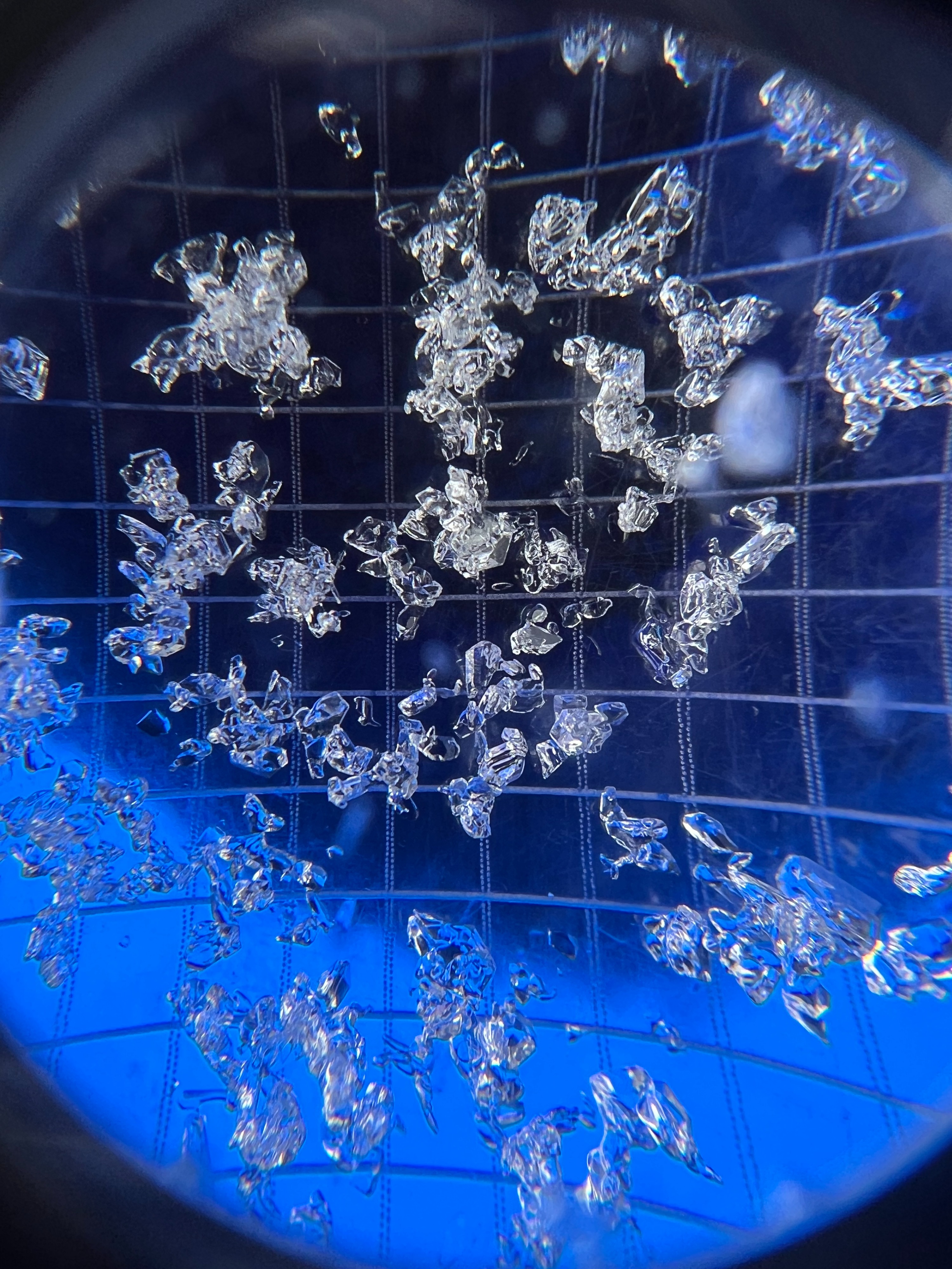
Both the upper and middle elevation snowpits on NE aspects contained faceted snow (1-2mm) from the early December drought (~9 days) buried on 12/8. The upper elevation snowpit propagated (ECTP24 down 24") while the middle elevation did not. The main difference was the quality of the overlying slab being more wind affected and denser in the upper elevation. Tried to dig in a location where I suspected to find surface hoar in the middle elevations but did not find any evidence. Overall this is the main layer of concern right now and it's important to track the first major loading event and associated avalanche activity to help determine how it will behave down the road.
Avalanche
- Size
- D2 R2
- Type
- SS
- Aspect
- NE
- Elevation
- 8400 ft
Seen from a distance. Unknown trigger although tracks can be seen adjacent to crown. Looked to be covered by snow so likely occured before 12/18.