
Quick report
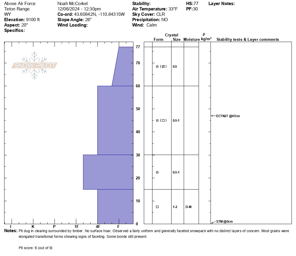
We observed a shallow and generally faceted snowpack in north facing terrain at ~9,000’. This is similar to other recent reports from the region. We did not observe any distinct layers of concern, however, the entire snowpack is showing evidence of weakening as high pressure persists. Dug a pit on an open slope surrounded by timber. No surface hoar was present here. Height of snow = 30in (77cm). No propagation observed in stability tests as no real slab is present, yet. South facing slopes at ~9,000’ are even shallower with depths ranging from 0-12”. Surface crusts are present on solar aspects that are holding snow.
Right now, stability is good in locations with a snowpack. This will likely change once significant snow returns to the area. The snowpack is shallow and weak where it exists and is unlikely to respond well to the next big loading event. One positive observation is the lack of any widespread crust/facet combination hidden in the middle of the snowpack. Time will tell if this continues and how future avalanche activity will respond to this setup. Now is a good time to take note of surface conditions and which terrain is/isn’t holding snow, as the bare slopes will be safer when winter returns.
Weather
- Air Temp
- 34
- Cloud Cover
- clear
- Wind Loading
- none
- Recent Snowfall
- 0
- Snow Avail For Transport
- small smounts
Clear and calm. Mild temperatures at 9,000'. Valley inversion is still in place.
Snowpack
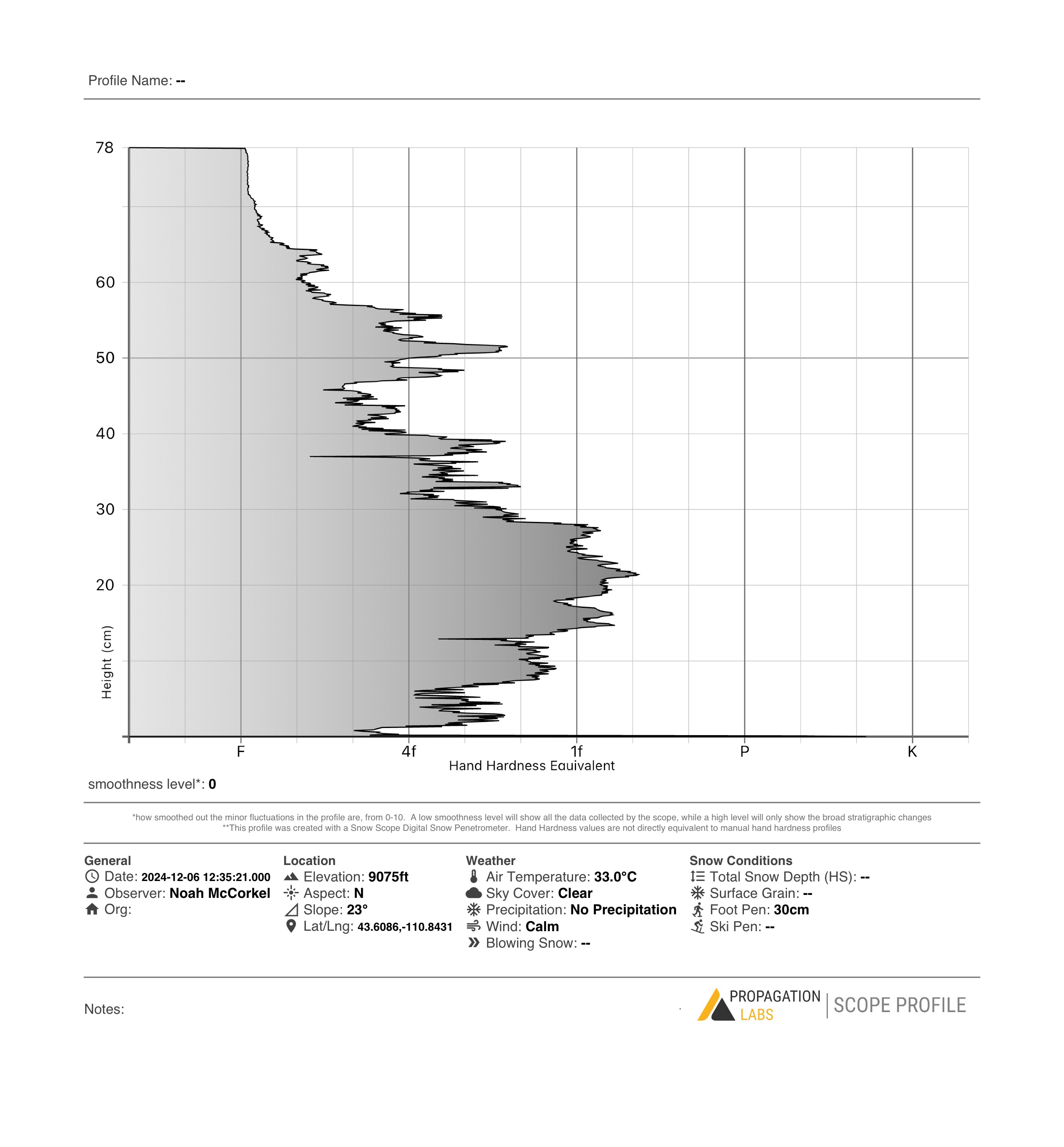
Snow nerd alert. We tested out a high-tech probe that automatically creates a hardness profile as one probes. The results from the device look pretty similar to our manual profile. Interestingly, the probe detected a decrease in hardness at ~47 cm which is where our ECT failed. This hardness change was not detected in the manual pit.