
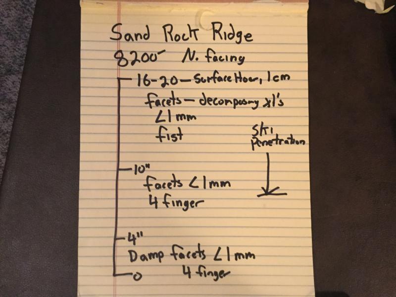
Quick report
- Aspect
- North
- Red Flags
- Poor Snowpack Structure
- Elevation
- 2499 m
- Slope Angle
- 5°
- Red Flags Comment
- <p>The poor snow structure is more of a red flag to come. Similar situation to the central Wasatch. I would imagine that it would be possible to trigger a shallow windslab in the exposed upper elevation areas of the Pavants.</p>
I was surprised by the lack of loose basal facets in the area of my snow profile. i did see them in some other areas.
Could have had the cover of facets magazine today if I had a partner and camera.
Trailbreaking is harder than it should be.
Apologies for the low tech profile, living the simple life down here in Fillmore.
Forecaster Note: I have also found the basal facets to be damp near the ground during the limited travel I have done along the neighboring Skyline region. Kobernik
Low danger is for areas traveled today.
Snowpack
- Instability Comment
- <p>Normal caution for shallow snowpack. I would be leery of any upper elevation aspects with wind loading.</p> <p> Extra caution for large kitty cats, crossed a set of tracks as big as I have seen on the ski out, they were not there on the way in!</p>
Faceted and loose on all aspects traveled today (6800 to 8300'). Surface hoar feathers to 1 cm. Snow pack on most aspects is rotting to the ground. The one exception is sheltered areas above 8000'. These areas have a bit more structure, 4 finger as opposed to fist. this is similar to what I saw this weekend in upper BCC.
HS @8200 is 16 to 20". The Pine Creek snotel site is reporting 20". 3"new during the last storm a total of approx. 6" in the last week. Big Flat in the Tushers is only report a HS of 13".
Was able to drive to 6800' could have gone a bit higher with chains.