Reudi’s Meadow
Dec 16th, 2023 11:50 AM
carrienlula
North Columbia
Details
Type
quick
Coordinates
51.287900, -117.086190
Weather
Snowpack
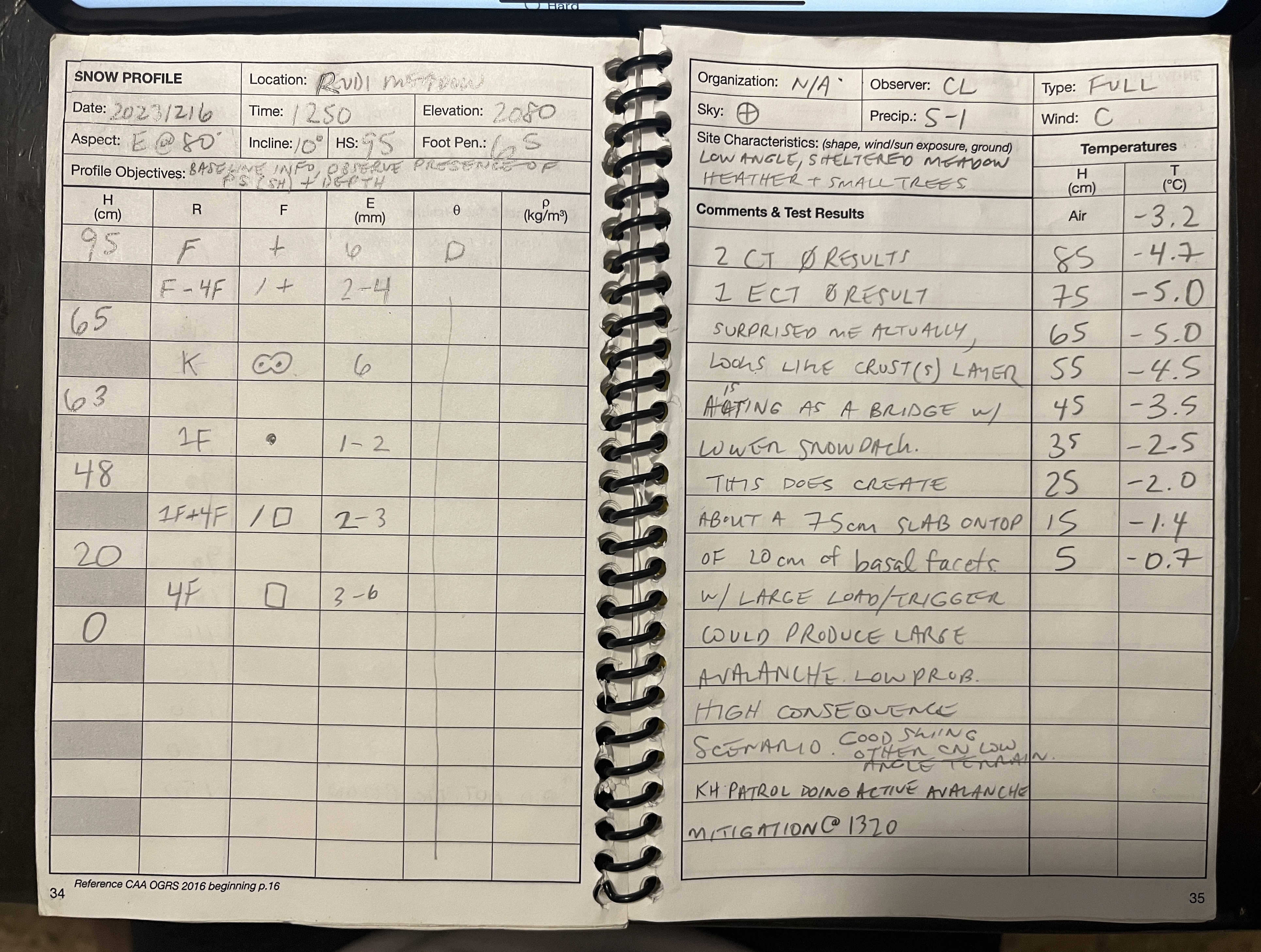
Full profile dug in meadow @ bottom of Rudi’s Bowl just outside ski area boundary (See photo for headers).
Layer Identification (top down)
95–65cm | F-4F | PPsd @ surface 6mm / DF 2-4mm
65-63cm | K | MF 6mm (obs wall – it looked like on my test wall there was another 2cm crust within the 10cm below - which could explain better explain the results of the stability tests.).
63–48cm | 1F | RG 1-2mm
48–20cm | 1F-4F | DF & FC | 2-3mm
20-Ground | 4F | FC 3-6mm
Appeared to have faceting melt-forms on ground.
2 CTs and 1 ECT produced zero results (surprised me but I’m thinking the crusts are providing better bridging than I expected). With a pretty consolidated upper/mid-pack and +20 cm of facets to ground I guess this is more of a low probably, high-consequence scenario unless a large trigger is introduced.
Purpose was to gather baseline info - first day with my head in the snow.
Photos (1)