
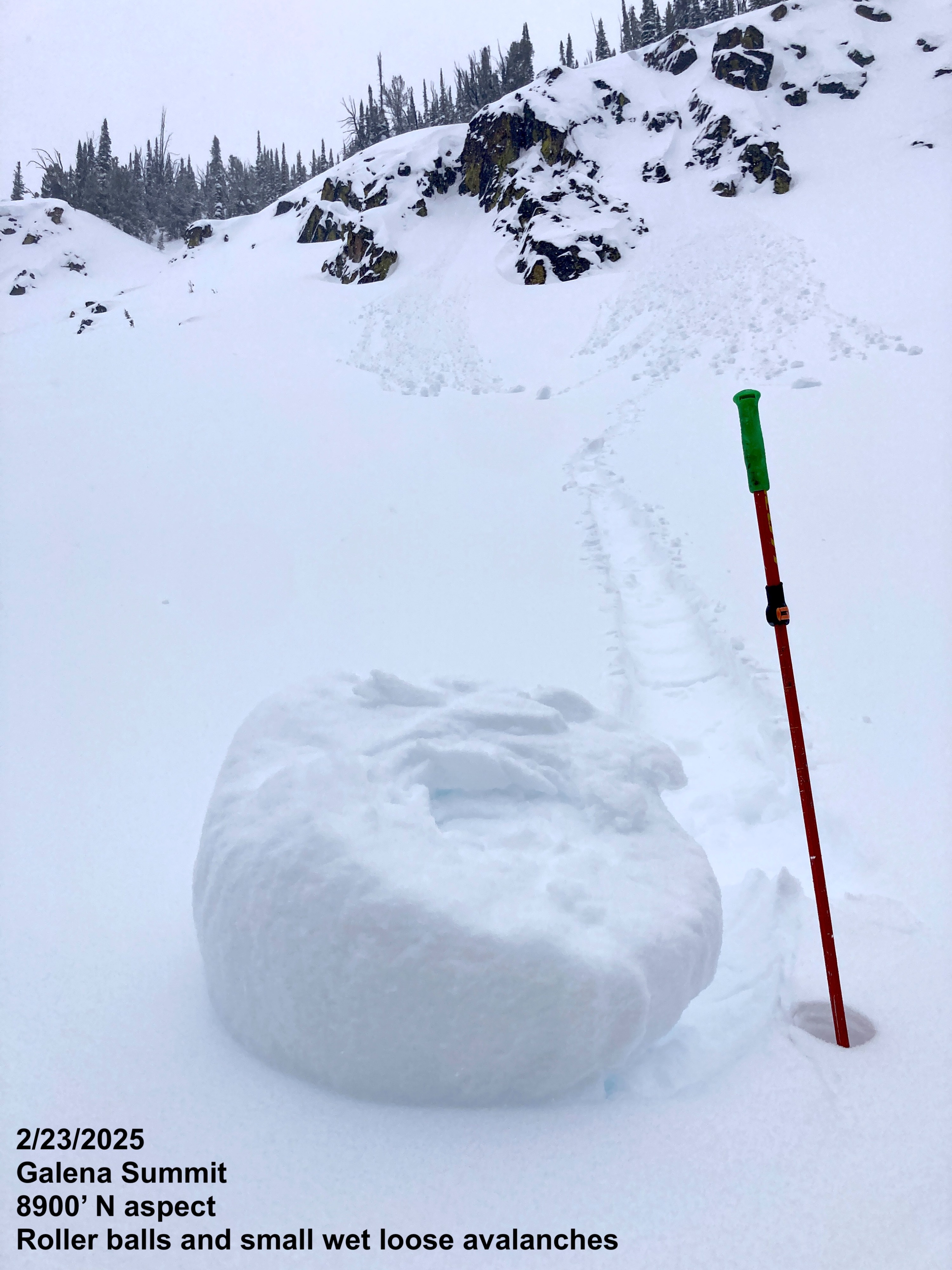
Quick report
Stormy conditions existed today at Galena Summit with warm, wet snow falling on a variety of snow surfaces. This new snow was generally unreactive this afternoon, but is expected to double or triple in depth overnight. Conditions are rapidly changing after a week of relative stability and we were heads-up when travelling in areas with more new snow than the generally 3-6 inches that had accumulated by the afternoon.
Snow/rain lines were at 7750 feet on the Smiley Creek side of the pass (at 4pm) and 6200 feet on the Ketchum side of the pass (at 4:45pm).
No obvious signs of instability observedWeather
- Air Temp
- 30
- Cloud Cover
- overcast
- Wind Loading
- none
- Rain Elevation
- 7650
- Recent Snowfall
- 10
- Snow Avail For Transport
- small smounts
S-1 snowfall rate increasing to S2 by 4pm with moist large flakes falling
Snowpack
3-6 inches of new snow had fallen on a variety of snow surfaces above 8000 feet. The surface snow was falling with warming temperatures throughout the day and, therefore, was coming in "upside down" - with softer snow buried by heavy wet snow - forming small storm slabs. These were unreactive while we were in the field but can act as an indicator of what to be on the lookout for tomorrow. Under the new snow, we found stout crusts on solar aspects and generally bonding soft snow interfaces on shaded northerlies. We did not find any surface hoar or developed near surface facets, despite snooping around for them in hand pits.
We dug a quick pit at 9275 feet on a N aspect that was nearly 7 feet (210cm) deep. The 1/31 interface was buried 3.5 feet (105cm) below the surface and unreactive in stability testing. The weakest snow was found a couple of inches below the 1/31 interface (4F+ facets) and had a PST 60/120 END (stable) test result. The weak January drought snow seems to be healing at this location.