
Quick report
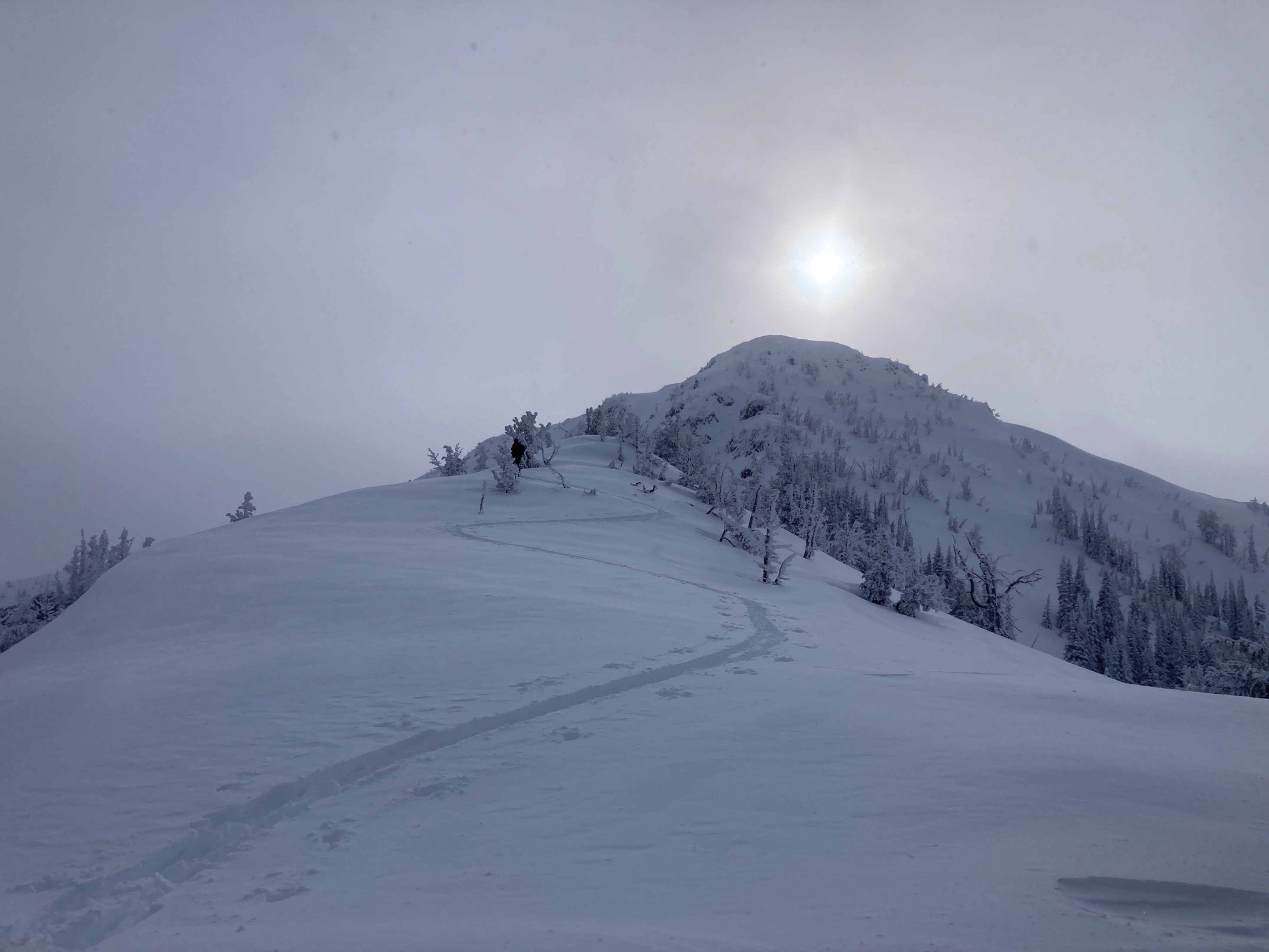
Recent storm snow is generally F hard and approximately 30cm's deep above ~5000'. Winds were calm to light in the AM and moderate in the PM from the W-NW, minimal wind transport was observed at ridge top. Skies were generally clear with a fog layer in the AM and overcast in the PM.
Weather
- Air Temp
- 24
- Cloud Cover
- overcast
- Wind Loading
- light
- Recent Snowfall
- 30+
- Snow Avail For Transport
- large amounts
Snowpack
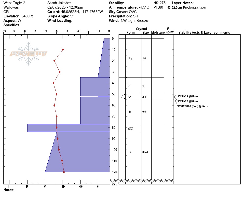
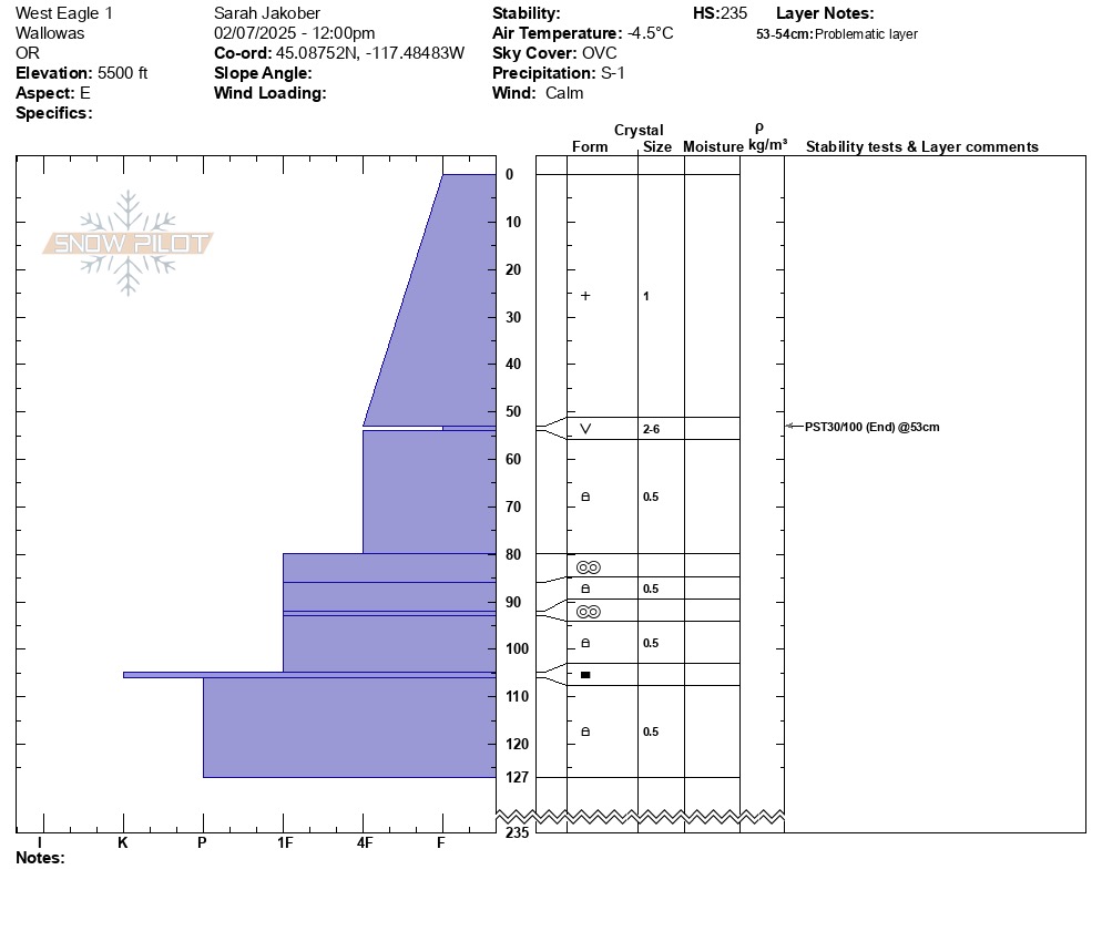
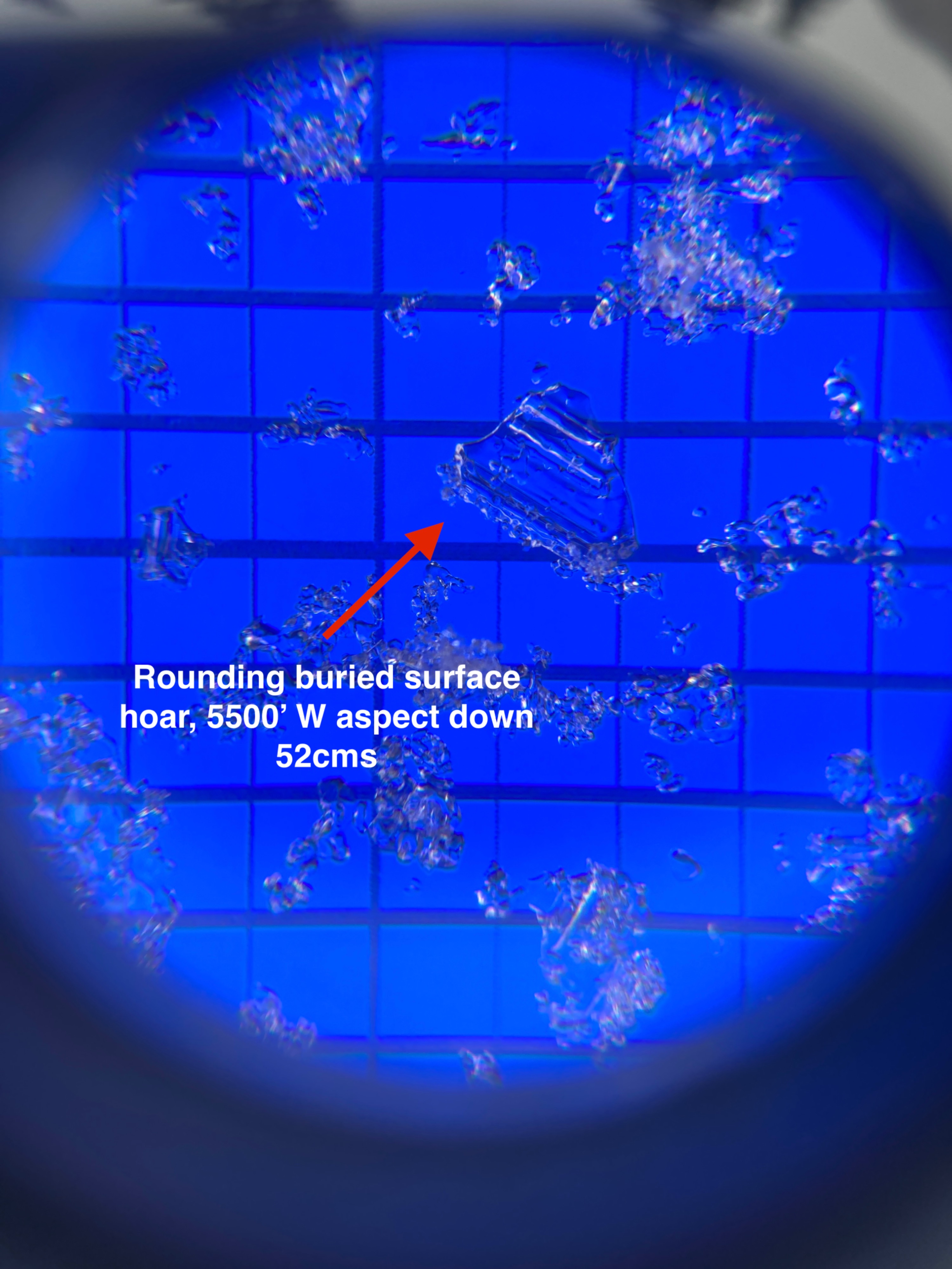
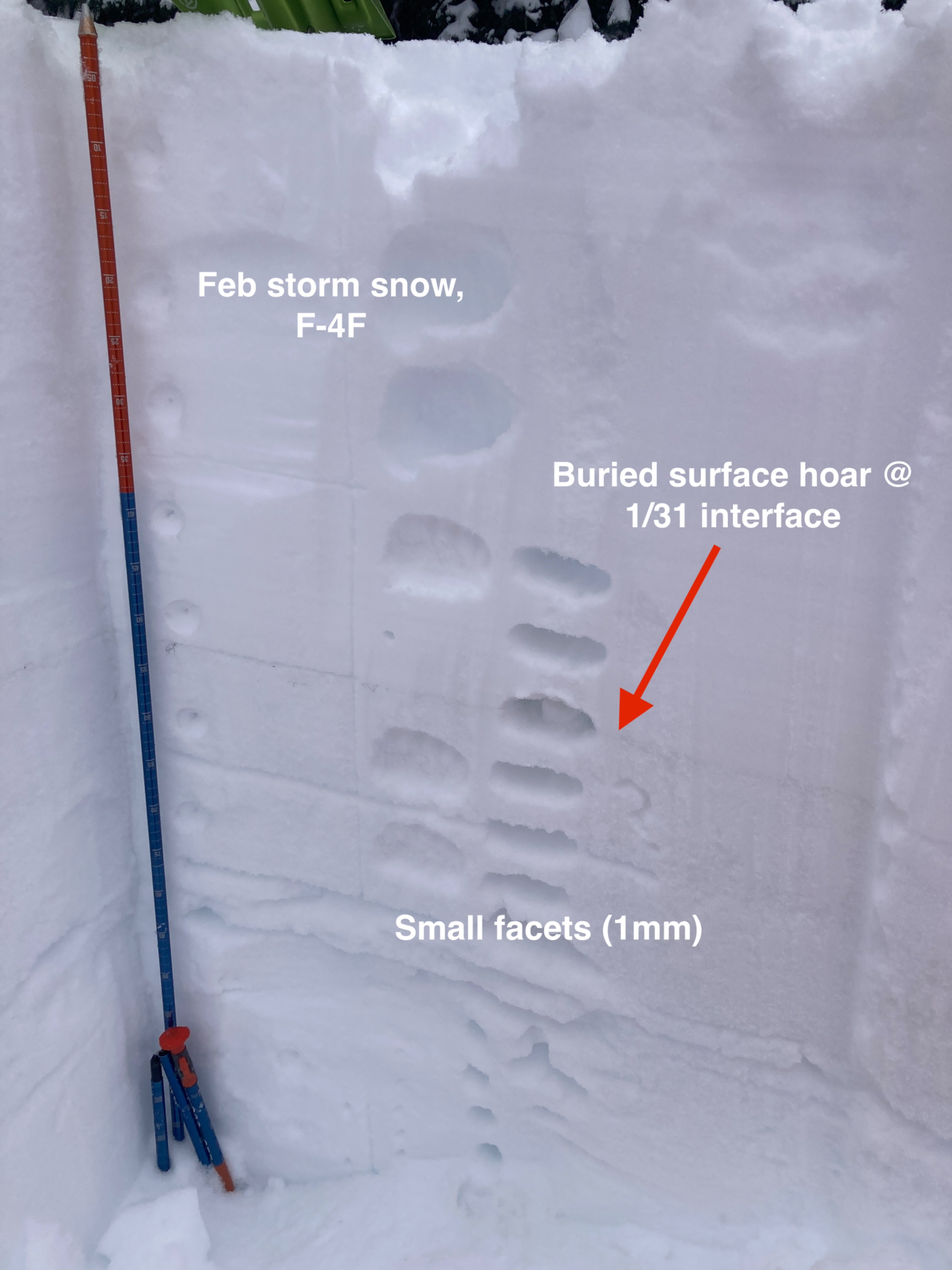
Throughout our travels we observed very soft, deep storm snow and the riding quality was excellent. We dug in two separate locations on either side of West Eagle Meadow at approximately 5400'. The total height of snow ranged from 235-275cms (8-9 feet). We discovered buried surface hoar in both locations: smaller grains buried on a west aspect 52cms (~2 feet) down and larger grains at a similar depth on a east aspect. In both locations this layer was highly reactive during a propagation saw test but did not propagate in an extended column test. Below this layer (suspect 1/31 interface), small faceted grains were observed and showed some evidence of rounding. The 1/3 rain crust was also present in both locations around 80cms (2.5 feet).