
Quick report
- Cracking
- isolated
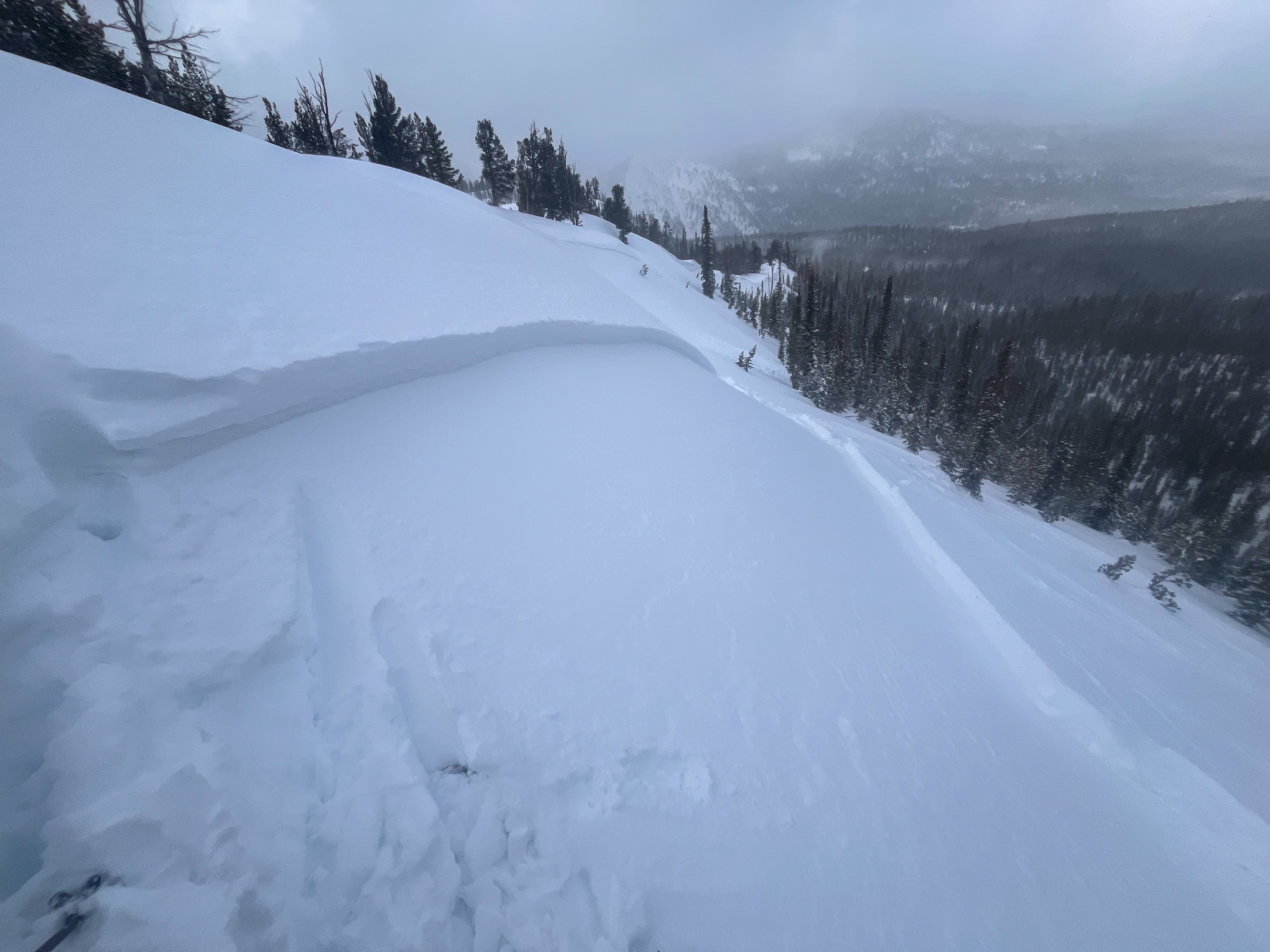
Wind and ~10" of recent snow built touchy wind drifts near exposed middle elevation ridge lines.
Cracking in wind drifts formed lee to W and SW wind since 3/10.Weather
- Cloud Cover
- overcast
- Wind Loading
- moderate
- Recent Snowfall
- HST = 25 cm (and counting) since 3/10
- Snow Avail For Transport
- moderate amounts
Banded, spring time convective precipitation. It was overcast during most of the tour with a couple of brief breaks of blue. It snowed S2 on average but also dumped S4 to S5 for short periods of time. Winds blew moderate from the WSW. I could hear intermittent stronger wind at higher elevations.
Snowpack
Snow accumulations since 3/10 increased from about 5 cm at the highway to 12 cm at the lake and 25 cm at 8,700'. Beneath the storm snow, any slope with a southern tilt had a soft/flexible crust. Wind since the onset of snowfall on 3/10 had formed a thin 4F+ slab in exposed terrain that was growing in thickness today.
The small slabs I triggered had a max crown height of 45 cm and tapered quickly away from the ridge. They were quite sensitive, failing on small near-surface facets above a 5 cm soft crust. I did not travel in upper elevation terrain, but it stands to reason that these slabs would be thicker and more widespread there. I'd expect these to remain touchy through tomorrow.
When the sun comes out tomorrow or Thursday, we will have a good pile of snow on sunny slopes to turn into loose snow avalanches and subsequently a healthy pulse of meltwater to push into the snowpack.
Avalanche
I triggered pockets of wind-drifted snow along an exposed middle elevation ridgeline (see photo).