Could it be (another) size 5?
Mar 29th, 2026 8:00 AM
cdnmoose11
Details
Type
quick
Coordinates
51.648640, -117.330930
Quick Observation
See 'Avalanche' tab for details and mass calculations.
Mt Rowley is approximately 46 km NNW of Golden, BC, and immediately east of Kinbasket reservoir.
Avalanche Information
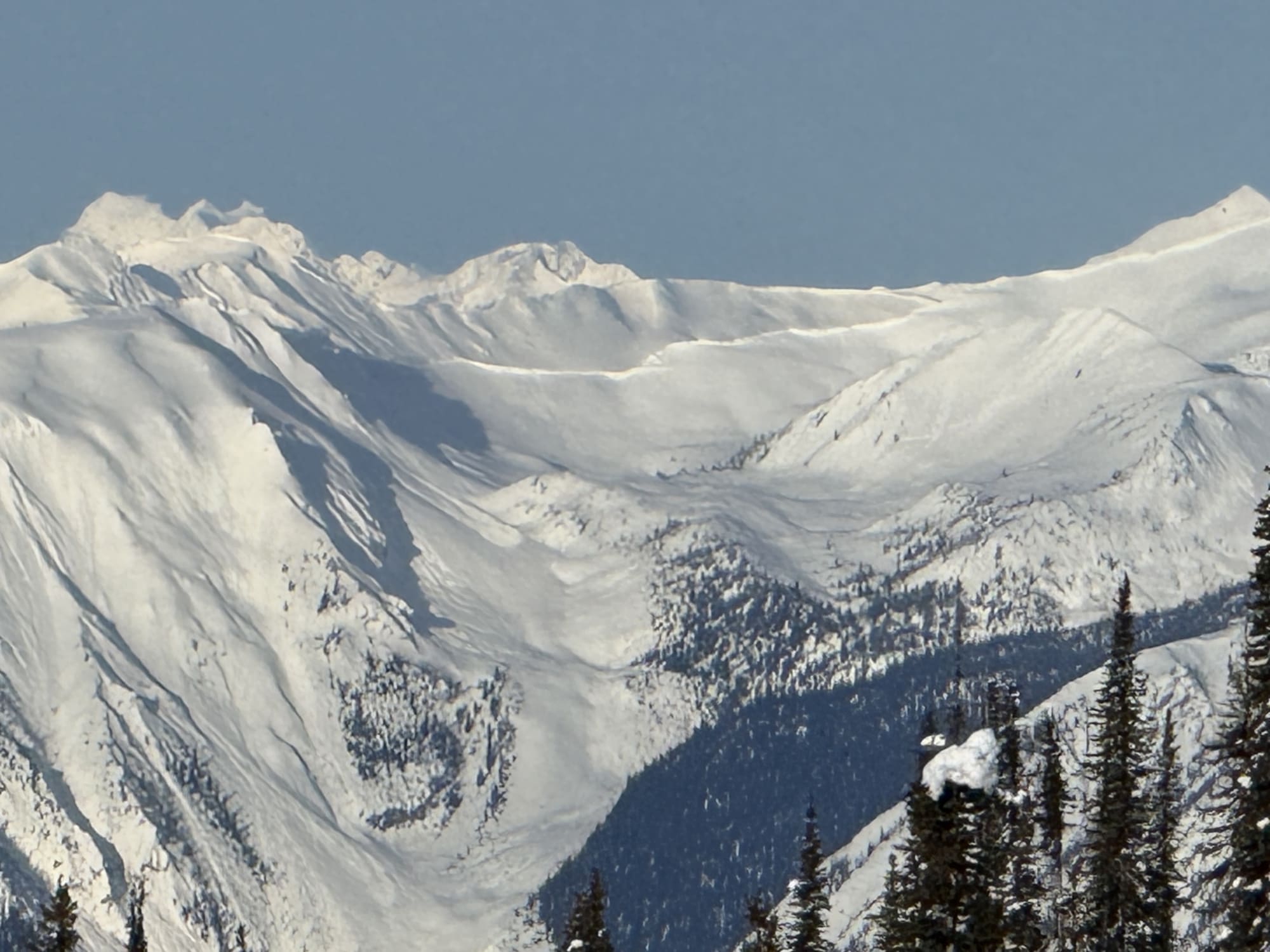
LARGE AVALANCHE ON MT ROWLEY: LIKELY FROM THE MARCH 17-20th, 2026 ATMOSPHERIC RIVER
Observed Monday March 23rd @ 0900hrs.
Posting for historical reasons (and apologies for the delay - out of range at Campbell Icefield Chalet).
Avalanche seen from outside the front door of the lodge: 23 km away as the crow flies, measured on CalTopo.
Numbers below taken from Google Earth estimates based on the attached photo.
Width: 1300m
Crown: 2m (estimate - if you can see a crown clearly defined from 23km away, I'd guess it's at least 2m high... but it may be 3m +)
Distance: estimate 200m average (range 100-300m). Could not see debris piles from the chalet.
====================
Mass: 1300m x 2m x 200m x 200 kg/m3 (conservative average snow density) = 104 million kg (~115,000 tons).
Size 5 avalanche defined as greater than 100,000 tons.
***
Photos (1)