
Quick report
- Collapsing
- isolated
We experienced a few fairly small collapses when regrouping sleds in one location. These seemed to involve the 1/6 weak layer. Collapses did not radiate out very far from the point of initiation. No visible surficial cracking was visible.
Weather
- Cloud Cover
- broken
- Recent Snowfall
- 3-5
Skies stayed mostly cloudy to overcast throughout the day. Winds were calm to light in the terrain we were in. 3-5cm of new snow from this morning's storm. We had some periods of light precip throughout the day, including a light drizzle of freezing rain extending above 6,000' in the late afternoon. It wasn't obvious if there was enough water falling to produce a sensible layer in the snowpack, nor how widespread this event was.
Snowpack
Mostly moving through terrain and getting a sense for the snowpack in a location we have not visited yet this season. While this area sits at the boundary between the Banner Summit and Sawtooth and Western Smoky Mtns forecast zones, I found a snowpack that most closely resembles the snowpacks found further south in the Galena Summit and Eastern Mtns zone.
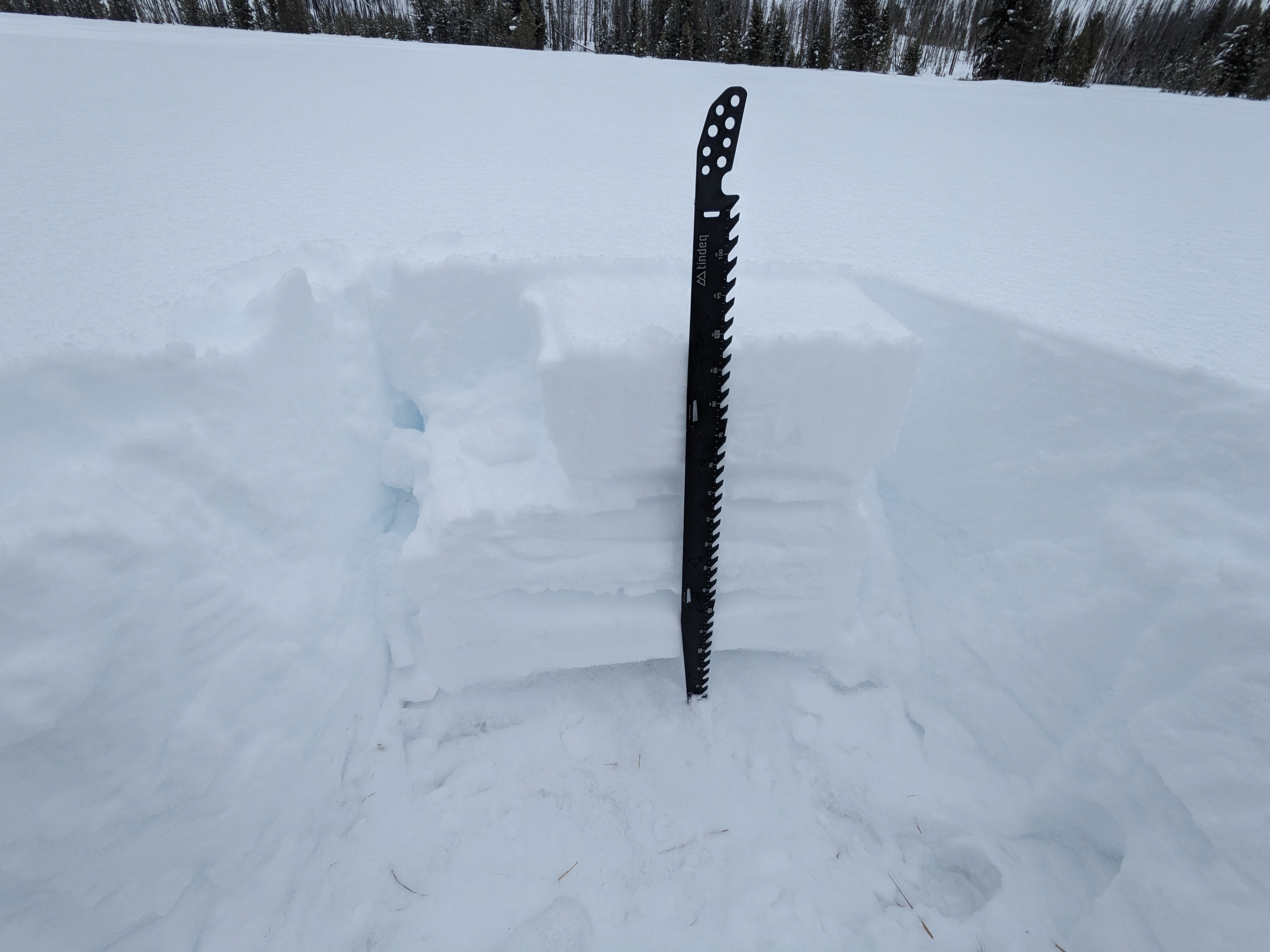
Most of the terrain I traveled through was in the low elevation portion of the Banner zone (below 7,500'). Here, the average snowpack depth was around 100cm:
-The 2/14 interface was buried 25-30cm down, and presented as an aerated MFcr.
-The 2/1 interface is buried underneath 40-45cm of snow from February. This soft slab grades from F- at the surface to 4F at the base. There are several storm intervals apparent in this snow. 2/1 presented as a 6-8cm thick stack of crusts, with evidence of once-liquid water frozen between melt-freeze polycrystals. Significant water had pooled at the base of this crust, forming a 2-3mm thick water ice lens. There were some small facets loosely attached to both sides of this package. I initiated fractures at this interface but they did not propagate across the column (ECTNs in the upper teens to low 20s). As observed in many other locations, with a stronger slab this layer may become more reactive.
-The 1/6 weak layer is buried 60-70cm down. The large facets/depth hoar here are quite weak (4F to 4F-)The slab overlying this is a real mish-mash, with the thick, icy crusts of 2/1 in the middle, plenty of PP/DF on top, and a faceted slab underneath the 2/1. I received repeated ECTPs in the low to mid 20s on this interface. It's always difficult to interpret snowpack results with very dense slabs/strong ice crusts in the middle of the slab. These types of units in the snowpack have a lot of lateral strength that makes impacting the weak layer difficult, and this lateral strength is removed when isolating columns. While the presence of the dense slab/strong ice crusts is reducing the likelihood of triggering, large avalanches are likely to continue failing on this snow during large loading events and during the eventual spring meltdown (wet slabs baby!).
There was evidence of water percolation through much of the snowpack.. This water was likely largely derived during rain events and a few hot days of sun at the end of January. Water had traveled down to and past the 1/6 interface and there were percolation columns present here and above and below. Based on the appearance of the snow, and the behavior of snowpack tests, this saturation event did not have the effect of healing all issues, even where the snowpack remains thin.