
Quick report
- Cracking
- Observed
- Collapsing
- Observed
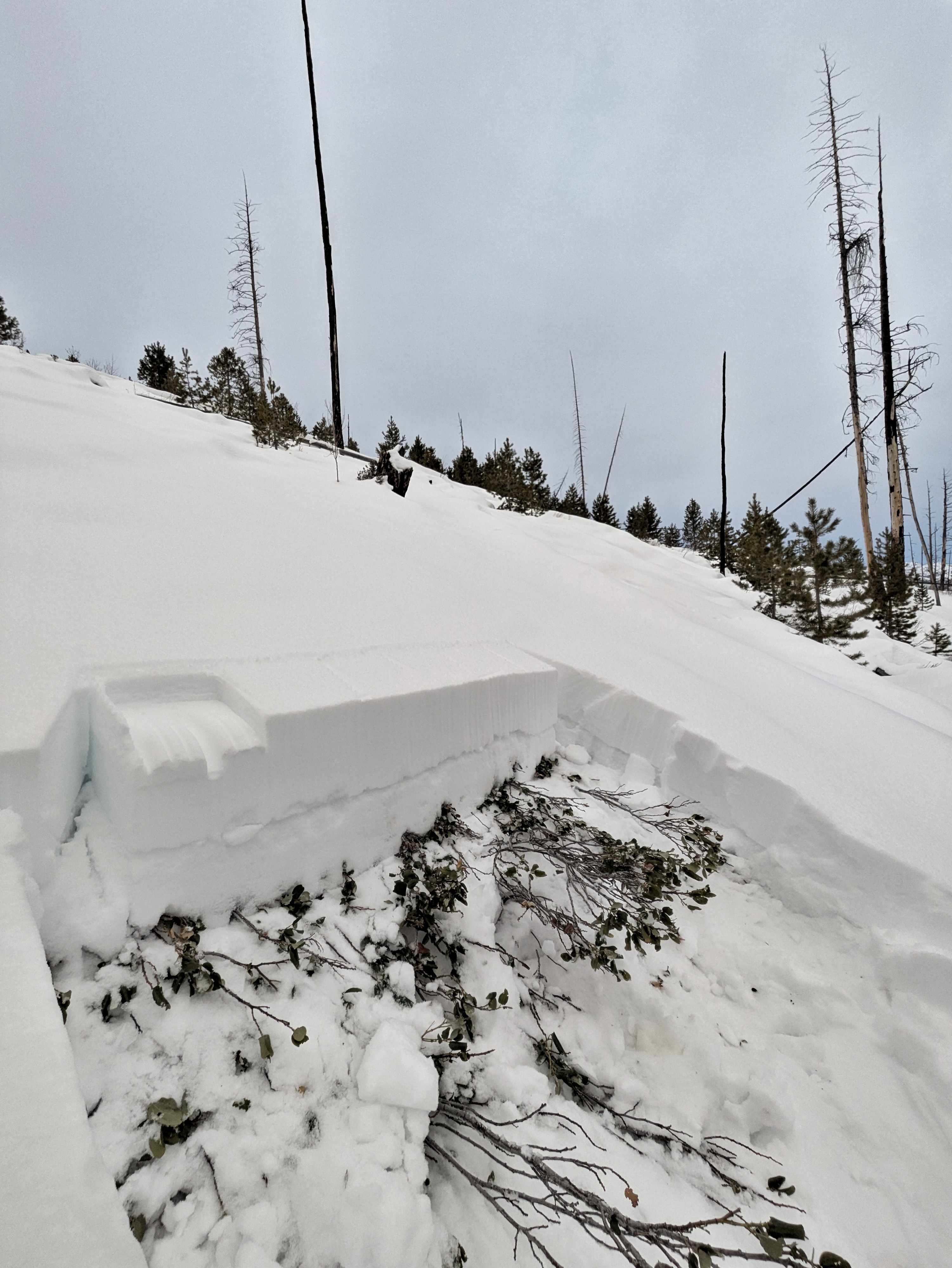
I came to warm springs to look at the snowpack ahead of the forecasted series of storms. Also, I wanted to play in a bony snowpack as an expression of solidarity with the drought stricken folks of Utah. As anticipated, I found quite an ugly snowpack. The 12/13 weak layer (described below) is primed to produce a widespread avalanche cycle when rapidly loaded. *I did not see any debris at the bottom of the large paths that commonly hit the warm springs road at Frenchman's Bend. Based on today's observations these paths are likely holding an ugly weak layer sitting uncomfortably underneath a slab that is about to grow significantly... I would be surprised if these paths don't produce avalanches during this loading event, and it might not take much to get them there... Relatively low snow cover and many dead, downed trees in the tracks may slow these slides down a bit, but you won't catch me hanging out under them. *The avalanche path at the hairpin near the top of Galena pass ("Verlons") now has enough snow coverage for wider, larger avalanches. This can be a good indicator path for crust+facet issues on solar margins. I experienced frequent collapses in any terrain with a hint of a slab on top of the 12/13 weak layer. Some of these traveled for at least 50' before being arrested by the terrain (generally downed logs). These occurred in obviously wind loaded areas as well as sheltered areas. I did not observe any avalanches, but the light was poor and I did not glass.
Weather
- Air Temp
- mild
- Cloud Cover
- overcast
Light snow starting around 7pm. Mild temps, light winds.
Snowpack
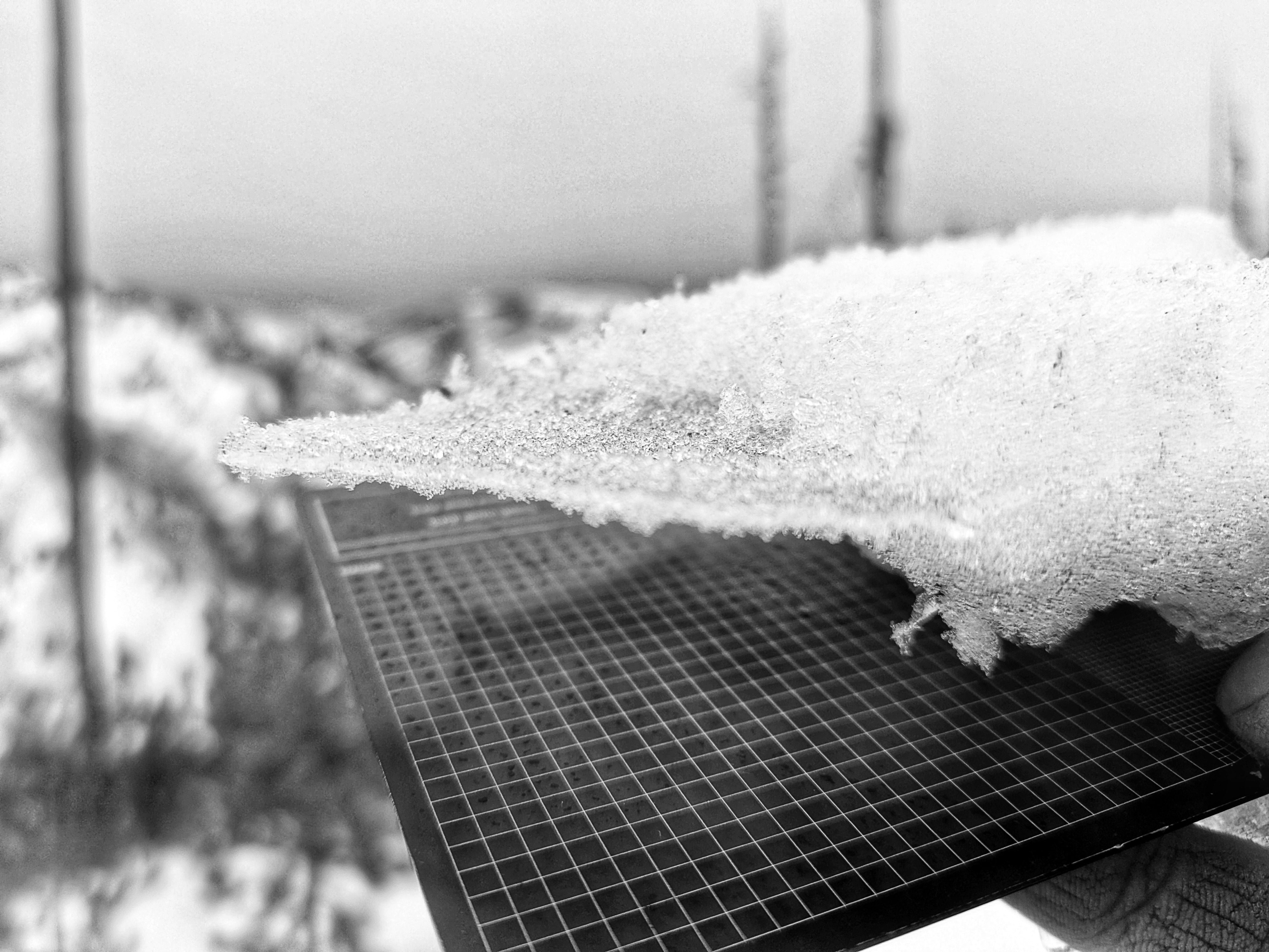
The slab on top of the 12/13 weak layer is still pretty lean, averaging 20-25cm thick. In spite of this, the slab+weak layer combo produced dozens of collapses and many unstable results in multiple snowpack tests in 3 different snow pits dug between 6,500 and 7,500'. The layer presents as a 1-2cm thick stack of advanced facets (many chained and cupping and striating) sandwiched between two crusts (pre-Thanksgiving rain crust and rain/time crust at base of the slab (deposited 12/14, I think). I like to think of layers that look like this as near surface depth hoar (unofficial SWAG code is DHsf). They aren't common, but the WRV is good at making them. It will not take much to overload this very weak snowpack. Coverage at lower elevations is not great, but the snowpack, where present, still seems to have impressive weak layer connectivity here. I'd anticipate we will see some unusual avalanches in many places as this is loaded. The solstice rain crust was buried around 1cm down at drainage floor and a few cms down up higher. I found evidence of this all the way to my highpoint at 8,500'. *The snowpack I encountered today is similar to what exists in untraveled areas in the out of bounds terrain adjacent to baldy.