
Quick report
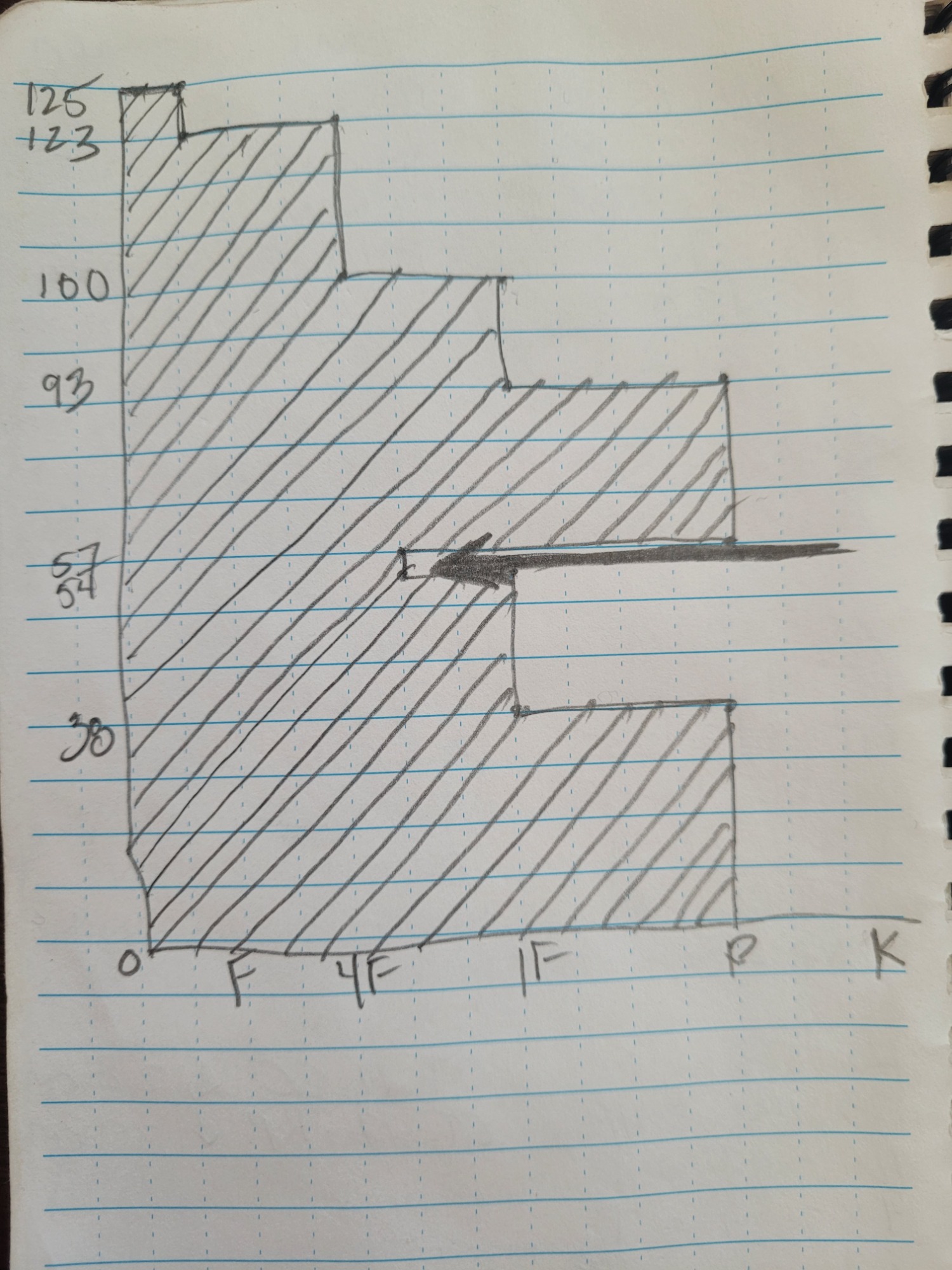
We did not see any red flags but the weather between Saturday and Sunday changed quite a bit. See attached photo of a rough snow profile drawn in field notes. We had surprisingly varying results in our snowpits amongst the three groups of students and instructors. The majority of us observed stable snow with one layer of conern buried between 75 - 85 cm from the surface. On Saturday, on a NW aspect, one of the three groups saw propagation on their ECTs on moderate and hard taps. The moderate tap propagation occurred on a zipper crust down 30 cm from the surface. The hard tap propagation occurred on the deeper layer. On Sunday, again, only one of the three groups found propagation on moderate and hard taps on those same layers.
Weather
- Air Temp
- 24 F
- Cloud Cover
- overcast
- Wind Loading
- light
- Recent Snowfall
- It snowed lightly all day and increased in the afternoon
- Snow Avail For Transport
- small smounts
The weather changed between Saturday and Sunday. Saturday we observed NO precipitation, light to moderate winds, and a high of 32 F. Sunday we observed consistent light snowfall of about 3 inches throughout the day. However, once we got back to the Visitor Center it was snowing moderately and perhaps matched the expected precipitation amount forecast at up to 5 inches. Sky cover was overcast all day. Winds varied from light to moderated, with occasional gusts that included blowing snow and bending trees.
Snowpack
Overall we have a right-side-up snowpack with the exception of the 4-finger-hardness layer that consists of rounding facets. It appears to be stubborn and the layers above are strong and large enough to perhaps prevent triggering that layer. Among the instructors, however, we all agreed that we would still not commit to steeper, more consequential and complex terrain.