
Quick report
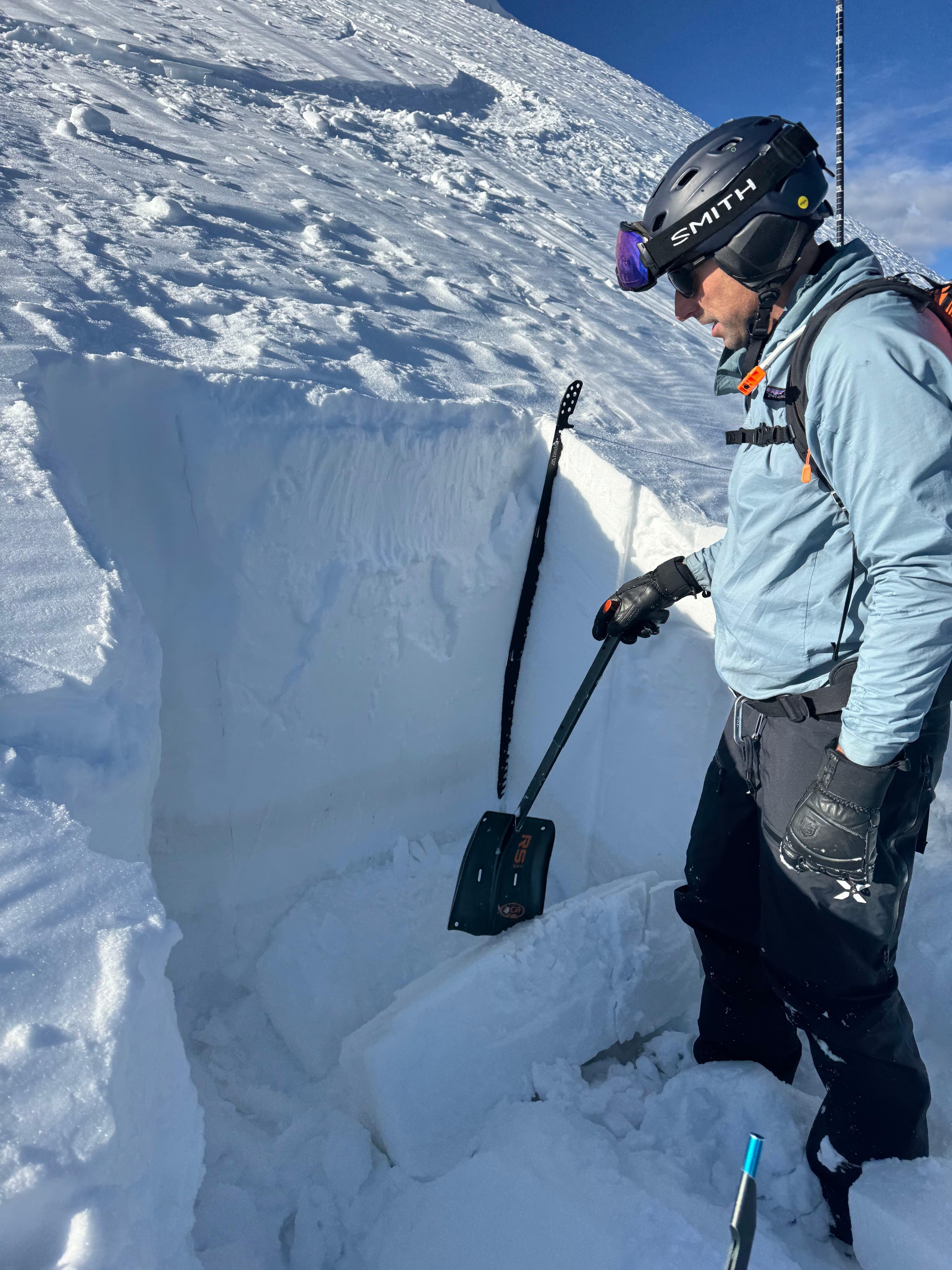
Today our objective was to look at the snowpack structure on Saddle Peak near the natural avalanche that released last week.
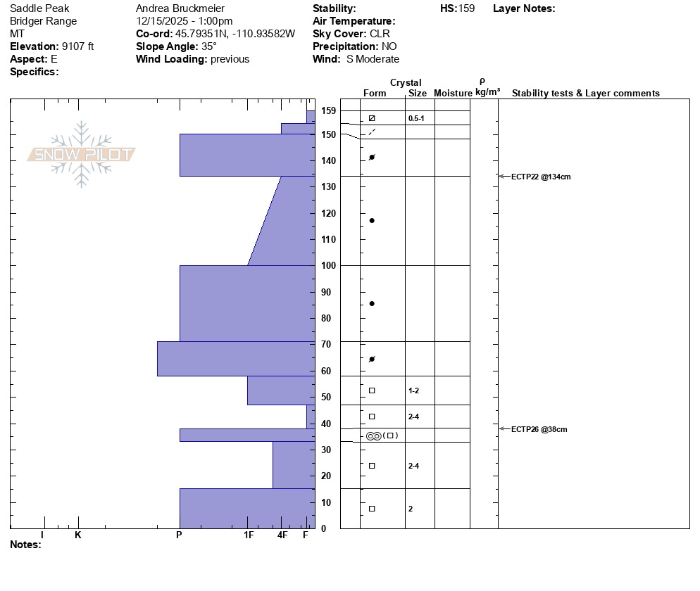
Our snow profile shows three concerning things:
We found the persistent weak layer with fist hard facets near the bottom (150 cm /~5 ft deep) on which the avalanche from Dec 7th released on. Our test resulted in an ECTP26 on that layer.
We further found thick, pencil hard wind slab layers above that weak layer, and had another ECTP22 result within the wind slab.
Most concerning in regard to the next upcoming snow storm, however, are the near surface facets we found in the upper 2 inches of the snow profile.
With today's snowpack conditions, there are two ways that will see an avalanche on Saddle Peak:
The first is that a skier or snowboarder hits a trigger point near rocks or cliff bands where the snow is shallow.
The second is that we get a large load of new or wind drifted snow.
For more information check out today's GNFAC video: A First Look - Saddle Peak