
Quick report
- Collapsing
- specific
Most of the observed avalanches were wind-driven during the beginning of the storm. A couple of them could have failed on buried surface hoar that was located on Peanut. Last Friday I toured into the basin between Duncan's ridge and Hyndman and found surface hoar high in the basin. I heard numerous collapses while breaking trail up E/SE wind-loaded subtle ridges. Collapses traveled 20-30'.
Weather
- Cloud Cover
- few
- Wind Loading
- previous
- Recent Snowfall
- HST 40 cm
- Snow Avail For Transport
- large amounts
The morning was sunnier than expected, but then low-hanging clouds rolled in and out.
Snowpack
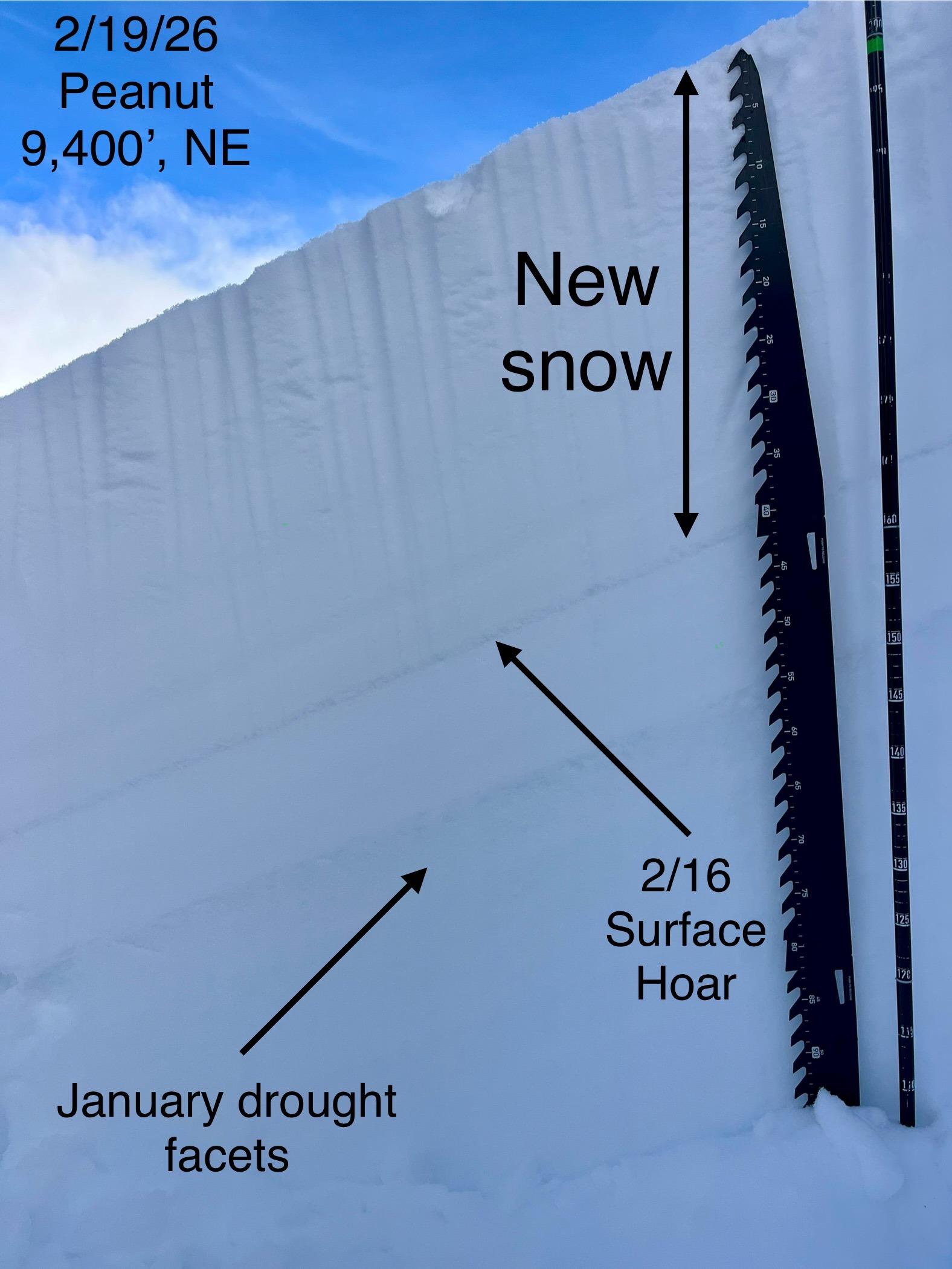
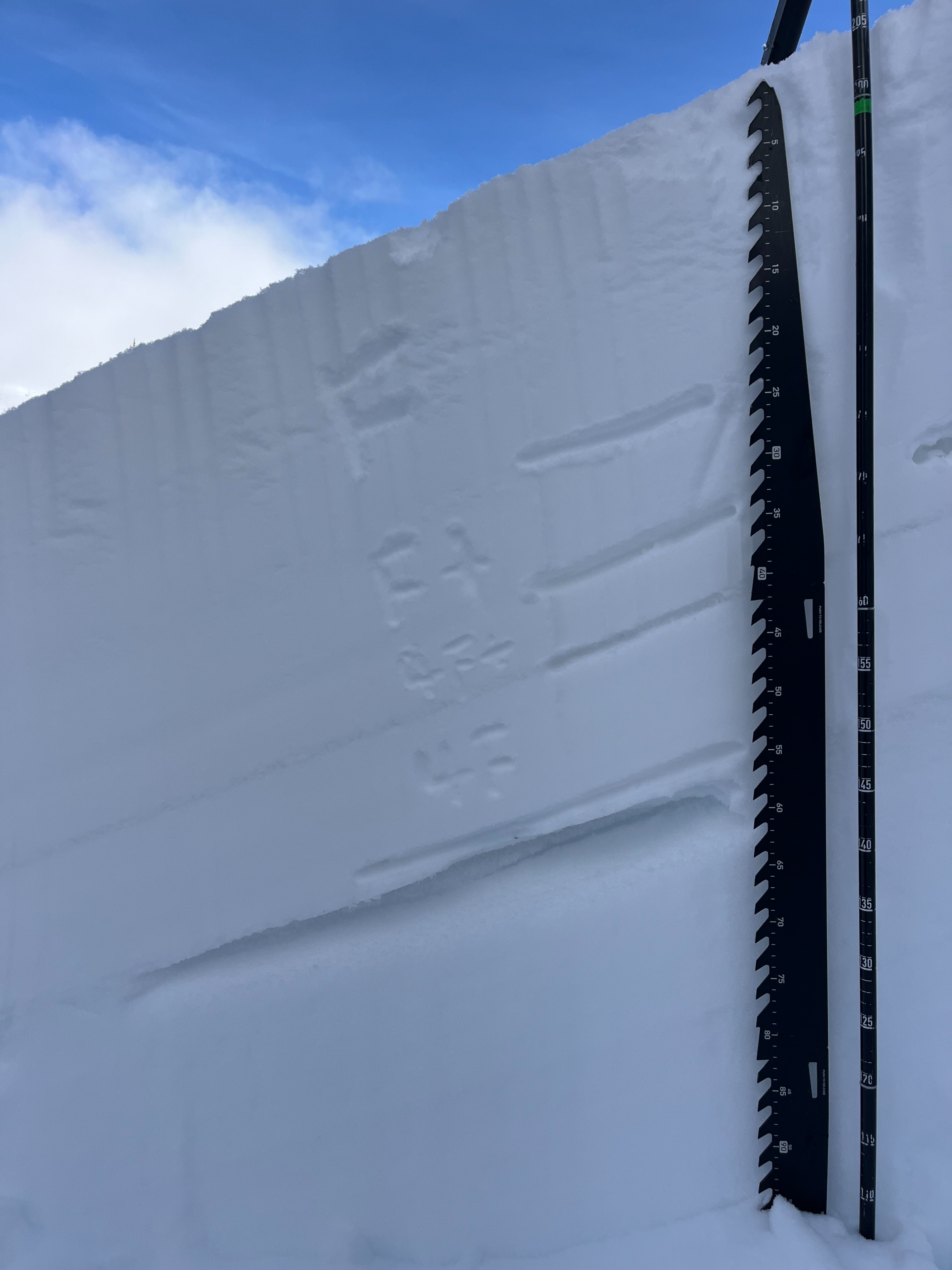
A northeast pit on Peanut at 9,400' showed 40 cm over buried surface hoar (3-6mm) at the 2/16 interface. A thin melt-freeze crust was at the 2/8 interface, with 5-7cm of weak facets below it (January drought). Large column test results were ECTN21,23 on SH and targeted January drought facets with PST35/100 (End) x3. The previous group at Pio put a skin track above 50' above this pit, so the SH may have collapsed. When I pried on the back of the ECT, it popped off on the SH layer. Hand pits on SE and low-angle E had 35 cm over a thicker crust 1-2cm with facets below it.
Avalanche
- Size
- D1.5
- Count
- 5
- Aspect
- NW
- Trigger
- N
- Elevation
- 8500 ft
The depth of the crown appears to have failed on the 2/16 and likely buried surface hoar based on the location.