
Quick report
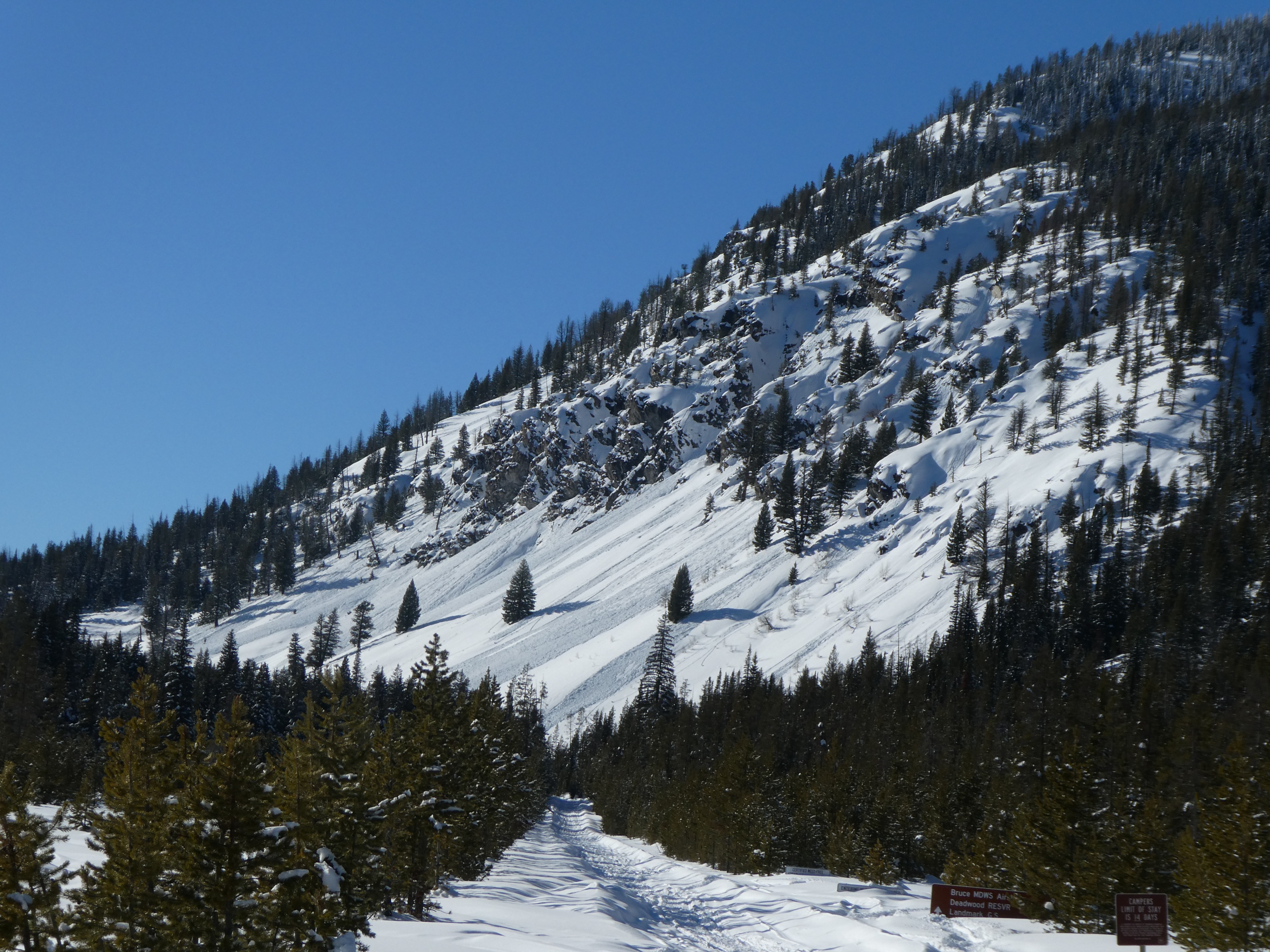
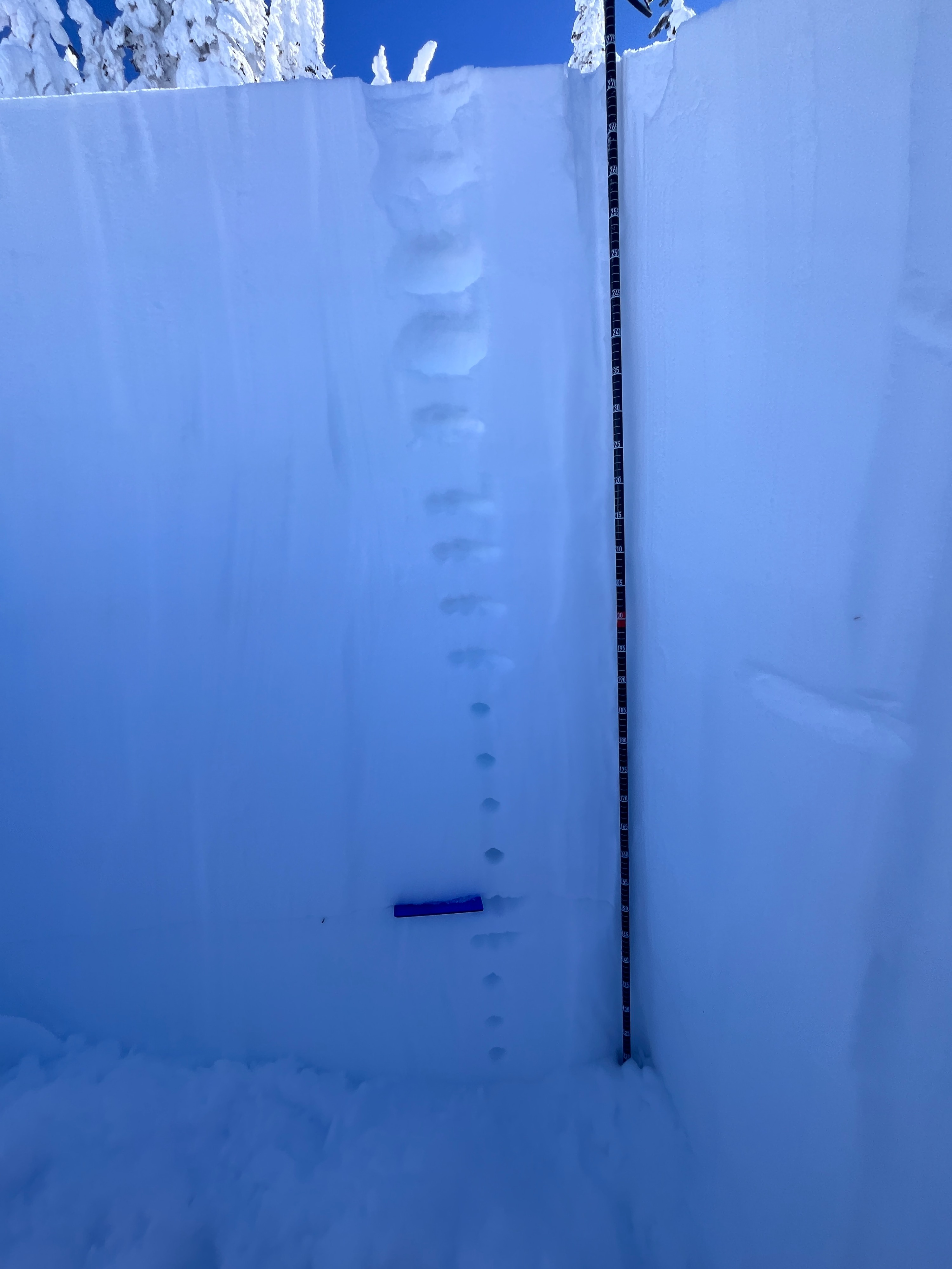
Near Cape Horn summit I found a deep, generally stable snowpack, with 4-9' of snow on the ground. January weak layers are buried 3-4+ feet in many areas, and were unreactive in stability tests. The snow surface was slow to warm at middle and upper elevations, becoming moist by mid-afternoon. The lower elevations warmed quicker and several loose wet avalanches were observed along the steep rocky cliffs near the parking lot.
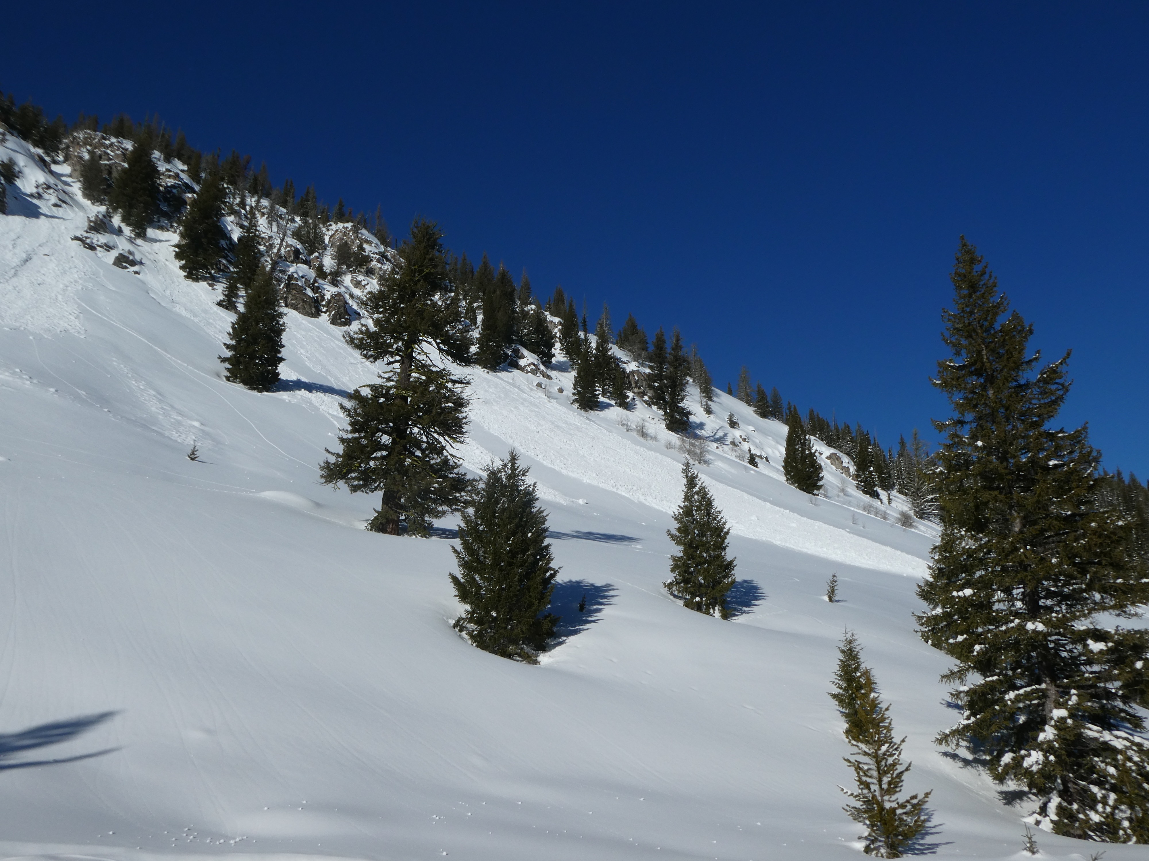
By 3:30 PM, several small wet loose avalanches (D1-D1.5) were observed in the rocky steep south-facing near the parking lot (see photos).Weather
- Air Temp
- 30s
- Cloud Cover
- clear
- Wind Loading
- none
- Recent Snowfall
- 5-10
- Snow Avail For Transport
- small smounts
The skies were clear and temperatures were moderate (holding steady in the 30s F in the parking lot). Ridgetop winds were calm to light, from the NW flirting with the W at times.
Snowpack
Surface: 5-10 cms of new snow was observed from yesterday's/ last night's pulse of moisture. Solars were slow to warm today above 8000'—eventually losing the battle to the sun, becoming moist by 2:45 PM. Below 8000', the surface was moist trending to wet by the early afternoon, and several loose wet avalanches were seen in steep craggy terrain near the parking lot.
Weak Layers: In all areas traveled today, 1/31 weak layers lay below a generally right side up slab, 100-125+ cm thick (F trending to 1F+). Stability tests yielded no results (HS: 275, ECTX). Weak layers below the slab present as a FC-MFcr combo on SE and portions of E.
Avalanche
- Size
- D2 R2
- Aspect
- W
- Trigger
- N
- Elevation
- 7600 ft
Photos of a slide that likely happened during the early Feb. storm cycle. The crown was mostly filled in and obscured. The slide crossed the road to the valley bottom below.