
Titus Ridge on skis - driving/glassing and roadside obs Ketchum to Banner Summit
Quick report
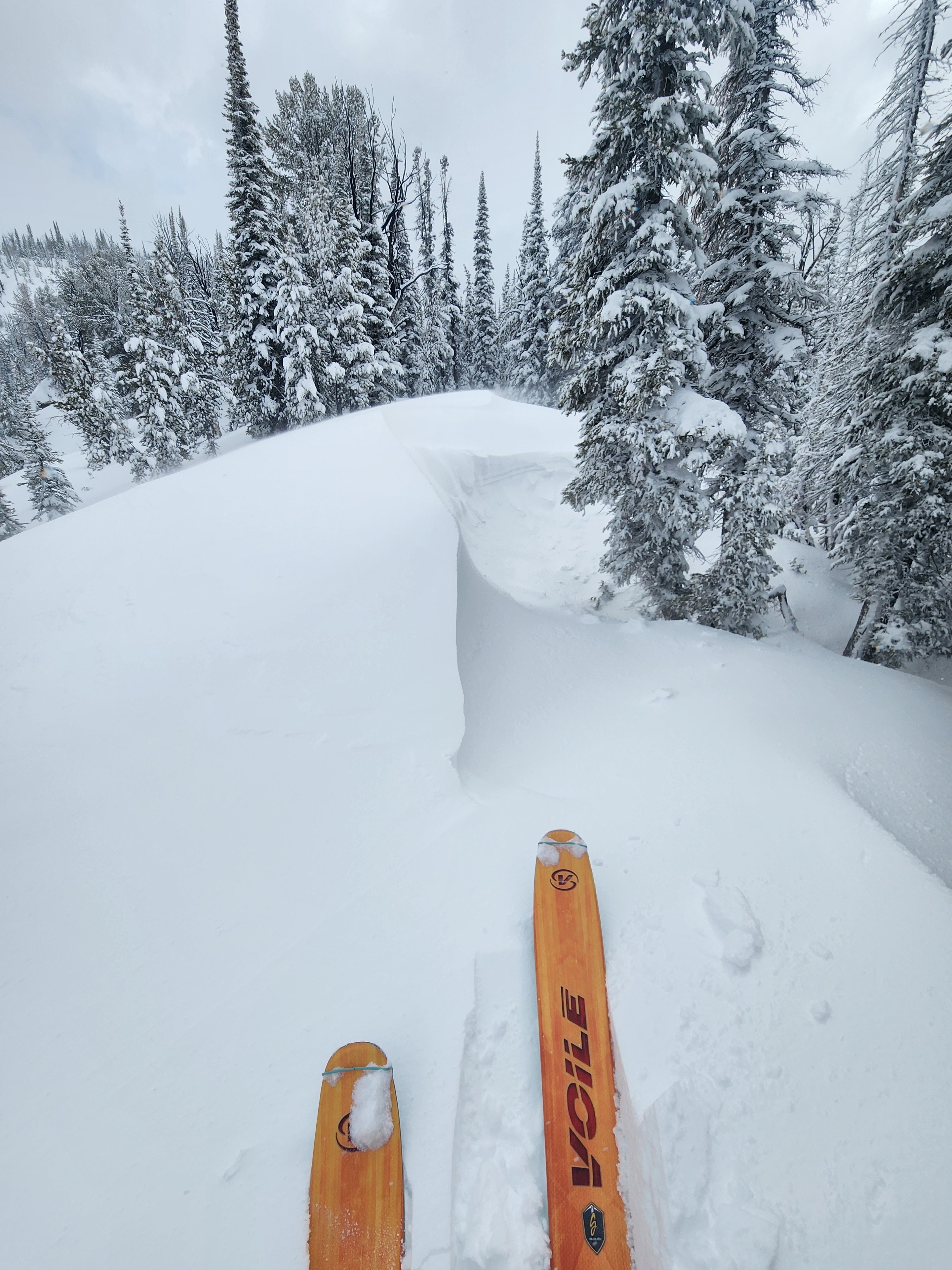
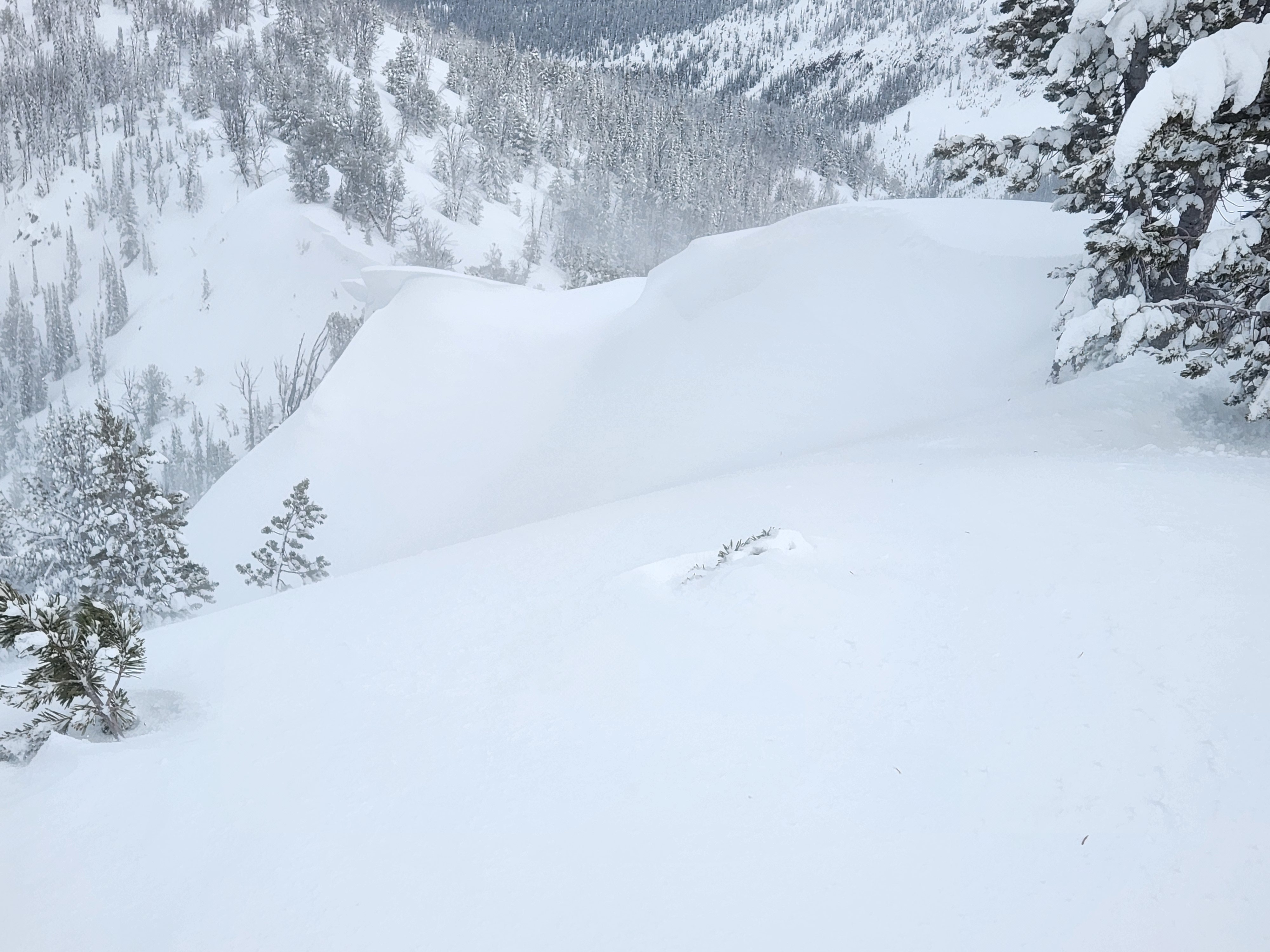
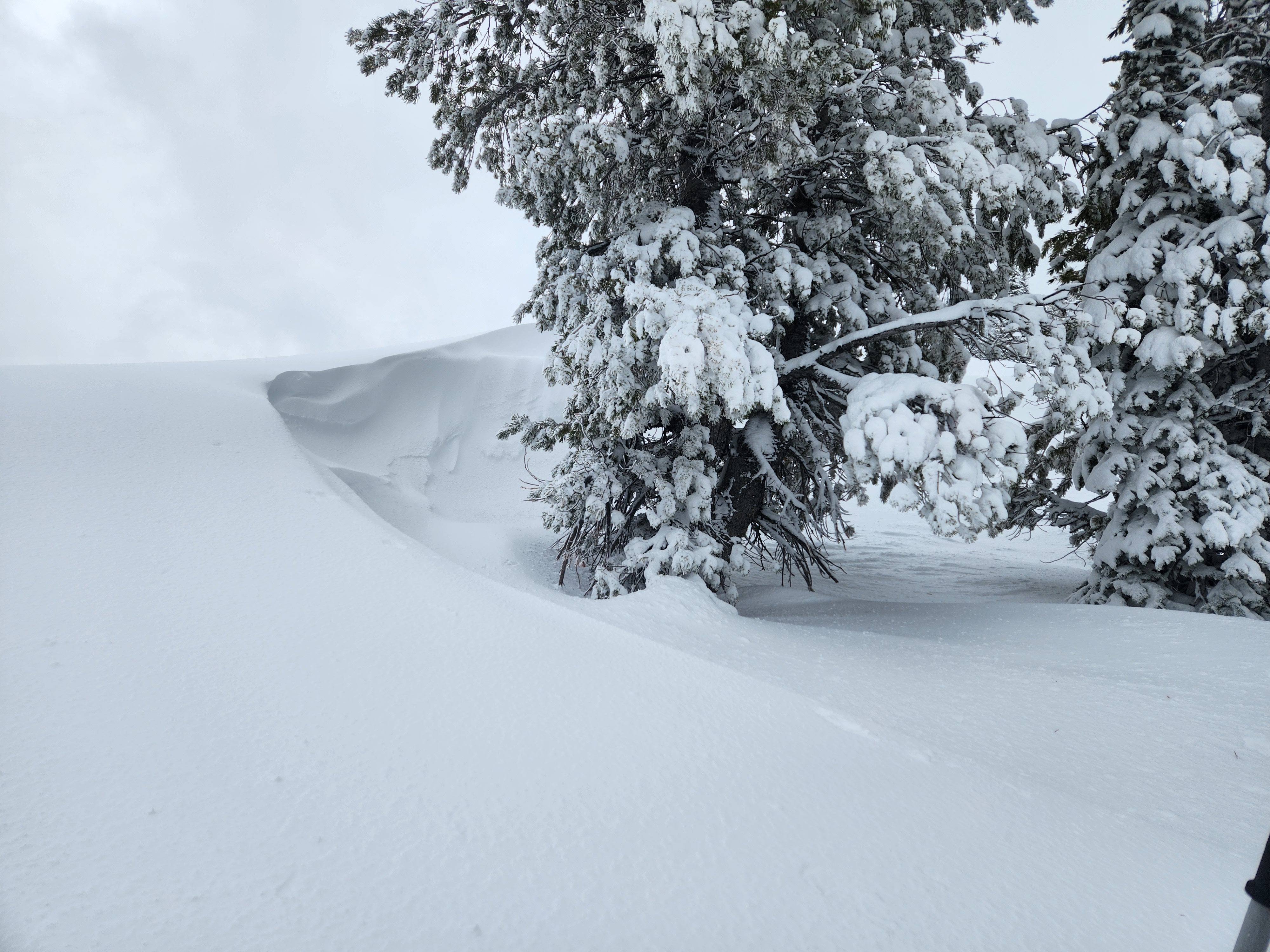
I didn't see a single natural avalanche today - this was surprising. Visibility wasn't great, but I had decent view of the roadside terrain from Ketchum to Banner, the Boulder Mtns, Titus Lake/Titus Ck area, McDonald and Parks Peaks, Abe's, and some terrain in the Banner Summit zone. There were stiff drifts and wind slabs on/near ridges on Titus Ridge (middle elevation), and obvious new cornice growth. They did not appear to be very easy to trigger. It appeared the wind slabs are larger and more widespread in most upper elevation terrain. The density change mid-way through the storm snow was more concerning than the interface on the rain crust from yesterday - it will be interesting to see if that is still the case Friday and Saturday.
I stomped on and walked through lots of stiff, thick drifts, and only got a 1 foot crack and a 2 foot long crack.Weather
- Air Temp
- Low 30s from 7500-9000'
- Cloud Cover
- overcast
- Wind Loading
- previous
- Rain Elevation
- >9500' on Wood River Valley side, probably higher on Salmon River side
- Recent Snowfall
- 0-30cm
- Snow Avail For Transport
- small smounts
Skies ranged from obscured to PC. Temps were about 4F higher on the Salmon River side (at the same elevation as Wood River side). HN = 1-2cm at Baker Ck lot and Banner Summit, 8 cm at Galena Lodge, 12cm at top of Galena Summit, increasing with elevation on Titus Ridge to 25-30cm above 9200'. Yesterday rain line >9600' on Titus Ridge. Today's rain line much lower (~7500', 8000' on Stanley side). Lots of previous wind loading from S-SE winds; from 4-6PM, winds got rowdy (strong, gusting extreme?), creating big plumes off the peaks and lots of snow moving but mostly sublimating and only loading isolated places. Small to moderate amount of snow is available for transport with additional southerly winds - the wind already did most of what it can do.
Snowpack
7000-7200' Banner area: 1-2cm of wet glop on surface, then a thin intact crust on all aspects. Northerly aspects had 10-15cm of very wet snow, southerly had well drained wet to damp MF crystals underneath. Shady and solar aspects had other intact crusts (ice masses on solars) in upper 20cm. Shady was not foot supportable in places, solars were foot supportable.
Titus 8700-8900': 12-15cm dense, damp new snow. Interface was still greasy (not frozen), very wet on shady and damp/draining on solars. There was still some potential for triggering WL at the interface.
8900-9100': Interface in the process of freezing, but still damp on top and within freezing crust. Interface was stickier than at 8700-8900'.
9100-9300': 25cm new snow, bottom half very stiff (P) and dense, then well graded right side up above. Clean shears at density change about half way through the storm snow. Interface was a 1cm frozen crust with damp MF crystals below on solars and wet DF on shadys. New snow was well bonded to the crust.
9300-9600': 25-30cm new snow, similar structure to 9100-9300' and same density change. The interface crust (yesterday/last night rain event) thinned as you gain elevation, but it was still there at the top of 1st bump.
Lots of 30-90cm thick drifts on the ridge - interesting middle elevation landscape.