
Quick report
- Collapsing
- specific
Rain,warm temperatures, and sunshine are adding wet instabilities to an already fragile and unstable snowpack. While small, these wet slides will be dense, heavy, and pack a punch on their own — however they carry the likely possibility of stepping down to the persistent weak layer below to create an even larger, destructive avalanche. Remotely triggering a large persistent slab avalanche remains likely, and there is a lot of uncertainty around how the mositure, temperatures, and sunshine will affect our persistent slab problem. These complex conditions call for conservative travel and wide margins.
While I observed less collapsing than in recent days, the collapse that I did hear was much more powerful, louder, and implied much more force going through the snowpack than recently. This is due to the added moisture and stiffness of the overlying slab during the rain event.Weather
- Air Temp
- 38
- Cloud Cover
- overcast
- Rain Elevation
- Precip fell as rain in all terrain I travelled
- Snow Avail For Transport
- none
Leaving Stanley around 1100, light intermittent rain continued throughout my drive south. Clouds were mostly scattered North of the pass, with sunbreaks frequent. As I drove up Galena Pass, I entered a cloud deck that started near Camp Ck, and carried on to the summit, making skies obscured. Rain persisted from Camp Ck through to Cherry and Prairie Cks.
Snowpack
Driving south from Stanley, I was able to observe widespread surficial wet loose activity and warning signs such as pinwheels and roller balls on low and mid-elevation terrain. Precipitation had fell as rain in all areas I traveled, including to the summit of Galena Pass, where the top 25cm+ of the snowpack was saturated with moisture as it was actively raining. Heading down to Cherry Ck then Prairie Ck, I traveled primarily on lower and mid-elevation terrain on several aspects and found the warm temperatures and active rain to have not only saturated the upper slab on top of 1/6, but to have stiffened it, adding density to the slab and likely multiplying consequence if one was to trigger a persistent slab avalanche. While the depth of this slab varied in the different aspects and elevations that I observed, it had the similar characteristic of becoming much stiffer, denser, and wetter than it was prior to our warm up and rain event. Rain continued to fall as I exited the field, suggesting this process would continue. Stopping on the north side of the pass on my way back to Stanley where the rain had stopped earlier, I was able to tell that while the upper slab was still stiffer than the day prior, moisture was already starting to drain from the upper portion of the snowpack.
Avalanche
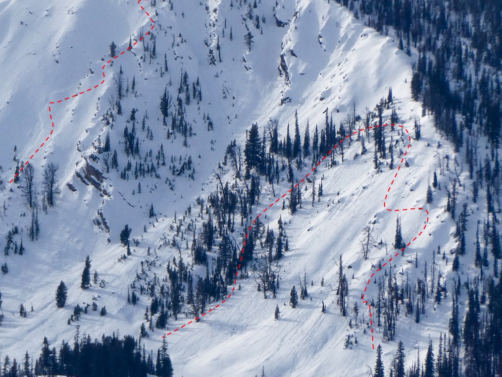
I observed many small (D1) loose wet slides as well as warning signs such as pinwheels and roller balls at lower and mid-elevations. While I was limited in the terrain I traveled, while shooting photos I observed one small (D1) slide on an upper elevation solar aspect.