
Quick report
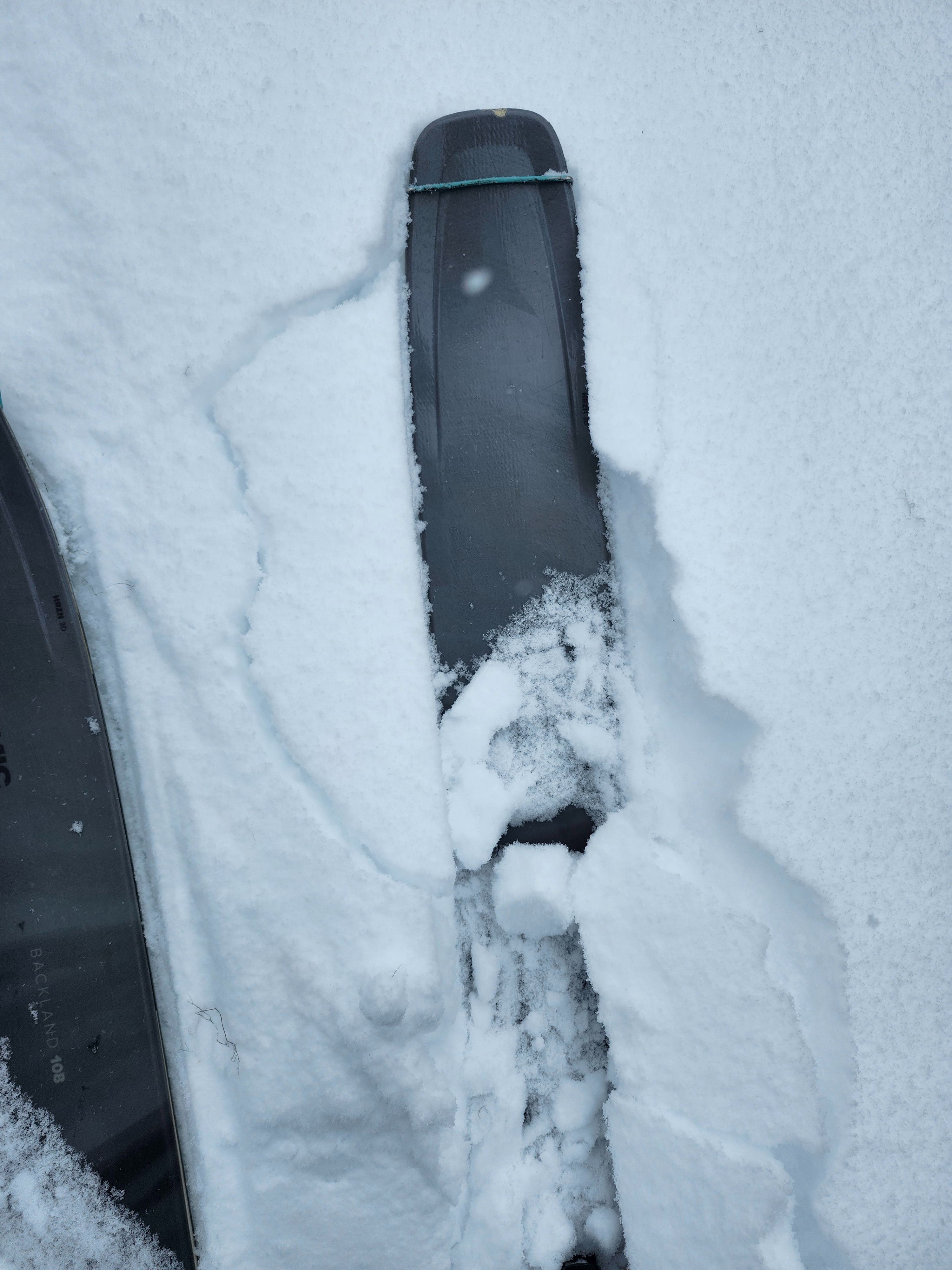
There was about 14 inches of low-density storm snow from the past four days.
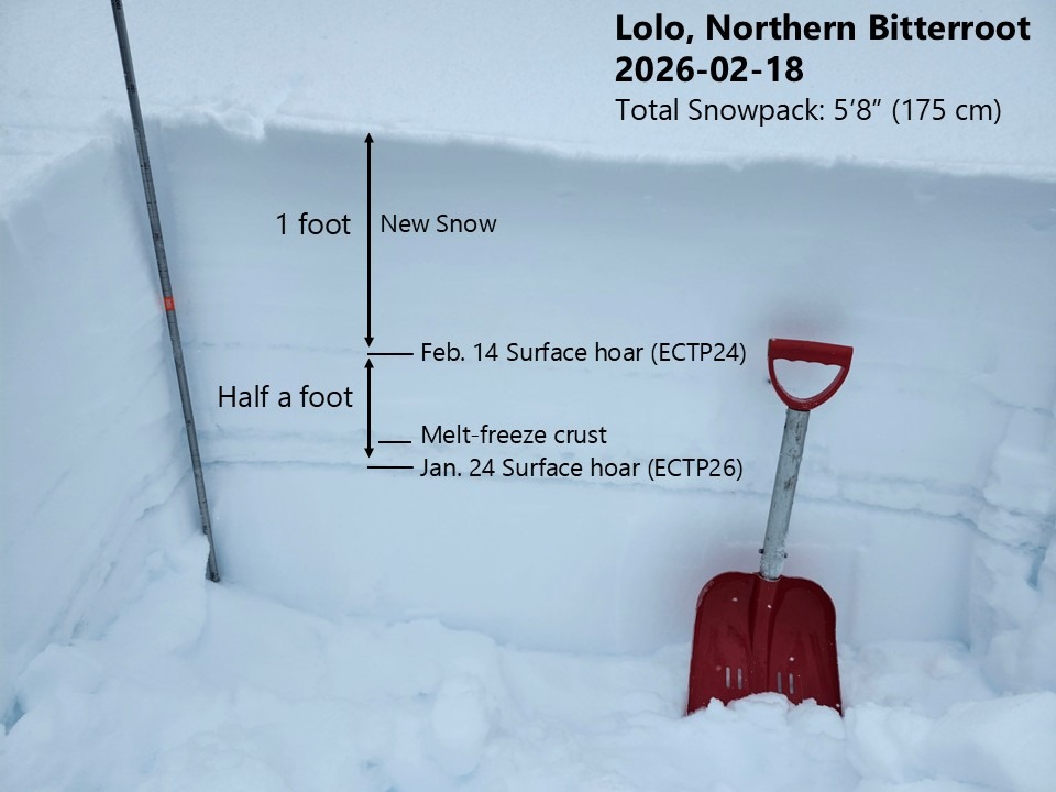
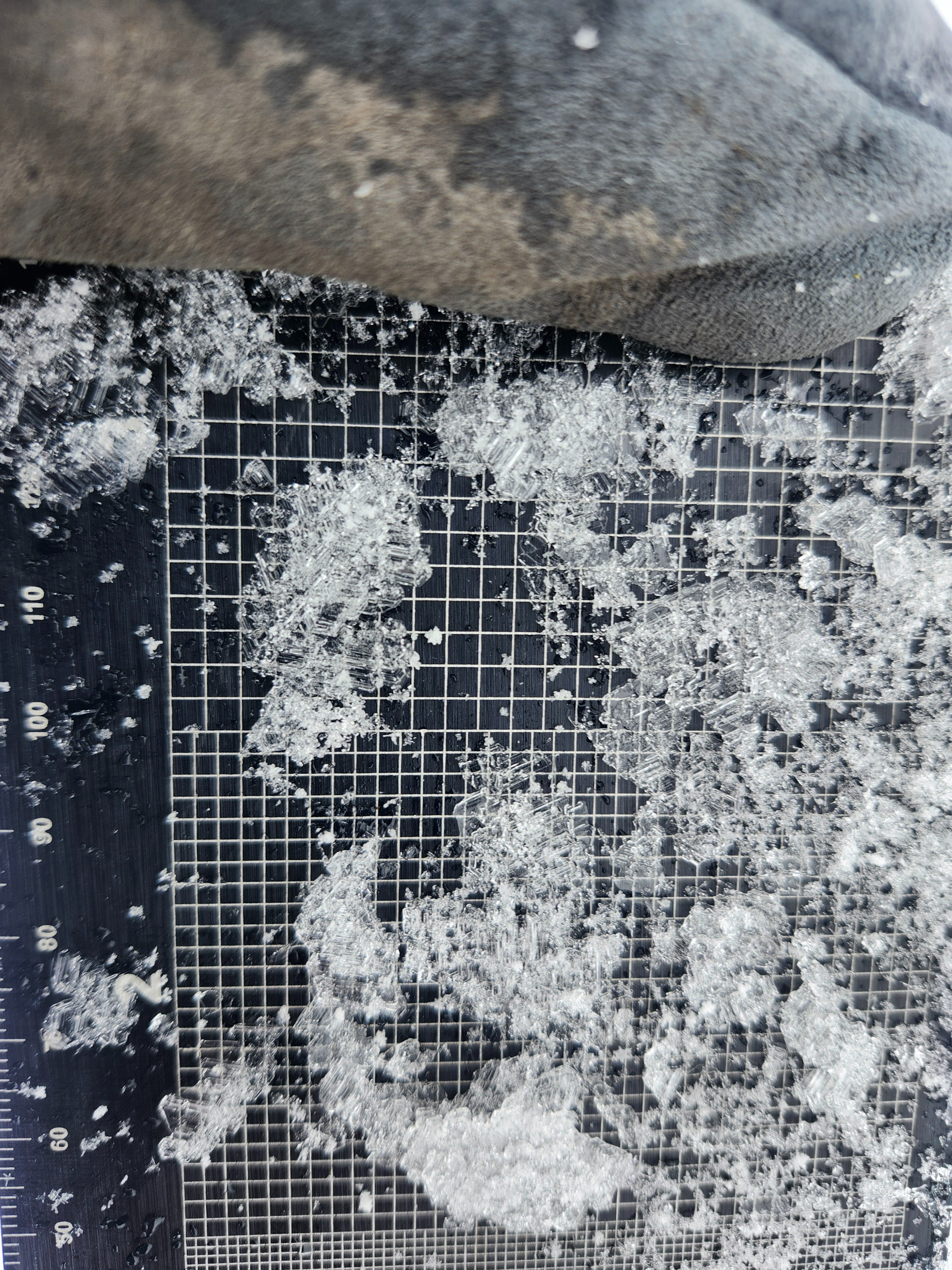
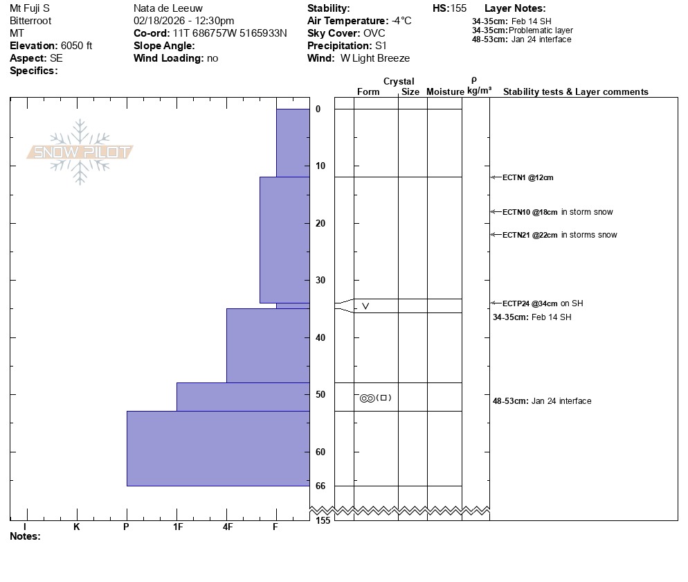
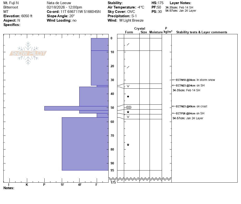
Unfortunately, I found both of the weak surface hoar layers we've been tracking. The first is about a foot deep and was buried by this most recent storm. The second is about a foot and a half deep and was formed during the January dry spell. Snowpack tests showed signs of instability on both layers (see snowpack description below).
Interestingly, I found the uppermost surface hoar layer on southerly aspects as well as northerly. Often, surface hoar gets destroyed by the sun on south aspects, but that was not the case this time.
I saw no recent avalanches or other signs of instability, such as collapsing or shooting cracks. However, the presence of these layers and the snowpack test results kept me on slopes under 30 degrees in angle. This is the sort of avalanche problem that can take discipline to manage. Luckily, the skiing was really good on lower-angle terrain.
Weather
- Air Temp
- 25
- Cloud Cover
- overcast
- Wind Loading
- none
- Rain Elevation
- N/A
- Recent Snowfall
- 30
- Snow Avail For Transport
- large amounts
It snowed the entire time I was out and winds were light.
Snowpack
Since February 14th there has been about 35 cm (14") of new storm snow.
This snowfall buried surface hoar. I found the surface hoar layer in both of my pits, which were at 6050' elevation, on a north aspect and a southeast aspect. In the southeast pit, I got a propagating extended column test result (ECPT24) on this layer.
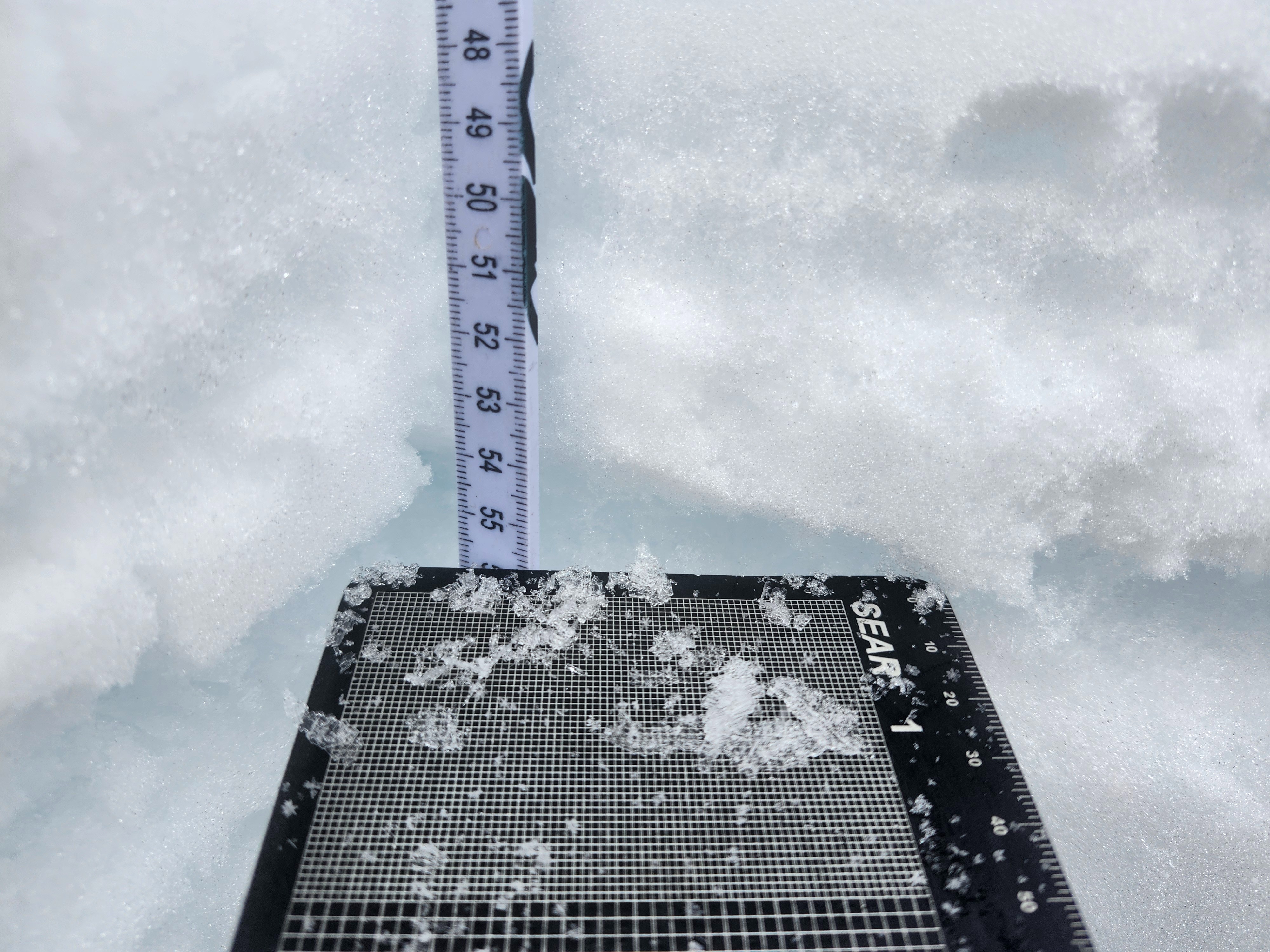
Buried about 50 cm (20"), I found the January 24th interface in both pits. On the north aspect it was surface hoar, and I got a propagating extended column test result (ECTP26). On the south aspect it was a facetting crust.
The total height of snow was 175 cm (69") on the north aspect, and 155 cm (61") on the south aspect.