
Quick report
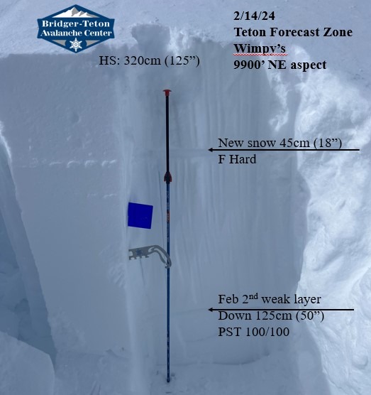
Strong storm last night brought deep riding conditions. Solar influence created slightly upside down character with clear, sunny skies by noon. New low density snow has not set up into a slab. Slight wind affect in specific terrain, but no wind slabs forming up 10k found in our travels. Storm slab appears to be bonding decently on new to old interface (Stable PST results, thanks to Diamond for info). Large sluffing would likely be encountered on steep terrain. Feb 2nd interface is buried 125cm (50") with no signs of instability at 9900' on a NE aspect (PST 100/100). Jan 4 weak layer was buried 215cm (84") at same location. Dug at a similair location where the last reported avalanches (Feb 10th) were remotely triggered on Feb 2nd weak layer (Rendezvous Mtn, Son of Apocalypse).
24 hour snow: Lower elevations 15cm (6")
Middle elevations 20-25cm (8-10")
Upper elevations 30-45cm (12-18") including wind drifted areas.
More snow on the way tomorrow increasing recent snow instability. Decent amount of uncertainty in the Feb 2nd weak layer. Still finding propagation and unstable results in specific areas. Be cautious on suspect terrain where avalanches on this layer occured which includes terrain above 9500' on N to E aspects on wind loaded unsupported slopes near cliff features.
No recent avalanches, cracking, or collapsing.