
Quick report
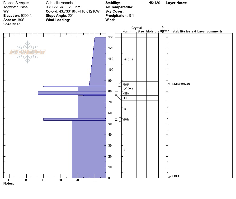
We found good riding conditions on protected features and weak but stable deeper snow on southerly aspects. Northern aspects hold a greater amount of weaker snow here, and I remain leery of them, particularly on steep slopes that end in creek drainages or are treed/terrain traps with any weather changes. Periods of snowfall or periods of warming will equate to greater instability. Each time it has snowed in this range, large avalanches on weak snow have been noted, however there are very variable in where they occur throughout the range. The primary culprit is a weak layer of snow buried in January that now sits below a firm, cohesive slab, around 3-5+ feet deep dependent on your elevation. Areas that have held shallower snow all season hold higher odds of encountering this problem, however active weather should bring this problem to mind along with the problem above. Periods of warming throughout February have consolidated the snowpack fairly well on mid-elevation south aspects. Those with a supportable crust and new snow topping it currently have great, relatively safe riding. Shifting wind directions may have build drifts or cornice features in abnormal areas, so be on the lookout and feel for stiffer snow as you're riding. As with any day in the mountains, it all depends; there are plenty of places where you might trigger a slide and places where you might not. Avalanche hazard is difficult to communicate in this way. The best way to manage uncertainty is to build wide safety buffers for travel decisions. Be aware of the terrain you are traveling in, and picture the consequences of being caught, in even a small wind slab, in that terrain.
Weather
- Air Temp
- 10
- Cloud Cover
- overcast
- Wind Loading
- moderate
- Snow Avail For Transport
- moderate amounts
Light snowfall starting to intensify by late afternoon; storm set to hit around 8 PM