
Snowslide Canyon and Hardcore Ridge
Quick report
Man, what a storm! We went from backcountry survival rock/log skiing to great coverage and conditions!!! We saw evidence of numerous D2 avalanches from the ~Feb 7-9 storm cycle. Aspects of avalanches were generally NW-N-NE-E-SE. Elevations were near and above treeline (~11000-11900'). It seemed like we could find a crownline on every second or third slope of North Hardcore Ridge.
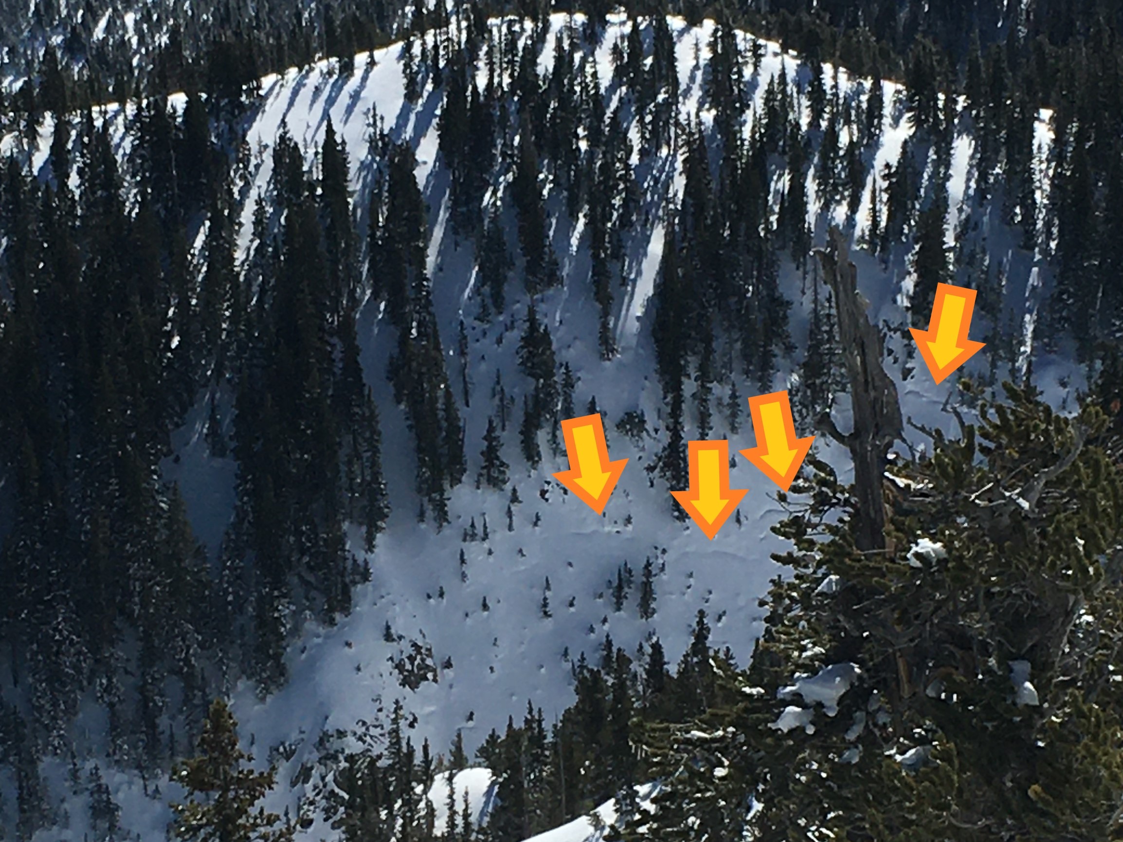
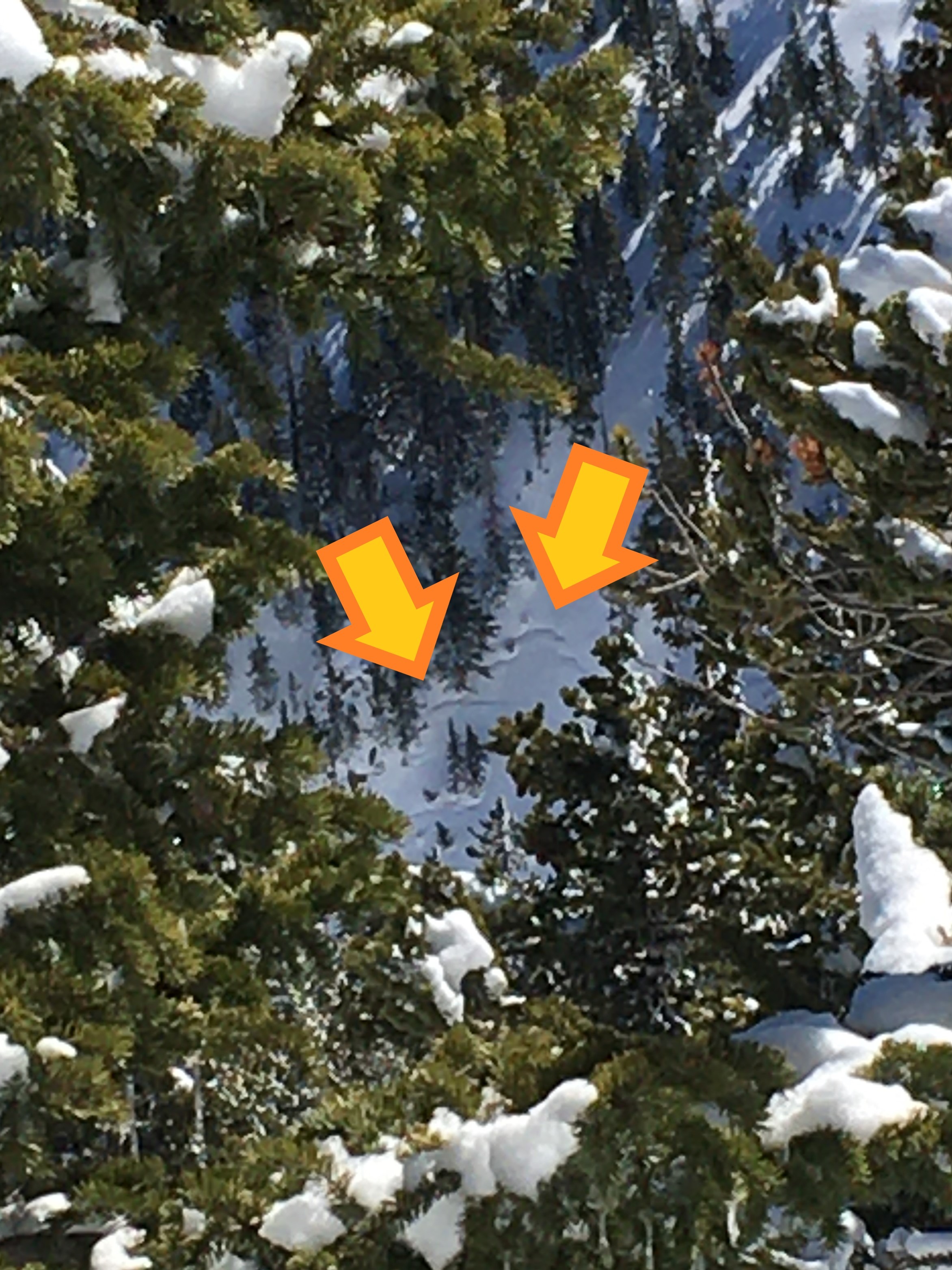
Snowslide Canyon Bowl avalanched sometime During our Feb. 7-9 storm Cycle. The avalanche likely occurred on Feb. 8 or 9. Crownlines are shown with arrows in the photo. The photo's right-side crownline arrow shows the approximate location. Much of the debris and crown lines were obscured by snow (from late in the storm cycle), so much of this report is estimated. The alpha angle (crown to debris) was measured at 24-25°, suggesting an avalanche size near D2.5. One area of debris deposition looked deep enough to bury a small to medium-sized car. Snowslide Canyon Bowl is generally an easterly aspect, with the edge of the bowl also having NE and SE components. The crownline on the SE aspect had a melt/freeze bed surface (from late January warming). The weak layer was facets just above the m/f crust. The weak layer was created/buried during 7-10" of accumulation during the ~Feb. 2 storm.
We saw evidence of an avalanche in Jay's Slide. See avalanche occurrence for more info.
Widespread and rapid settlement of the snowpack has occurred. See the picture with cones around trees. Snowpack settlement generally leads to a stronger and more stable snowpack. I observed some areas with wind-board (thin wind slabs), but nothing was reactive. No cracking or collapsing.
We observed some glide cracks on northerly aspects of Softcore Ridge (see photos). Don't hangout under glide cracks! We saw some minor loose wet releases on steep sunny slopes near and below treeline.
Weather
- Cloud Cover
- clear
- Wind Loading
- none
- Snow Avail For Transport
- large amounts
Avalanche
- Size
- D2.5 R2
- Type
- HS
- Count
- 2
- Aspect
- E
- Trigger
- N
- Elevation
- 11950 ft
Snowslide Canyon Bowl avalanched sometime During our Feb. 7-9 storm Cycle. The avalanche likely occurred on Feb. 8 or 9. Crownlines are shown with arrows in the photo. The photo's right-side crownline arrow shows the approximate location. Much of the debris and crown lines were obscured by snow (from late in the storm cycle), so much of this report is estimated. The alpha angle (crown to debris) was measured at 24-25°, suggesting an avalanche size near D2.5. One area of debris deposition looked deep enough to bury a small to medium-sized car. This is generally an easterly aspect, with the edge of the bowl also having NE and SE components. The crownline on the SE aspect had a melt/freeze bed surface (from late January warming). The weak layer was facets just above the m/f crust. The weak layer was created/buried during 7-10" of accumulation during the ~Feb. 2 storm.